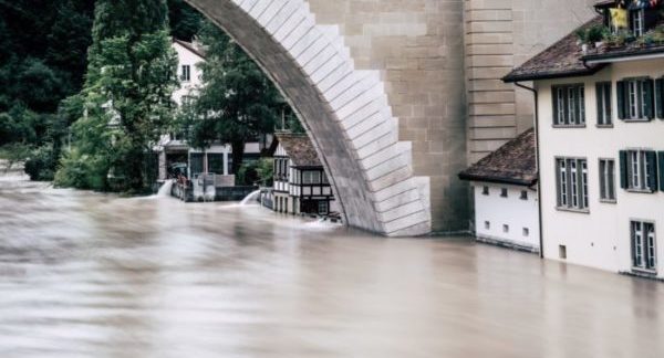
In summer 2020, extreme rainfall events dumped up to 320 mm of rain in a single day in the Baixada Santista metropolitan region, São Paulo state, breaking Brazil’s record for the biggest rainfall in a single event and demonstrating one of the greatest threats of climate change. The damage caused by the associated landslides led to dozens of fatalities and hundreds of homeless people, as well ...[Read More]
Mount Saint Helens 40 years later – May 18, 1980: for everything to stay the same, everything must change
Vancouver, Vancouver, this is it! Just a few words radioed by volcanologist David ‘Dave’ Johnston on May 18, 1980, to USGS headquarter in Vancouver, Washington State. It was 8:32 a.m., and a few hours later he lost his life during the (in)famous Mount Saint Helens eruption. That day, exactly forty years ago, the eruption of Mount St. Helen upset the world. It all started with a collapse on the nor ...[Read More]
How satellites measuring soil moisture provide a new understanding of rainfall patterns
Soil moisture and rainfall are the two fundamental variables in the water and energy cycle and their knowledge in many applications is crucial. For instance, for predicting the occurrence and the magnitude of flood and landslide events the knowledge of the initial soil moisture condition and of rainfall amount is mandatory. In the last decade, some authors have proposed a completely new approach, ...[Read More]
The Italian catalogue of earthquake-induced ground failures: saving the past for the future seismic hazard assessment #CEDIT
The Italian Catalogue of Earthquake-Induced Ground Failures (CEDIT) is a database available online since January 2013 that stores data about ground failures induced by strong earthquakes, which occurred on the Italian territory since 1000 AD up to now. CEDIT is freely available on a web-GIS portal (currently the access is granted using Firefox as a web browser, the upgrade to other browsers ...[Read More]