We are honoured to hear from Dr. Enner Alcântara, Professor at the São Paulo State University (UNESP) and leader of the Remote Sensing, Spatial Analysis, Environmental Modelling and Natural Disasters Research Group. His research in remote sensing has played a crucial role in recognising, managing and mitigating the impacts of disasters, bringing out significant contributions. Today, we’ll explore his career, motivations, and expertise, including essential lessons into the recent disaster in Rio Grande do Sul. Welcome, Prof. Enner!
“…we analysed the flood that occurred in the Taquari-Antas Basin in September 2023 [1]. We did not expect that in May 2024, the flood would be even worse. This article on the September 2023 flood revealed a large area with high risk.”

Prof. Dr. Enner Alcântara
Hello Prof. Enner, we are pleased to have this chat with you today, thank you! Could you tell us about your career?
I completed my PhD in Remote Sensing at INPE in 2010, and in 2012, I started working at UNESP. My focus has always been on using Remote Sensing to try to explain natural phenomena. In 2019, we created the Graduate Program in Natural Disasters; this program is a partnership between UNESP and CEMADEN. From that point on, I began focusing on using spatial data to model and map floods and landslides. Disaster risk reduction using remote sensing leverages satellite and aerial imagery to monitor and analyse environmental changes. This technology enables the identification of landslide-prone areas by detecting soil movement, changes in vegetation, and other geophysical indicators. Remote sensing provides real-time data, facilitating early warning systems and timely evacuations. It aids in mapping risk zones, assessing damage post-disaster, and guiding land use planning to avoid high-risk areas. Additionally, remote sensing supports the evaluation of mitigation measures’ effectiveness, ensuring adaptive and informed strategies. This approach enhances disaster preparedness, reducing the impact on communities and infrastructure.
Your research has made important contributions to disaster management in Brazil. Can you share what motivated you to pursue this field and how your journey began?
With the creation of the Postgraduate Program in Natural Disasters, we had the opportunity to focus 100% on studying disasters that occur in Brazil with the help of students. The priority has become the events that have just occurred in Brazil, which gave us the opportunity to explain firsthand why the disaster occurred and how it occurred, and in some cases, we offer an explanation of how to reduce the risk of a disaster. However, the ideal is always to anticipate the risk and avoid disasters.
In light of the recent and ongoing disaster in Rio Grande do Sul, how does your work relate to the current situation, and could you provide some context regarding its magnitude and impact for those outside Brazil?
We recently published an article in the npj Natural Hazards journal, in which we analysed the flood that occurred in the Taquari-Antas Basin in September 2023 [1]. We did not expect that in May 2024, the flood would be even worse. This article on the September 2023 flood revealed a large area with a high risk.
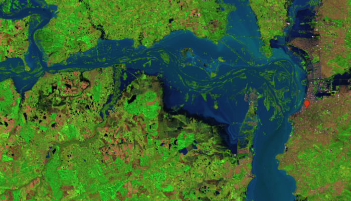
Our study on the Taquari-Antas Basin is highly relevant for understanding the current situation in Rio Grande do Sul. In September 2023, we recorded one of the largest precipitation anomalies, resulting in extreme rainfall events that caused significant floods. This work examines the impacts of these rains, using simulation models to predict the evolution of floods, highlighting affected areas and rainfall volumes.
The magnitude of these events is significant, causing extensive damage to properties, and infrastructure and affecting thousands of people. For those outside Brazil, it is comparable to major floods observed in other parts of the world, such as the devastating events in Europe and Asia in recent years. This context underscores the importance of effective mitigation and response strategies based on accurate data and detailed analyses provided in our study.
What key factors contributed to the recent disaster in Rio Grande do Sul, Brazil, and what immediate steps do you believe are crucial for effective response and mitigation in this context?
The recent disaster in Rio Grande do Sul, Brazil, was caused by several key factors, including extreme precipitation anomalies, land use changes, and the influence of the El Niño phenomenon. These conditions were exacerbated by the presence of a trough, an Amazon moisture corridor and atmospheric blocking due to a heatwave. Immediate steps for effective response and mitigation include improving flood modelling and risk assessment, enhancing urban planning and infrastructure, and investing in environmental conservation to increase resilience against future extreme weather events. We have already carried out a study on the catastrophic flood of May 2024; the article was submitted to the journal Urban Climate.
Based on your expertise, what lessons can be learned from this recent disaster to avoid similar situations in the future, and how can we enhance our disaster preparedness strategies?
The recent disaster in Rio Grande do Sul highlights several critical lessons for improving disaster preparedness and response. One key lesson is the importance of robust early warning systems to ensure the timely dissemination of alerts to residents. It is crucial to educate the public on how to respond to warnings through regular drills and information campaigns. Additionally, infrastructure resilience must be prioritised by conducting regular assessments of vulnerability, particularly in flood-prone areas, and enforcing zoning laws and construction standards to ensure buildings and infrastructure can withstand extreme weather events.
Enhanced coordination among local, regional, and national agencies is essential for a unified response, and local communities should be actively engaged in emergency planning and response efforts to leverage local knowledge and resources. Ensuring that emergency services have sufficient funding, equipment, and personnel is vital, as is maintaining strategic stockpiles of essential supplies like food, water, and medical kits in strategic locations.
Developing comprehensive risk maps to identify vulnerable areas and regularly updating disaster preparedness plans at all levels of government can greatly enhance preparedness. Investing in preserving and restoring natural buffers, such as wetlands and forests, can help mitigate the impacts of flooding. Continuous public education campaigns on disaster risks, preparedness measures, and community engagement programs can foster a culture of preparedness and resilience.
Finally, collaborating with international organisations to share best practices and access advanced technologies for disaster management is important. Participating in international training programs can help build local capacity for disaster response. By learning from this disaster and implementing these strategies, future risks can be mitigated, and communities can be better prepared to face similar challenges.
“The recent disaster in Rio Grande do Sul, Brazil, was influenced by several critical factors, including extreme precipitation, geographical features, and climate anomalies such as the El Niño phenomenon. The combination of a trough, an Amazon moisture corridor, and atmospheric blocking due to a heatwave resulted in severe rainfall and subsequent flooding.”
In conclusion, to mitigate such disasters in the future, several lessons can be learned and implemented:
- Enhanced Monitoring and Early Warning Systems: Investing in advanced meteorological and hydrological monitoring systems is essential for timely alerts and effective response. This includes river monitoring, weather forecasting, and early warning systems to inform communities at risk of impending floods.
- Improved Urban Planning and Infrastructure: Developing and maintaining robust infrastructure such as drainage systems, flood barriers, and sustainable urban planning that prevents construction in high-risk areas can significantly reduce the impact of floods. This also involves enforcing zoning regulations and using flood hazard mapping to guide development.
- Environmental Conservation and Management: Protecting and restoring natural habitats such as wetlands and forests, which act as natural water absorption and flood mitigation areas, is crucial. This also means adhering to and enforcing environmental laws and regulations to prevent further degradation of these vital ecosystems.
- Public Awareness and Community Engagement: Educating the public about flood risks and preparedness measures can enhance community resilience. This includes public awareness campaigns, emergency drills, and ensuring that local populations are informed and equipped to respond effectively to flood warnings.
- Research and Adaptation Strategies: Continued research into the impacts of climate change on weather patterns and flooding is necessary to develop adaptive strategies. This includes integrating climate change projections into flood risk assessments and disaster management planning to build long-term resilience against extreme weather events.
By implementing these strategies, we can enhance our disaster preparedness and reduce the vulnerability of communities to future flooding events.
What advice would you give to a young scientist looking to pursue a career in this field?
For a young scientist pursuing a career in disaster risk reduction, it’s essential to start with a strong educational foundation in relevant fields such as environmental science, engineering, geography, or urban planning. Specialising in areas directly related to disaster management can provide a solid base. Embracing an interdisciplinary approach is also crucial, as it involves integrating knowledge from various domains like climate science, sociology, and public policy to grasp the complexities of disasters comprehensively.
Gaining practical experience through internships, volunteer work, or field research is invaluable. Engaging with organisations involved in disaster management can provide hands-on experience that theoretical knowledge alone cannot offer. Building a professional network by attending conferences, joining professional associations, and connecting with experts in the field is also vital. Networking can open doors to opportunities and collaborations that are crucial for career growth.
Developing proficiency in using technological tools and software for data analysis, risk mapping, and early warning systems is important. Staying updated with technological advancements and methodologies will keep you at the forefront of the field. Additionally, enhancing your communication skills is critical. Being able to convey complex scientific concepts to diverse audiences, including policymakers, communities, and other stakeholders, can significantly impact disaster risk reduction efforts.
Cultivating resilience and adaptability is essential to working effectively in challenging and often unpredictable environments. Flexibility and resourcefulness are key traits in disaster scenarios. Finally, staying committed to continuous learning by keeping up with the latest research, policies, and best practices in disaster risk reduction will ensure you remain well-informed and effective in your role. By following these steps, you can build a solid foundation for a successful career in disaster risk reduction and make meaningful contributions to enhancing community resilience and safety.
References
[1] Mantovani, J., Alcântara, E., Pampuch, L.A. et al. Assessing flood risks in the Taquari-Antas Basin (Southeast Brazil) during the September 2023 extreme rainfall surge. npj Nat. Hazards 1, 9 (2024). https://doi.org/10.1038/s44304-024-00009-8
Edited by Hedieh Soltanpour and Navakanesh M Batmanathan