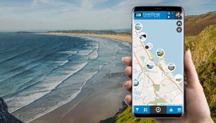
CoastSnap is a global citizen science project aiming at monitoring the changes in our coastlines due to processes such as storms, rising sea levels, and human activities using smartphones. We will discover more about this promising project by chatting today with Dr Mitchell Harley, founder of the CoastSnap program. Mitchell is a Researcher and Senior Lecturer in the School of Civil and Environmental Engineering’s Water Research Laboratory at the University of New South Wales in Sydney, Australia. He is a leading international researcher in the field of coastal hazards, wave climates, coastal monitoring and real-time early warning systems.
Hi Mitchell, it’s a great pleasure to have the chance to ask you about the CoastSnap project. Could you tell us about your background and your current position?

I am a researcher in coastal erosion at the University of New South Wales in Sydney, Australia. My research is focused on how sandy coastlines change over time, whether it be due to waves, currents, extreme storms, sea-level rise or engineering projects like beach nourishment. I am particularly interested in how coastal data can be used to forecast coastal change over different time scales – from just a few days out to the next 100 years or so. With that information, we can hopefully better manage the coastline for future generations.
I grew up on the coastline of Sydney, and like most Sydneysiders, the beach is an integral part of my day-to-day life. Sydney beaches are very dynamic (as they are exposed to year-round waves coming from the Southern Ocean), which makes for the perfect outdoor laboratory to measure and test new ideas about how beaches change. Our research group (http://narrabeen.wrl.unsw.edu.au/) have been measuring one beach (Narrabeen Beach on Sydney’s Northern Beaches) every month for the past 46 years, which is one of the longest continuous measurements of beach change worldwide. CoastSnap commenced in 2017 and was in part conceived to supercharge these beach measurements by crowdsourcing the data collection using community smartphone images. This data provides us with enormous insight into how beaches fluctuate over time due to changing waves and climate patterns.
There is, of course, also the human element to studying coastal erosion as well that fascinates me. Everyone wants to live close to the coast, but this is often in conflict with this dynamic coastal boundary. This sets up enormous challenges that we continue to grapple with as a society – particularly as climate change and increasing coastal populations exacerbate these effects.
How did the idea of the project originate?
CoastSnap was the convergence of several ideas. I did my PhD using a technique known as coastal imaging, which was developed at Oregon State University in the USA and uses video cameras pointed at the beach to collect very detailed data about coastal change. It uses a process known as photogrammetry that converts the pixels in the image from an oblique view taken from land (usually on the roof of a building or tower) to an aerial image as though it was taken from a plane or satellite. Through this image conversion process, we can then accurately measure all sorts of features about the beach – like shoreline and dune positions, the movement of sandbars and even the underlying seabed.
In the early 2000s, coastal imaging relied on camera lenses that are not too different to what you would find today in your smartphone. One day I saw a post on Twitter from a group called “Nerds for Nature” that was installing timber posts in US National Parks and crowdsourcing photos taken by smartphones and uploaded to social media to monitor wildfire recovery. I thought that the same thing could be done for tracking coastal change but was supercharged with the photogrammetry algorithms that we had been using in coastal imaging for a couple of decades.
One of the main challenges with this idea though was that rather than relying on a single camera that we knew all the details about (as we had been doing in coastal imaging), smartphone data sourced by the public would use whatever phone model the public was using at the time. This meant that we had to adapt our approach considering all these ever-changing camera lenses while still getting accurate data. Fortunately, it worked, which meant that we could use this crowdsourced approach for coastal monitoring.
I noticed that the project is also being used by local authorities as an awareness-raising tool. In this sense, have you identified advances that the project offers with respect to disaster risk reduction? Could you punctuate these potentials?
At the base level, the project collects images of how a beach changes over time, which we then stitch together into timelapse movies for each beach. Local authorities find these movies extremely valuable as a means of communicating to the public about the dynamic nature of the coast – and to remind people about the dangers of building too close to this dynamic zone.
We are also starting to use the data collected from our CoastSnap stations to build up a record of storm impacts, which we are then feeding into our forecast models to better predict future storm impacts. Each time there is a storm forecast, we put out a call to our network of CoastSnap volunteers to try and collect snapshots of the beach immediately before the storm arrives. We then repeat this step after the storm has passed to get a very accurate picture of the storm’s impacts.
What are the main challenges you have encountered in the project?
One of the main challenges has been the project’s popularity. When we started CoastSnap, we had two pilot stations in Sydney. Five years later and we now have 280 stations in 24 countries! The project’s success has been wonderful but has meant that we are now dealing with a lot more sites than we ever anticipated.
Another challenge has been in maintaining community engagement over time. Like all citizen science projects, it is important to continually communicate results with the public so that people can see exactly how their efforts are being used. This takes effort, but we are trying to use our various communication channels (social media, the CoastSnap website, etc.) to show that every snap that someone takes is an extremely important source of information for us.
Can a tool like CoastSnap be used in other environments with a similar monitoring scope? Maybe related to different natural hazards, for example, on flanks potentially affected by landslides?
There is a range of other photo-point monitoring initiatives that are being used for all sorts of interesting projects (like the bush regeneration project I mentioned earlier). Where I think CoastSnap is a bit different is that we go that extra step in using photogrammetry to extract accurate data from the images. This could be used in a range of applications, for instance, looking at how riverbeds change or for landslide monitoring… the important first step though is to get people taking photos in the first place as the longer the record becomes, the more powerful it is!
Post edited by Joana Parente and Silvia de Angeli