GD
Geodynamics

visualization

Understanding geodynamic modelling results through maps of neural networks

Understanding geodynamic modelling results through maps of neural networks

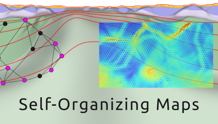
The huge amount of data produced in Geosciences is increasing exponentially, and numerical modelling has become a key tool for understanding tectonic evolution over time, which also increases the volume of data produced. Here, I, João Bueno (PhD student at University of São Paulo, Brazil)  will present how a machine learning technique known as Self-Organising Maps can be used to understand the int ...[Read More]

Geekology #1: Matplotlib for geosciences, tips and tricks

Geekology #1: Matplotlib for geosciences, tips and tricks

This week inaugurates a new series of posts: Geekology, fusion of geek and geology. In this section, we will try to unravel tips and tricks of programming applied to geodynamics, from new innovative libraries to good programming practices, interviews with geologists who code and more! To kick off the series, this week’s article is written in collaboration with Baptiste Bordet, doctoral resea ...[Read More]

Animating the past using numerical modeling

Animating the past using numerical modeling

The human lifespan is too short compared to the geological time. To comprehend long-term phenomena, numerical modeling emerges as an imperative approach. But, there are several ways for visualizing the output of these models. Among these, animations stand out as a powerful tool, allowing us to watch the dynamic evolution of our planet over geological epochs like a movie. Our lives are too short co ...[Read More]