When reading a scientific paper or a text explaining the physical workings of the Earth, one of the most striking aspects is the methodological approach—sometimes involving numerical models, other times fieldwork and/or rock geochemistry. This diversity of approaches can initially cause some discomfort, a feeling that things are like square pegs in round holes. How can a computer model dialogue with field observations? How do we translate what we see in the field into a model? How do we interpret a model based on field evidence and geochemical data? Here, Sara will share some of her brief reflections from on her research in geodynamics, focusing on the interplay between field practice and numerical modeling. She also is glad to show us how we can see them not as conflicting worlds, but as complementary tools.
Sara dos Santos Souza is a Master’s student at the Institute of Geosciences of the University of São Paulo. She is currently developing 2D numerical models of rifting, applied to the evolution of the Santos Basin (Brazil). She has previously investigated the impacts of the precollisional phase on collisional orogens. Her upcoming PhD project will focus on continental collisions using 3D numerical models. Her research interests encompass the entire Wilson cycle, from rifting to orogenesis.
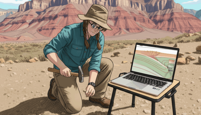
When I began working with geodynamic numerical models, I was greatly surprised to learn that the traditional geology I knew—collecting samples under the blazing sun, hours spent hammering rocks, and kilometers of hiking—would not be part of my daily life as a researcher. This might seem obvious, but fieldwork is the bedrock of geologist training in Brazil—and this is not a criticism. A geologist in Brazil is quite generalist, meaning we are trained to fill any role that requires a geologist. Over five years, we first receive extensive mandatory training in fundamental geology and the mathematics background—petrology, stratigraphy, structural geology, mineralogy, paleontology, calculus, physics, chemistry. This is followed by a compulsory foundation in professional applications: engineering geology, petroleum geology, hydrogeology, geological mapping, mining (exploration, resource assessment, deposit genesis), environmental geology, and so on. Our curriculum is far more rigid and general compared to the systems in Europe and the United States. So, my idea of what it means to be an Earth scientist came from what I learned in igneous petrology, metamorphic petrology, structural geology, and geological mapping—a world of fieldwork, field notebooks, and sampling.
Furthermore, in Brazil, there is only one established geodynamics group, formed in the last decade at the University of São Paulo’s Institute of Astronomy, Geophysics, and Atmospheric Sciences (IAG-USP)—where the Mandyoc numerical code is developed. It’s worth noting that the Institute of Geosciences (IGc-USP), which houses the Geology program, only began to establish ties with this group in recent years. Therefore, the very concept of geodynamics only reached me—a trained geologist—through a few specific lectures covering the physics of plate tectonics and a handful of papers that attempted to reconstruct the tectonic evolution of orogens based on physical processes.
The Scale, Nature and Validation of Geodynamic Models
Confronted with the fact that an aspect of geology I loved was not such a good fit for geodynamics, I began to question why. The first explanation I received concerned resolution: we are dealing with different scales. While an outcrop is metric, sometimes decametric in scale, the vast majority of geodynamic numerical models operate on a lithospheric scale—on the order of hundreds of kilometers.
The second reason is inherent to modeling itself: the definition of a model. A model is a simplification of a scenario that considers only the main factors influencing the process under study. For example, if I am studying volcanism in the upper plate and its thermal effect on the rheology of the host rock, it matters little—in principle—whether the initial scenario of my model includes sediments on the active margin or not. A simple configuration allows for a more objective analysis of the key parameters.
However, when we develop numerical models, we validate our results against natural analogues. It is at this stage that geological background makes all the difference. Knowledge of the spatial arrangement of terrains, their lithotypes, and their pressure-temperature conditions throughout a collision, rifting event, or any other lithospheric process enables a far richer description and a more insightful investigation of the numerical model. Just as models are validated by field observations—along with other geophysical and geochemical data—hypotheses generated from fieldwork can also be tested, accepted, or refuted through numerical models. These models demonstrate, through simple and elegant explanations, how a given process happened over geologic time. Thus, field activities—a fundamental classroom for geoscientists—are and should remain a vital part of the research process for geodynamicists.
Integrating Earth’s Story: Code, Fieldwork, and Collaborative Science
It took me considerable time to understand this, and also to realize that there are different types of geodynamicists. There are those with an affinity—or who had the opportunity and resources—to develop skills in writing numerical codes and post-processing scripts, who can effortlessly handle vast datasets, but who may not possess extensive geological knowledge. Then there are those who can read and understand—or know where to find—research on the geochemistry of alkaline rocks, the tectonic evolution of Precambrian terrains, or even the genesis of mineral deposits. These individuals can translate these complex scenarios into models and identify novel numerical modeling approaches to geological problems, even if they are not expert programmers. Other types surely exist, but what they all do is process a range of scenarios, test parameters, discuss the effects, and identify their natural analogues.
Once I understood this, much of my impostor syndrome melted away. Logically, the ideal is a middle ground, but that only comes with time and experience. Moreover, science is a collaborative effort, with each contributor playing to their strengths. For those who, like me, identify with the second category—who chose geodynamics to explain the Earth while keeping one foot in traditional geology—field practices within geodynamics may not be as grueling as dedicated sampling campaigns, but they create pathways to a systemic and comprehensive understanding of a region’s geology.
It may not yet be easy to directly link field observations, geological cross-sections, and analytical data to models. However, with the advancement of computational power—as we’ve witnessed over the last two decades—we can expect model resolution to increase, allowing us to discuss geology in far greater detail. Because, although there is only one Earth, within a minuscule slice of geological time, we have under our feet the incomplete record of countless past Earths, preserving processes that are ready to be hypothesized and modeled by us.


Veleda Muller
I am also brazilian and did my undergrad and master’s degree in Brazil, followed by a PhD in Geodynamics in Italy/France, and currently postdoc in the USA. I try to do both Geodynamics and Field/geochronological analyses. Althouth I think it’s beautiful to think that Geodynamics and Field geology can be reconciled, I found that there’s not enough time to do both well, even if you are totally dedicated to research. I end up trying to divide myself in two, and feel that the Geosciences community is pretty confused when trying understand my background and goals. It’s good to hear that there is more Geodynamics being incoporated in brazilian research, and all around the world, because we definetly need it to understand Earth processes. But I hope the future comes with more interaction and understanding between “Geodynamicists” and “Field Geologists”, maybe trough more friendly codes which can relate more easily to geological data. An incorporation of some geodynamics in undergrad curriculum might be important for that too, maybe in courses like “Tectonics”. Good to think about it. Thanks for this post!