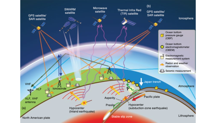
The fundamental of Space Geodesy is the observation of the dynamics of the Earth, such as its rotation on its axis, changes in shape, and the external gravitational field etc., which allow for the monitoring of the Earth system in general. Space Geodetic techniques, such as Global Navigation Satellite Systems (GNSS) / Global Positioning System (GPS), as well as Interferometric Synthetic Aperture R ...[Read More]
What is the role of fluids in seismic cycles

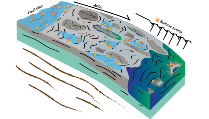
Conceptual distribution of seismicity and water in a subduction zone, modified from Behr et al. 2021.
What is the role of fluids in seismic cycles ?
Investigating earthquake activity of the 2018 Kīlauea Volcano eruption

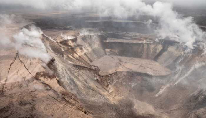
Photograph of Kīlauea’s summit, Halema’uma’u Crater, partway through the 2018 eruption. The seismic events at the summit and associated eruptive activity greatly changed the structure of the summit and surrounding region. Photograph by Hawaiian Volcano Observatory on June 12, 2018 (https://www.usgs.gov/media/images/k-lauea-volcano-halema-uma-u-crater-0).
Both earthquakes and research project directions can be hard to predict. This week Becky Fildes, a graduate student at UC Davis, takes us on a journey of how she came to study earthquake behavior in Hawaii during an active volcanic eruption and how our understanding of caldera collapses can be further improved. In my first year of graduate school in 2017, I had started studying earthquake statisti ...[Read More]

