“The mountains are calling.”
This week, we are embarking on an adventure to the highest mountain in the world – Sagarmatha (also known as Mt. Everest). We will join Tshering Lama Sherpa, from the University of Arizona, as she unveils the exciting world of geological fieldwork amidst the majestic Himalayas in her post.
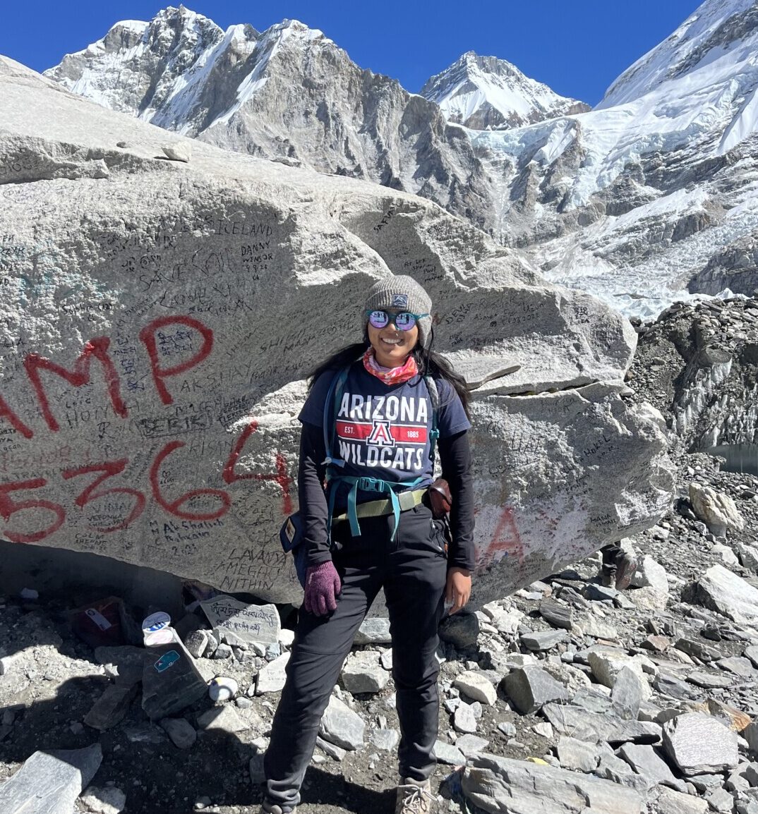
Tshering Lama Sherpa is a geologist working to unravel the secrets of the Himalayas. She is pursuing her Ph.D. with a focus on Himalayan Tectonics at the University of Arizona. One of her recent field trips included fieldwork around the Everest Base Camp, where she is investigating a potential high-elevation low-relief (HELR) surface.
In October of 2023, I set out on my fourth geological fieldwork season in the Nepal Himalaya. I have been working in Nepal since 2018, when I first started my master’s research at the University of Arizona. At the time, I investigated a high-elevation low-relief (HELR) surface, which we called the Bhumichula Plateau (Figure 1). At ~4800m, this anomalously flat surface stood out distinctly amidst the rugged topography of the western Nepal Himalaya, which led to my research into elucidating the HELR surface’s geological origin and evolution. The results of my research concluded that the Bhumichula Plateau is a remnant of a relict paleo-landscape that has been dramatically incised since Mid-Late Miocene time (~11-8 million years ago) (Sherpa et al., 2022). A similar landscape evolution model in eastern Nepal was also proposed by Carrapa et al. (2016) based on cooling ages from the northern (Carrapa et al., 2016) and southern flanks (Streule et al., 2012) of Sagarmatha (Everest). Preliminary results and observations (Sherpa et al., 2023) from south of Sagarmatha suggest that a possible HELR surface in eastern Nepal could be an analog for the Bhumichula Plateau and support the presence of a continuous paleotopographic surface throughout the Himalayan orogen.
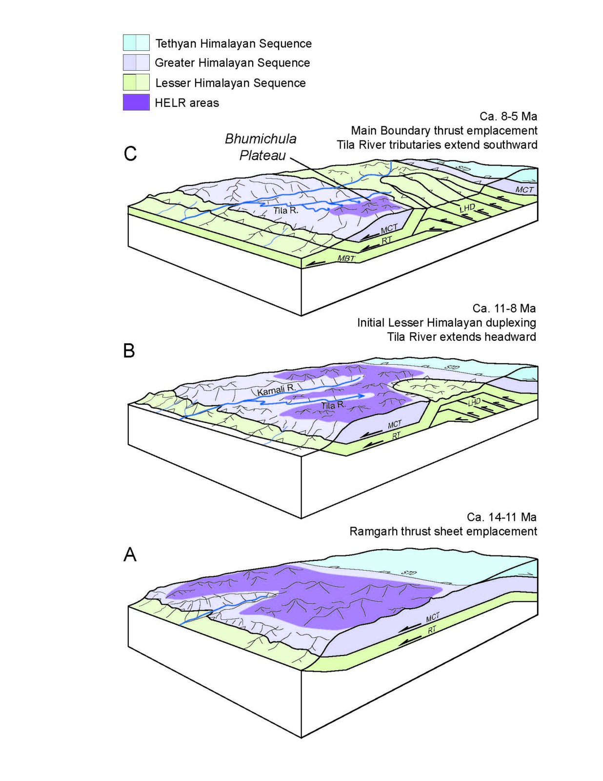
Figure 1. Schematic diagram showing the development of the Bhumichula HELR surface in western Nepal (Sherpa et al., 2022)
To investigate this potential HELR surface in the eastern Nepal Himalaya, I applied for and received grants to conduct a reconnaissance field expedition into the upper catchment of the Dudh Kosi River. I was excited about this because in the 4th year of my PhD, I was finally closing the circle of my graduate research by revisiting my first original research question. However, there was also another personal reason for circling back: the Sagarmatha region is home. This is where my father’s family comes from, a place I frequented as a child.
Geographically, the Sagarmatha region lies in the Solu-Khumbu district of eastern Nepal. Solu encompasses the ‘lower’ midland villages and towns whereas Khumbu includes ‘higher’ settlements on the modern trekking trails. My father’s family is a part of the Lama clan, which largely has origins in the village of Junbesi in Solu. As fate would have it, the potential HELR surface that I was investigating also lay in close geographic proximity to Junbesi and so I planned for a transect that would cover the HELR surface with which I had grown up.
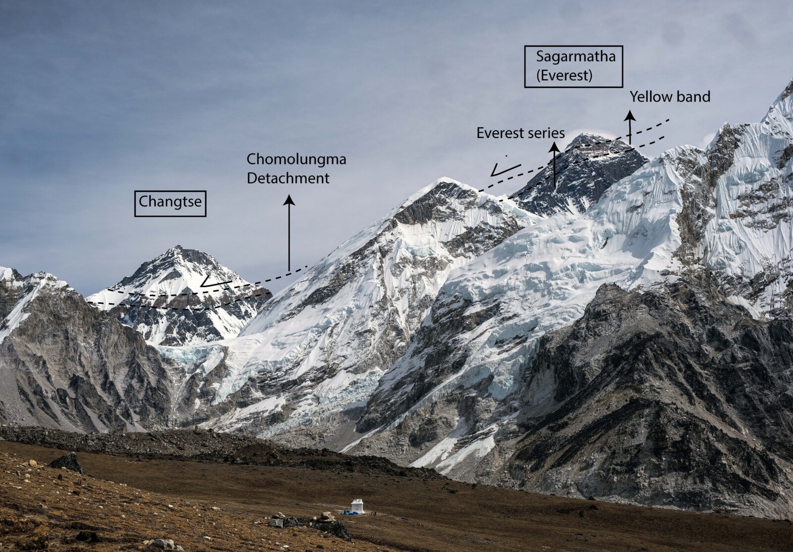
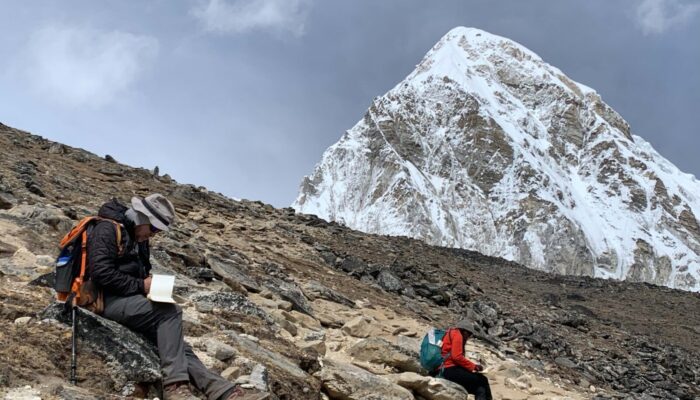
View from Kala Patthar, facing east towards Sagarmatha (Everest). A strand of one of the most famous orogen parallel low angle normal fault, South Tibetan Detachment System (Chomolungma Detachment- CD) is visible both on Sagarmatha (8848m) and Changtse (7543 m). Here, the CD places Tethyan Himalayan rocks on top of Yellow band carbonates and Everest series metapelites. In the foreground, parts of Nuptse (7861m) and Khumbutse (6636 m) expose orthogneiss and leucogranite units.
To understand regional topographic evolution, we also needed to understand the geology of the upper catchment of the Dudh Kosi River. We initiated the trip from Kharikhola (2137m), trekking up to Sagarmatha Base Camp (5360m), Kala Patthar (5644m), Gokyo (5357m), and eventually Numbur HELR surface (~4700m). The first two transects in the Upper Dudh Kosi basin were conducted in a traditional ‘tea house trekking’ style which was convenient, reliable, and logistically cheaper. In the last transect to the HELR surface, we switched to an ‘expedition’ style fieldwork which is more conventional in the Himalaya, especially when the transects cover remote regions. In this style of fieldwork, the team moves in camps and is fully self-sufficient with food, water, fuel, tents, and other essential items.
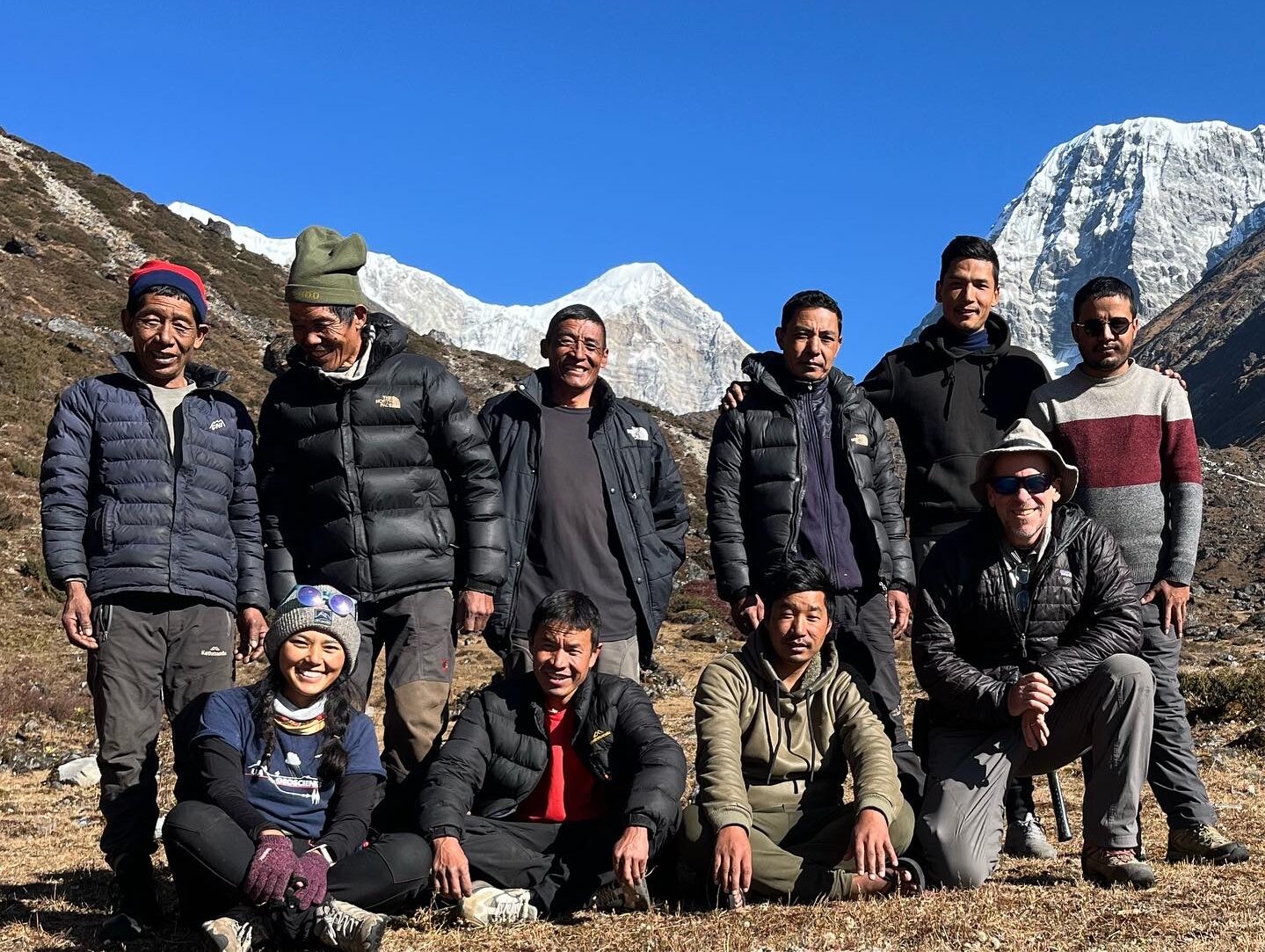
The expedition crew from the 2023 field season. Top Left to right- Hira Lal Tamang, Bam Bahadur Tamang, Dhal Bahadur, Dhal Bahadur Tamang, Icchyak Tamang, Chabbilal Pokhrel. Bottom left to right- Tshering Sherpa (author), Singhman Tamang, Shambo Tamang, Dr. Peter DeCelles. Not pictured: Bhairab Sitaula.
During my four years of fieldwork in Nepal, I have worked with Bhairab dai (our field logistics organizer) and his group who are always respectful and reliable. In Nepali culture, everyone is customarily titled dai and bhai (elder and younger brother) or didi and baini (elder and younger sister). And so, to the crew, I am Tshering baini and they are my dais. Our field crew was phenomenal this year as well, filled with familiar faces of dais with whom I had worked before. Despite our familiarity, the professionalism and work ethic of our support staff has never faltered. In fact, anyone who has worked in the Nepal Himalaya can attest that all scientific fieldwork and research is built on the shoulders of hard-working Nepalese support staff.
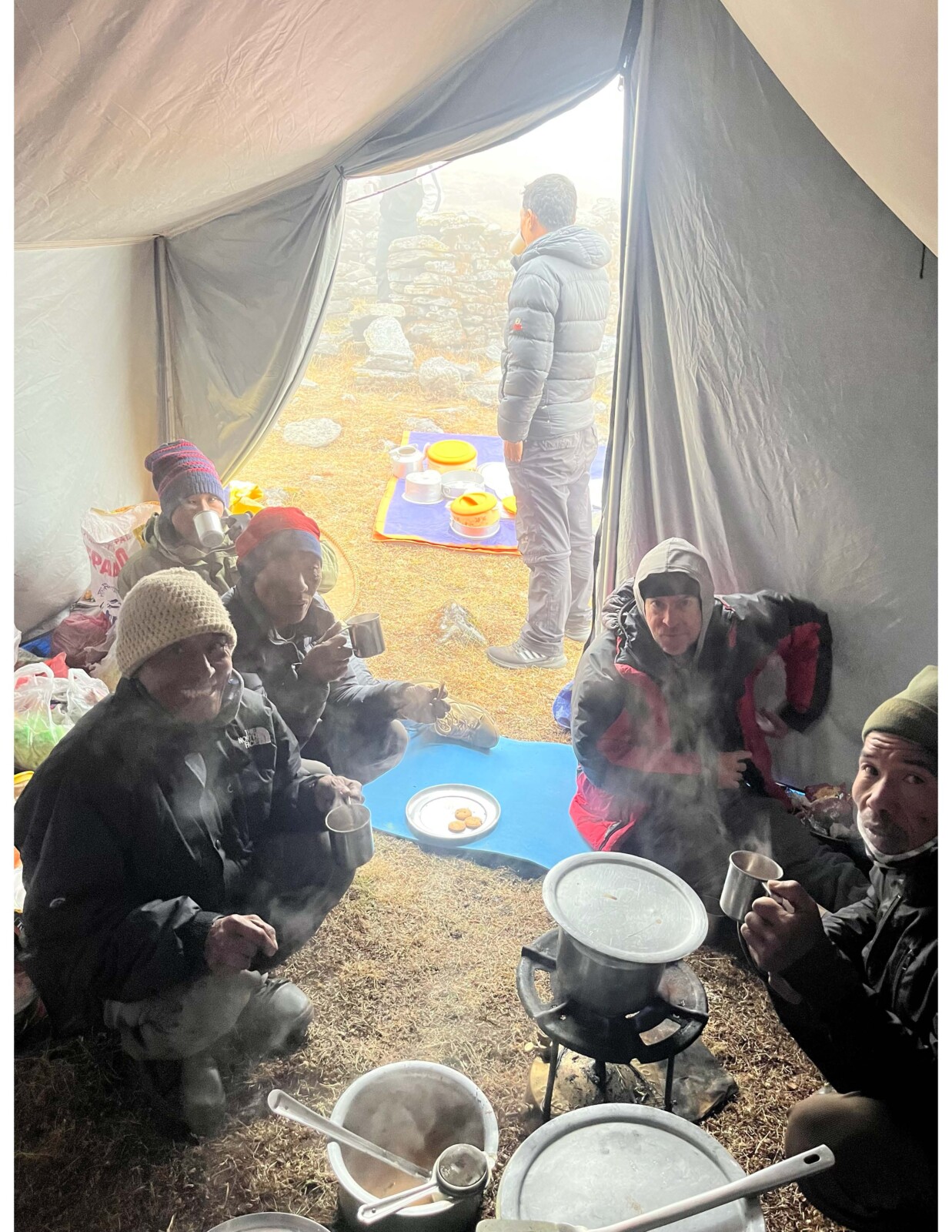
The crew shares a cup of hot dudh chiya (milk tea) in the kitchen tent after a long day of fieldwork. Left to right: Shambo, Hira Lal, Dhal Bahadur, Peter DeCelles, Bam Bahadur.
After three weeks in the Upper Dudh Kosi basin, the team of dais, Dr. Peter DeCelles (collaborator and advisor), Mr. Chhabilal Pokhrel (Nepalese collaborator), and I set off for the transect in the Numbur HELR surface. Unfortunately, throughout the trip, the weather was very capricious and while we would start with clear skies in the mornings, the afternoons would inevitably lead to dense foggy conditions shrouding our visibility. To combat the unpredictable weather, we usually had an early start, setting out of camp by 8 am and returning around 3-4 pm before the mist obscured everything. Nevertheless, we had good luck with sampling and conducting geology except on the last day, where a fresh bout of snow sped up our plans to descend from ~4700m down to Salleri (2200m) the next day.
Now, as I unpack the treasure trove of samples in Tucson, I am struck with how privileged I am with the opportunities to not only conduct fieldwork but also to revisit my homeland through the lens of a geologist. As I continue with my research and my academic endeavors, I am excited about the mountains and the people I will visit during my scientific pursuits.
The author would like to gratefully acknowledge the National Geographic Society and Lewis and Clark Foundations for funding fieldwork in the Sagarmatha region. Special thanks to Chhabilal Pokhrel (our collaborator), Bhairab Sitaula (our logistical organizer), Dhal Bahadur Tamang (head guide), Dhal Bahadur Tamang (head chef), Shambo Tamang, Icchyak Tamang, Bam Bahadur Tamang, Hira Lal Tamang, Singhman Tamang and Hari (driver).
References:

Carrapa, B., Robert, X., DeCelles, P.G., Orme, D.A., Thomson, S.N., Schoenbohm, L.M., 2016. Asymmetric exhumation of the Mount Everest region: Implications for the tectono-topographic evolution of the Himalaya. Geology 44, 611–614. https://doi.org/10.1130/G37756.1

Sherpa, T.Z.L., DeCelles, P.G., Carrapa, B., Schoenbohm, L.M., Wolpert, J., 2022. Bhumichula plateau : A remnant high-elevation low-relief surface in the Himalayan thrust belt of western Nepal. GSA Bulletin 135, 2121-2140. https://doi.org/10.1130/B36481.1

Sherpa, T.Z.L., DeCelles, P.G., Carrapa, B., 2023. Rates and timing of cooling in fold-thrust belts: Insights from low temperature tehrmochronology in Eastern Nepal Himalaya. 18th International Conference on Thermochronology Abstracts. 2023, 107.

Streule, M.J., Carter, A., Searle, M.P., Cottle, J.M., 2012. Constraints on brittle field exhumation of the Everest-Makalu section of the Greater Himalayan Sequence: Implications for models of crustal flow. Tectonics 31, 1–13. https://doi.org/10.1029/2011TC003062