A day in the life of a Geophysicist often involves engaging in tasks such as data downloading, processing, modeling, or some type of inversion. Unfortunately, these tasks are often burdensome or limited to closed-source software solutions. The Fatiando a Terra projects aims at overcoming some of these difficulties by offering a completely open-source Python toolbox tailored for Geoscientists. This week, Santiago Soler, a postdoc at University of British Columbia and one of the main software developers, will guide us through the world of Fatiando, providing insights into its capabilities and sharing how you can actively participate and contribute to this exciting project.

Santiago Soler is a Physicist and PhD in Geophysics. He is interested in researching new methods for processing and modelling gravity and magnetic data, and applying geophysical inversions on timely environmental problems. He is committed to contribute to open-source scientific software and to create a more diverse, open and reproducible science. He is one of the core developers of Fatiando a Terra and SimPEG. You can find his social media handles in his personal website
Fatiando a Terra is a community-driven project with the goal to build open-source Python tools for geophysics.
The project started in South America more than ten years ago, as part of the PhD dissertations of a group of graduate students from Rio de Janeiro, Brazil. Throughout the years, the project reached higher levels of maturity and gained contributors and core developers from different regions of the world.
Nowadays, the project is composed of a set of different Python libraries, each one with a specific goal and scope. Verde offers tools for spatial data handling and interpolation, with a machine-learning taste. Harmonica provides tools for processing and modelling gravity and magnetic data, while Boule hosts reference ellipsoids (e.g. WGS84) that can perform coordinate conversions and normal gravity calculations. Lastly, Pooch offers easy to use tools for downloading and caching data files from the web, and Ensaio provides curated open-licensed geophysical datasets useful for research and teaching.
Fun fact: Fatiando a Terra means “slicing the Earth” in Portuguese.
Choose your own pythonic adventure: what you can do with the Fatiando tools?
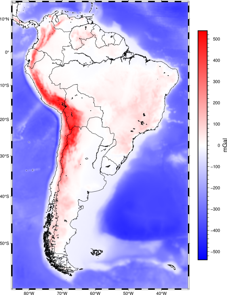
Fatiando tools can be used in a wide range of geophysical applications. For example, computing the gravitational fields of large structures can provide relevant insight to geodynamic applications, like validating numerical models against observed gravity data, or inverting Moho depths from satellite gravity data on continental scales (Uieda and Barbosa 2016). Harmonica offers tools to calculate the gravitational field of large scale structures using tesseroids, also known as spherical prisms, that take into account the curvature of the Earth. They come handy also in data processing steps, like removing the gravity effect of topography, also known as terrain correction (Figure 1).
Figure 1: Gravity effect of the terrain over South America, computed using tesseroids.
Harmonica offers classes to interpolate gravity and magnetic data through the equivalent sources technique, a method that relies on the non-uniqueness of potential fields. It consists in defining a set of synthetic sources and adjust their masses so they generate the same gravitational field as the observed one. Once defined, we can use them to predict the same field on any unobserved location. Harmonica’s gradient-boosted equivalent sources overcome the computational limitations of classical equivalent sources, allowing to interpolate very large gravity and magnetic datasets. For example, we were able to generate a regular grid of almost 2 million (!) gravity observations over Australia on a desktop computer (Figure 2; Soler and Uieda 2021).
Figure 2: Observed (a-b) and interpolated (c-d) a large gravity dataset over Australia. The interpolation was carried out through Gradient-boosted equivalent sources. Modified from Soler and Uieda (2021).
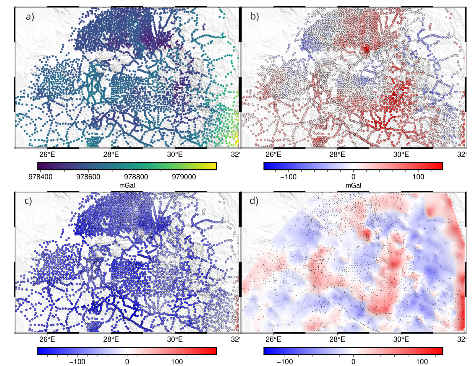
Moreover, Harmonica and Boule offer all the tools needed to process gravity data, from observed gravity up to gridded residuals: removing normal gravity with Boule’s ellipsoids (reference ellipsoids used to define geodetic coordinates, like the WGS84), computing the terrain correction by forward modelling a model of the topography, removing the regional field with deep equivalent sources, and producing a gridded product of this residual field using equivalent sources (Figure 3).
Figure 3: Processed gravity data over Bushveld, Southern Africa: (a) observed gravity data, (b) gravity disturbance, (c) Bouguer gravity disturbance, and (d) regular grid of the residual gravity field (obtained after the removal of the regional field).
Our goal: open and reproducible science
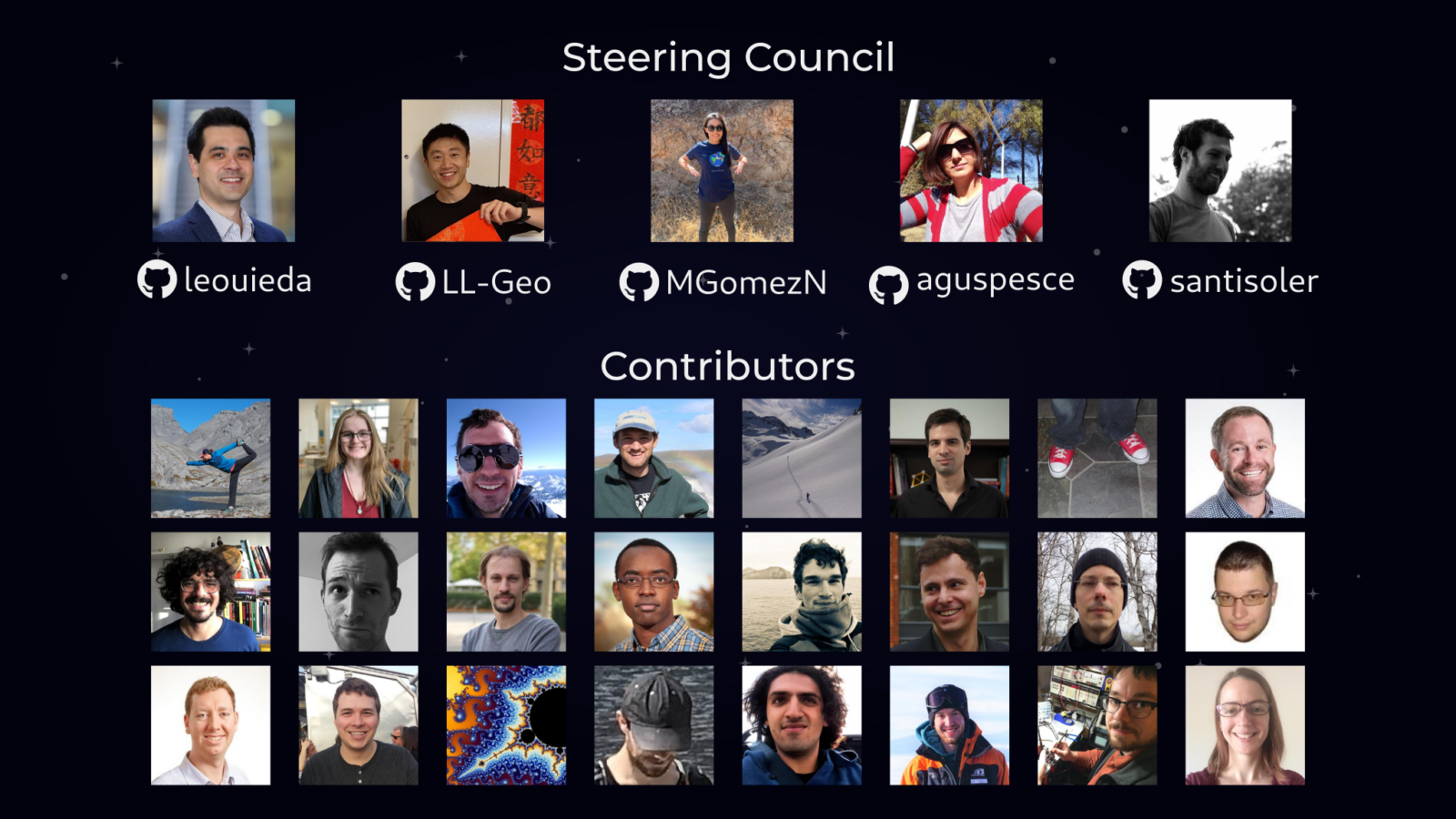
Fatiando developers and contributors are committed to build a more open and reproducible science (Figure 4). All its software is released under open-source licences, making it freely accessible to any researcher, and helping to make scientific results obtained by using it more reproducible
Interested in getting involved? We develop these tools in the open, through a transparent and auditable process, to which we invite everyone to join and participate. This process has created opportunities for collaborations between researchers from around the world, beyond the scientific paper: joining efforts to solve common problems and build tools in a collaborative way.
We also aim to promote best practices for software development among the scientific community, like creating good documentation, writing tests that guarantee the software works as expected, and peer-reviewing new additions to the code. Following these and other best practices helps to create high quality research software, and set the environment for other people to easily collaborate and learn more about software development. If you are a geoscientist interested in software development and open science don’t hesitate to contact us!
Figure 4: Fatiando a Terra Steering Council and Contributors
Roadmap for the future
We expect great things for the future of the project. By the end of July 2023, the Fatiando a Terra and SimPEG (an open-source Python project for running geophysical inversions) communities will join in a BIRS Workshop in Banff, Canada, to work on future roadmaps for the two projects and to join efforts to create further interactions.
We plan to keep building the project, developing new tools, and improving the existing ones. Along the way we expect to gain more contributors, enlarge the community and strengthen the relationships with the rest of the Python geoscientific ecosystem.
If you like to keep up with our latest updates, check out our website.
References

Soler, S. R, & Uieda L., 2021. Gradient-Boosted Equivalent Sources. Geophysical Journal International 227 (3): 1768–83. https://doi.org/10.1093/gji/ggab297.

Uieda, L., & Barbosa V. C. F. 2016. “Fast Nonlinear Gravity Inversion in Spherical Coordinates with Application to the South American Moho. Geophysical Journal International 208 (1): 162–76. https://doi.org/10.1093/gji/ggw390.

