Welcome back to the HydroData Chronicles, a fantastic voyage through the interesting aspects of hydrological data with deep impacts on climate research and societal resilience. It is now the turn of Greece to shine, with this superlative effort from the National Observatory of Athens with NOAAN, the NOA Automatic Network outpacing many others, high in meteorological observation all over the region. Join us as we explore the story of how this network came to be, its many uses, and what it means for the future of environmental research and economic innovation.
The NOAAN Vision and Development
The last ten years have seen a leap forward in Greece regarding the collection of meteorological data and its applications, thanks to the Institute for Environmental Research and Sustainable Development at NOA. Since 2006, IERSD has been operating the NOA Automatic Network, a dense web of automated weather stations, in order to cover the variable Greek terrain, including all its islands.
NOAAN was thus founded for dual purposes: to meet the research needs of the scientific community and to provide various sectors of the economy of Greece with reliable current weather data. Since its establishment, the network has been designed to respond to these needs by:
- Delivering high-quality, real-time weather data to users across sectors, including agriculture, construction, leisure, and tourism.
- The data are available through web-based repositories, is viewable therein, and can be downloaded in very usable form.
- • Relatively low-cost surface weather equipment, sustainability, transmission of data by exiting infrastructures, and involvement of local weather enthusiasts in the maintenance and debugging.
- The stations continuously transmitting measurements at 10-minute intervals, providing valuable insights for weather monitoring and analysis.

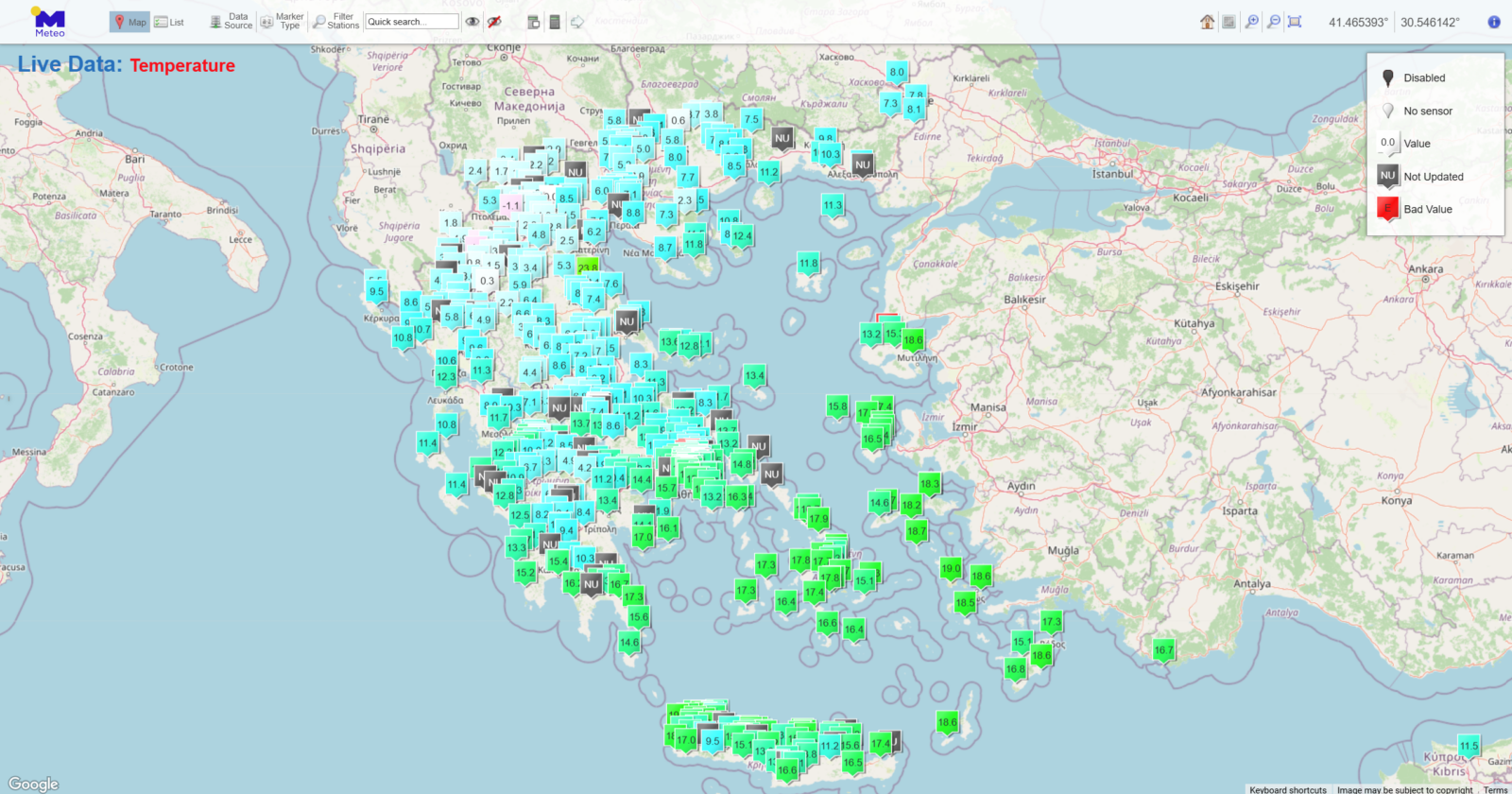
Meteo Web-GIS application illustrating the Geographical distribution of the network of automatic stations over Greece (@NOA, under the Creative Commons Attribution 4.0 License)
Applications Across Sectors
The impact of NOAAN goes beyond academia and is a vital asset for industries and communities alike. Some of the key uses of NOAAN data include:
- Scientific Research: The network supports urban environmental studies, severe weather event analysis, and climate model validation and verification.
- Agriculture: NOAAN data is used by farmers to analyze local microclimates and weather effects on crops to assist in planning activities.
- Construction and Insurance: Information from NOAAN feeds into calculations like degree days and maximum rainfall, which are useful for construction planning and estimating insurance damages.
- Public Awareness and Safety: Weather updates in real time enable preparation for severe weather events that are important in public safety and disaster management
Sustaining a Meteorological Legacy
One of the keys to NOAAN’s success so far has been in its sustainability: with the relatively low-cost equipment, strategic site selection, and reliance on local support, the network is able to operate continuously with limited resources.
While the rapid growth in the network has slowed over recent years, NOAAN continues to maintain an operationally high standard. Although, the strategy has downshifted to filling crucial gaps in coverage, and a number of about 400 stations was targeted to allow manageable maintenance, it would appear that by 2024, the network was oversubscribed, with over 500 operational stations providing high-resolution, real-time precipitation data at 10-minute intervals.
Looking Ahead
Now fully developed, the NOAAN is one of those ideal cases that was possible through collaboration cost-effectively within a meteorological network. Its applicability to both scientific research and economic development has been an important factor in securing this parallel desire of the public for safety. With more than 500 operational stations at present, NOAAN may stand as testimony to commitment, not just from IERSD but as a beacon for such initiatives from different corners of the world.
Explore NOAAN data
Whether you’re a researcher looking to track historical precipitation trends or a policymaker needing accurate climate data, NOAAN can be accessed here.
Call for Contents
As we continue our journey through the world of hydrological data, we invite fellow researchers, scientists, and enthusiasts to contribute to the HydroData Chronicles. If you have a dataset that you believe would be valuable to others in the field, we would love to feature it in an upcoming post.
Feel free to reach out to [athanseraf@hotmail.com] to discuss featuring your dataset in an upcoming post. Together, let’s delve deeper into the realm of hydrological data and uncover its untold stories.


Alfun adam
Good Information
Regards, Unissula