Inland surface water is a critical resource when scarce and a potential hazard when floods occur. Because the extent of surface water affects habitat condition, weather, and biogeochemical cycles, our ability to accurately track variations in surface water extent is important for resource management, science, commerce, hazard mitigation, and policy making.
Openly distributed data derived from satellite imagery offer the public a way to detect and track the extent of inland water bodies. A USGS approach used to depict United States water extent variations over a more than 40-year period is now being applied globally by NASA using multiple satellite systems. Several challenges remain – including assessment of partial surface water conditions across a range of environments.
Harnessing satellites to track inland surface water
As noted by Wulder and others, the open availability of systematically collected image data like those from the Landsat satellites is transforming resource management and science from local to global scales. Similar distribution of data from the Sentinel satellites is expanding these benefits. Demand for information on variations in surface water extent fosters the development and production of time series data from these systems, such as:
- JRC – Global Surface Water Explorer dataset
- USGS Dynamic Surface Water Extent dataset
- NASA OPERA Dynamic Surface Water Extent from Harmonized Landsat Sentinel-2 provisional dataset
All of these products identify ‘open water’, locations where an individual satellite observation (picture element or pixel) is dominated by surface water and is unobstructed when viewed by the sensing system.
When the water is deep, dark, and surrounded by more open water, accuracy can be high. However, as I discuss in a treatment of remote sensing for wetland science, when vegetation is in or over water, clear water is shallow over bright surfaces, or other land covers are present in or next to a pixel containing surface water, detection of the water via remote sensing is far more difficult.
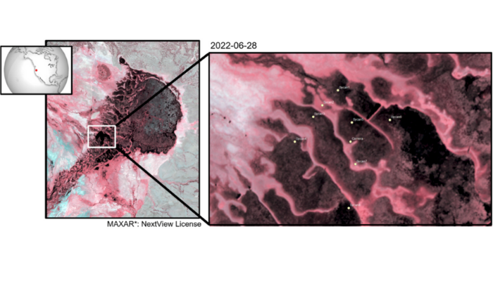
Sensors are placed to capture water extent variations and the data they provide are combined with fine resolution imagery for DSWx algorithm development and assessment.
Tackling the ‘Partial Surface Water Challenge’
Analyses of Landsat data in the Florida Everglades demonstrated that when these inundated pixels aren’t accounted for, important and frequent variations in water extents are missed. I refer to these pixels as ‘partial surface water’ and as described in this interview, the ability to monitor them has been a specific objective in the development of the U.S. Geological Survey (USGS) Level-3 Landsat science product named Dynamic Surface Water Extent (DSWE).
DSWE is operationally generated for the United States from the Landsat archive, providing a 40-year and growing record of open and partial surface water extents as a standard, openly available product (USGS Dynamic Surface Water Extent dataset).
Because the US Federal Satellite Needs Working Group (SNWG) identified near-global surface water extent with DSWE-like characteristics as a high priority information need, NASA created the Observational Products for End-Users from Remote Sensing Analysis (OPERA) project. Conducted by the Jet Propulsion Laboratory, OPERA develops satellite-based analysis ready data products for resource management, environmental protection, and science.
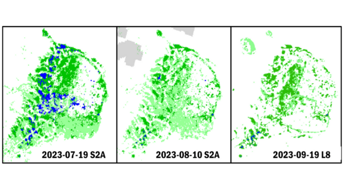
Surface water extent data time series showing complex changes in marsh hydrology and vegetation. Two satellite system inputs are represented: ESA Sentinel-2A (S2A) and NASA Landsat 8 (L8). Blues: Open Water; Greens: Partial Surface Water: Grey: Clouds.
OPERA Surface Water Extent
The OPERA product focused on inland surface water detection is named Dynamic Surface Water eXtent (DSWx). The first DSWx product release (DSWx-HLS) relies on Harmonized Landsat Sentinel-2 (HLS) data to yield a median observation frequency of approximately three days with near-global coverage. Like the DSWE algorithm, the DSWx-HLS algorithm targets open water and partial surface water.
DSWx-HLS provisional data production began in April 2023 and the results (NASA OPERA DSWx-HLS provisional dataset) are openly distributed (PO.DAAC). Subsequent DSWx releases will be based on radar from the Sentinel-1 and NISAR satellites, to yield DSWx-S1 and DSWx-Ni. These additional DSWx algorithms will target the detection of partial surface water as allowed by the sensing technology being employed in each case, so detection capabilities will vary by sensor. However, the DSWx product design, such as a uniform tiling system, spatial resolution, and georeferencing affords their combination by users during application.
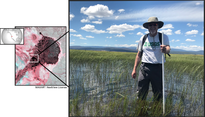
Evaluation of partial surface water detection is very challenging because we lack groundtruth data on where and when partial surface water exists. To address this, we are running collaborative campaigns to conduct field surveys and collect in-situ data at sites across the United States.
A volunteer carefully works their way toward an inundation sensor hidden from view by vegetation and water. Photo Credit: John W. Jones (USGS).
Become involved – Help us track Partial Surface Water
Are you already collecting data on inundation where vegetation cover is present? Perhaps you could easily modify your current field activities to collect such information as well? If so, we would like to collaborate with you to increase the number of global sites where partial surface water algorithms and products can be evaluated.
If you are interested in collaborating and are willing to pool your data in a global collection to improve global surface water mapping, please reach out to me. Regardless, EGU24 will provide opportunities to make others aware of your efforts to combine field and remote sensed data for science and water resource management. Perhaps we may meet there.
*Use of trade, firm, or product names is for illustrative purposes only and does not imply endorsement by the US Government.
Edited by Christina Orieschnig