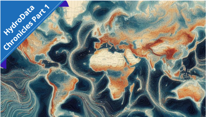
Welcome to our new blog-series focused on exploring the vast, yet fascinating world of hydrological datasets: HydroData Chronicles! Throughout this series, we embark on a journey through the intricate backend of hydrology, where data serves as the cornerstone of our understanding of water resources, as well as their potential impact on scientific research and policy-making. Join us as we navigate the streams of data, unlocking the secrets they hold, and unraveling the stories they tell about our planet’s water cycle. Who knows – you might discover a dataset that’s handy for your own research!
In our inaugural installment, we shine a spotlight on a new achievement in the realm of hydroclimatic data: a high-resolution 40-year rainfall dataset covering the entirety of the Contiguous United States (CONUS), developed by Emmanouil et al. in 2021.
Bridging Gaps with Atmospheric Reanalysis and Remote Sensing
The length and spatiotemporal scales of rainfall timeseries are particularly important for hydrologic modeling, as well as hydroclimatic risk estimation and impact assessment.
In the past, atmospheric reanalysis has already offered datasets with extensive record lengths and global coverage. However, their spatial resolution is often insufficient for distributed hydrologic simulations over finer spatial scales.
A potential alternative could be the employment of high-resolution rainfall estimates obtained through remote sensing. Yet their relatively short temporal coverage could pose challenges for water resources applications, while biases induced primarily by the complexity of the terrain and/or atmospheric phenomena can limit their applicability.
The Birth of a Comprehensive Dataset
To address these shortcomings, Emmanouil et al. derived a high-quality hourly precipitation product over the entire Contiguous United States (CONUS), which spans back to 1979 (more than 40 years) over a 4-km grid. To do so, they employed a refined statistical scheme to simultaneously bias-correct and downscale rainfall estimates from the ERA5 atmospheric reanalysis (i.e., offering extensive temporal coverage) to finer spatial scales, using radar-based products (Stage IV data, based on a multi-sensor hourly/6-hourly analyses) as the high-resolution reference.
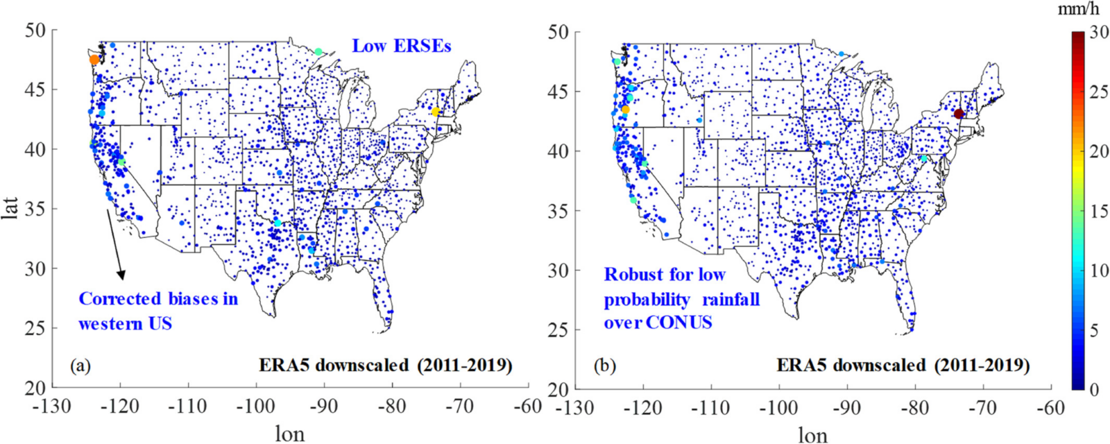
Maps of (a) Expected Root-Squared-Error (ERSE) and (b) ERSE95 of the downscaled ERA5 precipitation product for the calibration period (January 01, 2011 to December 31, 2019) (© American Geophysical Union)
Assessing Performance and Reliability
The study showcases that the developed dataset displays consistent and robust performance, as it benefits from the strengths of the incorporated information without being significantly affected by inconsistencies in the individual records. Through an examination across various Köppen climate classification zones, the authors noticed that the downscaled dataset presents a consistent behavior even for regions prone to snowfall or to the occurrence of mesoscale convective systems.
In essence, the reliable performance of the bias-corrected rain rates that correspond to low exceedance probabilities, supports the conclusion that the data can be effectively adopted for hydroclimatic risk applications and frequency analyses. Additionally, the dataset’s detailed spatiotemporal attributes render it valuable for implementing physically-based distributed hydrologic modeling.
Access the Dataset Here!
The CONUS-wide downscaled precipitation dataset is freely available at https://doi.org/10.5061/dryad.8kprr4xnq; (Emmanouil et al., 2021).
Given the recent developments from ECMWF, the dataset is expected to be extended to 1940, providing more than 80 years of valuable data.
Call for Content
We invite fellow researchers, scientists, and enthusiasts to join us in shaping the narrative of hydrological data exploration, as we begin this adventure. If you have a dataset that you want to share with the world, and believe would be valuable to other researchers, we’d love to hear from you!
Feel free to reach out to [athanseraf@hotmail.com] to discuss featuring your dataset in an upcoming post. Together, let’s delve deeper into the realm of hydrological data and uncover its untold stories.