Importance and challenges of snow modelling in Turkey

The large snow cover area in Turkey can be seen from the satellite image Credit: https://www.natice.noaa.gov/
Snow and glaciers in the high mountains play a crucial role for 1.6 billion people living downstream of mountainous areas. Thus, understanding snow dynamics is crucial for downstream irrigation, hydropower, flood control etc. In eastern Anatolia, Turkey (the mean elevation is around 1140 m), much of the precipitation falls as snow and is retained on the ground for more than half of the year especially in the mountainous regions. Although snow hydrology is labor intensive due to harsh terrain/weather conditions, investigations are needed for better management of the downstream reservoirs. To that end, the Upper Euphrates Basin (Karasu Basin) was selected as a pilot catchment in the last two decades.
Our research goals are:
- to analyze and understand the characteristics of the snow processes with ,
- to enhance the observation network especially at high altitudes,
- to conduct satellite snow product comparison, ground validation and hydro-validation (snow cover area, snow water equivalent) followed by impact assessment,
- to use multiple data sources (gauge, Numerical Weather Prediction, re-analysis, ensemble, satellite observations of snow, precipitation, soil moisture),
- to apply several hydrological models of varying complexity,
- to test various data assimilation methods through hydrological models,
- to provide recommendations for managers who operate downstream reservoirs,
- to develop an operational hydrologic forecast system for flood control, irrigation, hydropower, municipal use
- to understand the effects of climate change in snow dominated regions.
The Upper Euphrates River (Karasu River) Basin

Transboundary Euphrates River, the longest in southwest Asia, is formed by the union of two major tributaries: Karasu and Murat rising in the highlands of eastern Turkey. Euphrates Basin is the largest in Turkey with a drainage area of 127,304 km2 contributing 17% of the total potential of the country where most important dam reservoirs (Keban, Karakaya, Atatürk) are located within its boundary. Hence, forecasting the amount and timing of runoff at the headwaters of the Upper Euphrates highly important for operation of the reservoirs.
Karasu Basin (the headwater of the transboundary Euphrates Basin) is located in eastern Turkey and has a drainage area of 10,275 km2, ranging in altitude from 1100 to 3500 m a.s.l.. The land cover is pasture (35.0 %), agriculture (31.5 %), bare land (27.5 %) and others (urban, forest, lakes, 6.0 %). The Karasu Basin is highly snow-dominated where snowmelt constitutes approximately 2/3 of total annual runoff volume during spring and early summer months.
Several studies on Snow Cover Area (SCA) or Snow Water Equivalent (SWE) using satellite data and streamflow forecasting applications were conducted and are still ongoing in the Karasu Basin as one of the pilot basins selected for various national and international funded projects (EUMETSAT H-SAF, COST ES1404, TUBITAK). Even though particularly important, it is still a less-studied region of the world and extracting and assessing the important snow characteristics is challenging.

Main focus of these studies is runoff forecasting at different time scales using various data sources of direct/remote observations and numerical weather prediction together with modeling and assimilation tools.
Field Studies and Observations
Start of the in-situ works, installation of snow measurement tools and challenges
Due to the harsh climatology and topographical conditions and the large extent of the area, there used to be a scarce observation network. However, in the late 1990s, the snow observation network began to be enhanced with the contribution of governmental institutions and support from University led national and international projects.

Photos from in situ snow measurements and snow stations

Photos from Harmosnow Joint Event on International Workshop, 1st Field Campaign & Meetings which was held in Erzurum, Turkey between 1-3 March 2016.
Detailed snow telemetry (SnoTel) stations were installed including snow depth (ultrasonic), snow water equivalent (snow pillows and now dielectric cables), snow melt (snow lysimeter) and meteorological sensors. The number of SnoTel stations are increasing each year in order to maintain a stable observation network as well as to better monitor the area of interest. Moreover, snow pit studies are carried out at specific locations.
With all the infrastructure in the region, an international snow field campaign was organized on 1-3 March 2016 under the guidance of COST ES1404 action (harmosnow) (fieldcampaign). Other field campaigns were also carried out in different international field sites for the harmonization of snow measurements as summarized in the European Snow Booklet.
The “EUMETSAT Satellite Application Facility on Support to Operational Hydrology and Water Management (H-SAF)” project was initiated in 2005 as a part of the EUMETSAT SAF Network to provide new satellite-derived products from existing and future satellites with sufficient time and space to satisfy the needs of operational hydrology.

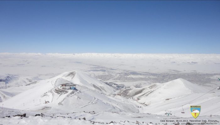
A snow pit time lapse example (4 March 2019 Palandöken-Erzurum) to extract snow profile for our snow model assessment shown below.

A 20-year snow extent observation of the area is summarized for the basin.
Remote Sensing Snow Data
In the 90s daily snow cover monitoring began using NOAA-AVHRR satellite and later MODIS platforms to continue the process assisted by MSG-SEVIRI and IMS imagery.
The “EUMETSAT Satellite Application Facility on Support to Operational Hydrology and Water Management (H-SAF)” project was initiated in 2005 as a part of the EUMETSAT SAF Network to provide new satellite-derived products from existing and future satellites with sufficient time and space to satisfy the needs of operational hydrology.

Observation of Snow Water Equivalent (SWE) by means of remote sensing is also carried out using SSMI/S and AMSR-E satellites, but in a coarser resolution (~25 km) compared to snow extent.
Re-analysis Data
Scarce snow observations in many mountain areas of the world are a strong limitation to properly quantify water stored in snowpacks and to predict runoff during the melting period. Recently, we compared simulated snow from two procedures of dynamical downscaling of atmospheric models (WRF and ICAR) with snow cover area and snow water equivalent retrieved from satellite products in cooperation with Spanish colleagues.
Precipitation is considered as one of the main elements with greater impact for hydrological modelling studies. Satellite-based precipitation (SBP) products are valuable for remote and poorly gauged basins, but still suffer from high biases especially in the mountainous regions. Thus, one current research aim is to test the performance of SBP in comparison with gauge-based data in an enriched station network area (installed with aforementioned projects) and investigates the impact on runoff prediction.

H SAF operationally provides high quality Precipitation, Soil Moisture and Snow products derived from Earth observation satellites, together with their continuous quality assessment. The basin is also a pilot study area in H SAF project for the hydro-validation and impact studies.
Satellite-based Precipitation Data
Precipitation is considered as one of the main elements with greater impact for hydrological modelling studies. Satellite-based precipitation (SBP) products are valuable for remote and poorly gauged basins, but still suffer from high biases especially in the mountainous regions. Thus, one current research aim is to test the performance of SBP in comparison with gauge-based data in an enriched station network area (installed with aforementioned projects) and investigates the impact on runoff prediction.
Modeling and Forecasting Studies
Hydrological Modeling and Forecasting
One of our major goals is to forecast discharge at the outlet of the basin. We have demonstrated several model types in Karasu Basin. One other merit is to clarify pros and cons of different modelling types in the mountainous basins. The applied conceptual hydrologic models are HBV, HEC-HMS, SRM and SWAT. After calibrating/validating the hydrologic models with long term precipitation-runoff and snow data, numerical weather predictions (deterministic/probabilistic) are used as input to predict discharges. Also, a recent study has been initiated to set up a distributed model via WFLOW. Due to the increasing attention on data driven methods and their capability on modeling nonlinear processes, lately machine learning methods such as multilayer perceptron, radial basis function, wavelet (models) are being employed which takes remote sensing snow products as input together with meteorological observations.
Data Assimilation
The uncertainties of the initial conditions are mainly tackled with Data Assimilation (DA) methods. Most of the existing implementations of DA in hydrology have focused on the assimilation of streamflow data. In this catchment, we are working to correct the As a part of the COST project, “Data Assimilation of Satellite Snow Products through Hydrological Modelling” and “Multi-parametric Variational Data Assimilation of Satellite Snow Products through Hydrological Modelling” studies aim to implement Variational technique (based on Moving Horizon Estimation) and Sequential techniques (Ensemble Kalman Filter) through a conceptual hydrological model (HBV) to assimilate MODIS snow products data. The tests were conducted in two different snow dominated catchments and a follow-up study implements a novel approach that generates a probabilistic estimate of initial states using a multi-parametric modelling method based on the variational DA.

Distributed SNOW-17 model results on height of snow and snow water equivalent for 1 March 2018.
Snow Modeling
The seasonal snowpack covering much of the mountainous eastern part of Turkey can vary spatially and temporally from year to year due to atmospheric movements, geophysical changes, global warming and human impacts. Therefore, snow components such as height of snow, snow water equivalent, duration of snow cover and metamorphism during the season need to be monitored in detail. In recent years, distributed snow modeling has been performed using the SnoTel network in and around the area of interest for calibration/validation purposes.
Effects of Climate Change in Snow Regions
One current research project aims to find the future projections of runoff and snow potential in Karasu by investigating changes of snow extent, snow water equivalent, snow line elevation, and snowmelt peak time in the. The results will help us to understand how these changes will affect operations of water resources systems (headwater/upstream reservoirs) in terms of flood control, energy supply, irrigation etc.
 Gökçen Uysal: Dr. Uysal is an assistant professor at the Department of Civil Engineering, Eskişehir Technical University. He has been involved in several national and international projects. His research covers (i) hydrological modelling, (ii) real-time operation of reservoirs and control systems, (iii) multi-stage stochastic optimization, (iv) integrated modelling within a Decision Support System, (v) data-driven models, (vi) climate change impact studies on water resources, and (vii) data assimilation of satellite snow products through hydrological modelling. He is currently the representative of the Early Career Committee (ECC) of the International Association of Hydrological Sciences (IAHS) within The International Commission on Water Resources Systems (ICWRS).
 Ali Ünal Şorman: Dr. Şorman is an emeritus professor at the Department of Civil Engineering, Middle East Technical University (METU), Ankara, Turkey. Until retirement, he led many projects and represented Turkey in many national and international committees. His research covers statistical, arid-land and snow hydrology with application of remote sensing methods as well as drought and flood management.
 Aynur Şensoy: Dr. Şensoy is a full-time professor at the Department of Civil Engineering, Eskişehir Technical University, Eskisehir, Turkey. Her principal research interests are focused on hydrological modeling in operational flood forecasting and water resources management. Her main interests are understanding and predicting hydrological processes across scales; catchment hydrology including snow and remote sensing technology; hydrological simulation and modelling; deterministic and probabilistic numerical weather prediction data for real time runoff forecasting; operational reservoir management.
 Ali Arda Şorman: Dr. Şorman is an assistant professor at the Department of Civil Engineering, Eskişehir Technical University (ESTU), Eskisehir, Turkey. He has been involved in several national and international projects/communities. His research interests cover snow measurements and modeling, remote sensing of snow, integrated hydrologic, hydraulic and reservoir modeling, operational runoff forecasting and data assimilation of satellite products in hydrological modeling.
 Mustafa Cansaran Ertaş: Dr. Ertaş is an assistant professor at the Department of Civil Engineering, Erzurum Technical University (ETU), Erzurum, Turkey. He has been involved in several national and international projects. His main interests are in-situ snowpack measurement and field instrumentation, energy and mass balance of snow modeling, remote sensing of snow, hydrologic modeling on mountainous regions largely fed by snowmelt, application of deterministic and probabilistic numerical weather prediction data for streamflow forecasting.
Edited by Matthias Sprenger
A. Ünal Şorman
Excellent work done. 👏👍🤗
Congratulations Gökçen and his collieges
Ali Danandeh Mehr
An outstanding research. Congratulations!
Hamed Hafizi
Thanks for sharing this valuable information. Great content really helped those who want to know and understand new aspects about the topic (Snow) , looking forward to more such valuable work.