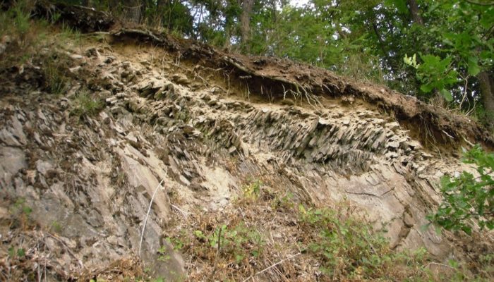
Slate bedrock, an often overlooked system

Catchment outlet during a summer drought
At first sight, the Weierbach catchment may seem unspectacular. It is indeed a small (42 ha) forested headwater catchment, located at mid-latitude in a low mountain range (450-500 m a.s.l.). However, when you take a closer look, and particularly below the surface, the Weierbach is a truly exciting eco-hydrological system. Located in the Luxembourgish Ardennes and as a part of the Rhenish Massif that extends through Belgium, France, Germany, and Luxembourg, the Weierbach is representative of a rarely studied Critical Zone system. Composed of (fractured) Devonian slate bedrock, is the Weierbach covered by Pleistocene slope deposits with a Dystric Endoskeletic Cambisol (Colluvic, Bathyruptic, Siltic) in the first 70 cms of the regolith. This highly permeable subsurface results in rather specific hydrological and ecohydrological processes. Although they are representative for substantial parts of the central European landscape, these processes have been often overlooked. In addition, the Weierbach is part of a lager set of catchments, monitored in the Luxembourg and that provide an ideal basis for catchment inter-comparison studies.
Rich data sets for understanding Critical Zone processes – an invitation to collaboration
In the Weierbach catchment, we – the Catchment and Eco-hydrology research group at the Luxembourg Institute of Science and Technology – use an interdisciplinary multi-method approach to better understand, transfer, and predict catchment functions that control storage and fluxes of water, solutes, and matter. Within the Weierbach, we combine long-term hydrological, ecohydrological, and geochemical baseline monitoring since 2002, as well as short-term project based studies and novel technologies to enhance our understanding and prediction capabilities of Critical Zone processes. Rich data sets exists and invite for collaborative research. Specifically, the baseline monitoring in the Weierbach consists of:
- Long-term (up to 20 years) hydro-climatological data that are recorded at a meteorological station; eight soil monitoring stations with (soil moisture & temperature) sensors at 10, 20, 40, and 60 cm depth; twelve wells installed in boreholes from 2.5 to 10 m depth that record water level, temperature, and electrical conductivity (EC); four stream gauges recording water level, temperature and EC; and quantification of throughfall (at three locations).
- Long-term (up to 10 years) fortnightly monitoring of water isotopic composition (δ18O, δ2H) and chemistry (EC, pH, alkalinity, anions, cations, silica, trace metals, DOC/TN, UV-abs 254) in precipitation (one station), throughfall (three locations), groundwater (12 wells), and stream water (four locations).

Visual and thermal infrared images of a saturated riparian area
In the past two decades, additional monitoring and experimental campaigns have been carried out:
- Suspended sediment concentrations were measured for 25 events using automatic samplers
- Characterisation of terrestrial and aquatic diatom communities were observed for event hydrographs, baseflow, and on the soil surface
- High-frequency (15 min) DOC/Nitrate concentrations were monitored over two years at the catchment outlet
- High-frequency (sub)-hourly signatures of δ18O and δ2H in streamflow and precipitation were observed for a wide range of runoff events
- Sub-daily monitoring of δ18O and δ2H in streamflow has been carried out at two stream gauges for >2 years
- Stream water was sampled monthly over two years for tritium analysis at the catchment outlet and occasional sampling took place at summer low flow for 5 years
- Bi-weekly chemical and isotopic characterisation of soil water using suction lysimeters for 2 years
- Characterisation of trace metal concentrations and Sr-Nd-Pb radiogenic isotope ratios in various water cycle compartments
- Riparian surface saturation with ground-based thermal infrared sensing at weekly intervals for two years and sub-hourly sensing for approximately half a year
- Groundwater level, EC, and temperature monitoring with a network of 36 wells in a 50 m section of the stream corridor and lower hillslopes for 2 years
- Sap flow monitoring at >30 trees for 2 years
- Weekly to bi-weekly sampling of δ18O and δ2H in xylem water in a randomised approach throughput the catchment for 2 years
- Electrical resistivity tomography surveys and core drilling to characterise the regolith

Results from repeated ERT survey covering the Weierbach catchment (by Laurent Gourdol)
Hydrological response driven by the interplay of surface and subsurface processes
- High permeability of soil and subsolum with high infiltration rate leads to rapid and deep percolation
- Pronounced double-peak runoff response with a small peak from the near stream zone (event water) concurrent with rainfall and a delayed (>20 hours) broad and higher second peak consisting of pre-event water
- The occurrence of the second peak is controlled by exceedance of a storage threshold in the catchment; furthermore the amount of storage connected to the stream is closely linked to catchment travel times
- Three distinct age components result in catchment travel times from young water near the stream, weeks to a few years old water from hillslopes and weathered bedrock, and water with several years of mean travel times from weathered bedrock
Open questions, current challenges and ongoing research
Ecohydrology and geochemistry in the Critical Zone
How is diverse forest vegetation modifying nutrient and element cycles in the critical zone? How are spatio-temporal patterns of vegetation water use and water sources controlled on homogenous soils, and how do these processes impact catchment runoff? Much of ongoing research focuses on ecohydrological processes as well as catchment scale geochemical processes. Tree water uptake of different species (main species: Fagus sylvatica and Quercus petraea), as well as nutrient and element cycling in the regolith-plant systems, are evaluated within different projects relying on trace elements, δ18O and δ2H, and sap flow observations. Beyond nutrient and element cycling, this work is geared towards a better understanding of landscape controls on spatio-temporal patterns of transpiration and vegetation water sources. Last, catchment scale mass flux of stable isotopes through vegetation are evaluated.
https://youtu.be/pe0ecMY7hg8
Catchment hydrology and numerical modelling
How do different streamflow generation processes combine to overall catchment response? The combination of deep and porous regolith, moderate slopes with forest vegetation, and small but mostly saturated riparian areas generate a complex combined hydrological response. Runoff generation and catchment travel times are studied by incorporating ecohydrological information and dense spatio-temporal sampling of δ18O and δ2H in a multitude of hydrological compartments. We complement the experimental process insights within the Weierbach by conceptual and physically based hydrological models to decipher streamflow geographic sources and catchment travel times under a non-stationary climate.

Conceptual understanding of runoff generation in the Weierbach, with rapid contributions from riparian soils (A), saturated flow thorough the basal layers (B) and at high catchment storage (C), and deeper groundwater contribution from the slate bedrock (D) (from Rodriguez and Klaus, 2019).
Ongoing research projects
The HYDRO-CSI doctoral training unit contributes to a better understanding of catchment functioning under non-stationary boundary conditions, funded by the Luxembourg National Research Fund (FNR, 2017-2023, PI Laurent Pfister) with several PhD research projects focusing on the Weierbach:
- Rare Earth Elements cycles in the soil-plant system (PhD student Alessandro Montemagno, Main supervisor Christophe Hissler)
- Modelling spatio-temporal variability in geochemical signatures (PhD student Nicolaus van Zweel, Main supervisor Christophe Hissler)
- Travel times in the critical zone using stable water isotopes (PhD student Adnan Moussa, Main supervisor Julian Klaus)
- Hyporheic and in-stream flow and transport (PhD student Enrico Bonanno, Main supervisor Julian Klaus)
- Climate resilience through a catchment comparison study (PhD Carol Tamez-Melendez, Main supervisor Laurent Pfister)
The EFFECT project aims at deciphering forest vegetation controls on runoff generation and water age in the Critical Zone (funded by the FNR, 2018-2021, PI Julian Klaus, Post-doc Rémy Schoppach).
The STEPUP project, where transpiration and tree water sources are investigated along topographic gradients and for different geologies and climates (PhD student Ginevra Fabiani, Main supervisor Julian Klaus in collaboration with Daniele Penna, University of Florence, Italy)
 Guest author Julian Klaus is a Senior Scientist at the Luxembourg Institute of Science and Technology working on hydrological and ecohydrological processes with experimental and modelling tools for better understanding and predicting fluxes of water, solutes, and matter in the Critical Zone.
 Guest author Christophe Hissler is a senior scientist at the Luxembourg Institute of Science and Technology. His research explores natural tracers for understanding critical zone processes by combining O-H stable isotopes and trace elements concentrations (rare earth elements) with radiogenic isotopic ratios (Sr-Nd-Pb) in natural and anthropogenic landscapes.
With contributions from the members of the Catchment and Eco-hydrology research group at the Luxembourg Institute of Science and Technology. The CAT research group enhances hydrological, ecohydrological, geochemical, and geophysical processes understanding through innovative monitoring, experiments, and modelling approaches.
Edited by Matthias Sprenger