Tropical ecosystems are of major hydrological importance for regional and global climate systems and are characterized by greater energy inputs, higher rate of change and dynamics compared to other hydroclimatic regions. Nowadays, the anthropogenic influence in the climate crisis exerts enormous pressure on tropical hydrological systems. This growing pressure affects water quality and quantity, which in turn can undermine socio-economic and human development of a vulnerable population as described by the Sustainable Development Goals (SDGs). Despite the importance of these climate change hot spots, the scientific evidence to understand how tropical catchments respond to external factors is limited due to the scarcity of even basic hydrological data.
The humid tropical San Carlos Catchment (SCC)

Photograph of the upper catchment area: Typical primary rainforest land cover. Photo credit: Christian Birkel
The San Carlos research catchment (2620 km2) in the humid tropics was instrumented by the Water and Global Change Observatory (OACG) in 2013. It is located in the north-east of Costa Rica, with the headwater at the continental divide in the Central Cordillera and draining into the San Juan border stream to Nicaragua in the north. The elevation varies between 2326 m.a.s.l. and 30 m.a.s.l. and the mean air temperature is 23°C. The annual reference evapotranspiration ranges from 800 to 1200 mm, and the average relative humidity is 83%.
From the headwaters down to approximately 1500 m.a.s.l. the vegetation cover is dominated by dense tropical montane rain forests (trees approx. 25m height) and cloud forests. These forests are almost entirely protected areas. At lower altitudes, forests transition into grassland and pasture areas for cattle ranching. The lowlands (< 250 m.a.s.l.) are dominated by intense agriculture with extensive pineapple and sugarcane plantations.

Photograph of the lower catchment area: Typical intensive pineapple plantations (right). Photo credit: Melisa Mena
The catchment is mostly influenced by Caribbean Sea weather patterns and closer to the continental divide, impacted by the decrease in rainfall associated with the Mid-Summer Drought from the Eastern tropical Pacific Ocean. The Caribbean climate is reflected by consistent rain and high relative humidity throughout the year, while the Pacific influence is associated with rainfall events mainly between May and November and a dry season from on average December to April. The annual rainfall in the SCC is on average 4000 mm with a spatial variability from 3000 to 5500 mm. The monthly rainfall regime exhibits a moderate seasonality with a wet season between April and December and a drier period between January and March. The discharge response to rainfall inputs is highly dynamic, even under pristine land cover, and mostly mirrors the climate regime and seasonality.
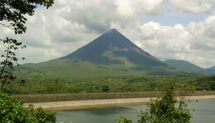
From a geological perspective, the uplands are the product of erosive processes and hydrothermal alteration of volcanic and volcanoclastic rocks. The active volcanoes Arenal and Platanar imprint chemically and geothermally the surrounding water. Andesitic and basaltic lavas, plagioclases and tobas are the dominant rocks. In the lowlands, the dominance of recent fluvial and marine deposits together with volcanic debris is evident. The uplands are dominated by Andosols and Entisols, soils of volcanic origin, rich in organic matter, porous, acidic and with high infiltration capacity (> 1000 mm/h). Ultisols cover the mid and lowlands of the catchment, being highly eroded by livestock activities and heavy rainfall. These soils contain a mixture of clay and quartz and are rich in iron.

The SCC during the wet (left panel – October 2018) and dry season (right panel – April 2019) with April 2019 showing one of the most extreme hydrological drought events for over 30 years. Photo credit: Christian Birkel
Experimental approaches at different scales
Three different monitoring schemes from small, experimental to meso and large-scale were established within the SCC. This aimed to gain fundamental insights about flux and water ages dynamics, runoff generation and how hydrological processes are shaped by environmental factors in the humid tropics.
The first small-scale monitoring scheme corresponds to a pristine rainforest headwater catchment (3.2 km2) located at the Alberto Manuel Brenes Biological Reserve (ReBAMB), which is accessible only for research and teaching purposes. In this experimental catchment, intensive monitoring is carried out since June 2013. Hydro-climatic data (5 min resolution), spatially distributed soil moisture and water samples for isotope analysis are collected sub-monthly and every 15 min during field campaigns. We sample water from gross rainfall, throughfall, the mainstream and two tributaries. In event-based monitoring, water samples collected for solute concentration analysis provided large hydro-chemical information from stream and all potential geographical sources to stream generation. Streamwater samples for tritium analysis were additionally collected at low flows in February, March and April 2018. Furthermore, soil samples were spatially collected to estimate soil erosion through analysis of radionuclide 137Cs and the stream dynamics and sediment transport is currently monitored at high resolution using aerial and subaquatic photogrammetry.

Citizen science monitoring approach where citizens being trained to measure water quality parameters. Photo credit: Maria José Molina
The second meso-scale monitoring, with a more inclusive perspective of community participation, was established in two sub-catchments (97 and 440 km2) in the central area of SCC. In these catchments, citizens were involved in a collaborative water quality monitoring. Citizens were trained to collect store and accurately interpret the generated information. In total 22 monitoring sites were successfully established from December 2018 to November 2019. Parameters such as pH, Dissolved Oxygen, Turbidity, BOD, Nitrate, Phosphate and Temperature were collected using EARTH FORCE® Low-Cost Water Monitoring Kits and data were directly shared among the group of participants with a newly developed mobile APP (WaterQuality©).
Lastly, the large-scale monitoring involved a dense, spatially-distributed isotope and geochemical sampling scheme covering the entire SCC. Monthly isotope data were collected in 46 rivers, covering longitudinal profiles of the most important water bodies. Together with isotope sampling, water quality parameters (pH, electrical conductivity, water temperature and the redox potential) were measured in situ. Further, isotopes in precipitation were monitored in the headwater catchment at the Soltis Research Station of the Texas A&M University. Longer-term daily discharge data is available at three nested sites (3.2, 154 and 1600 km2).

OAGC member collecting water samples for isotope analysis. Photo credit: Marco Martínez
The analytics were based on extensive national and international collaboration with different laboratories around the world. The isotopic composition (δ18O and δ2H) of the samples were determined at the laboratory of the Stable Isotopes Research Group (UNA-SIL), National University, Costa Rica; 137Cs concentration at the laboratory of the Research Center for Atomic, Nuclear and Molecular Sciences (CICANUM), University of Costa Rica, Costa Rica. Samples for tritium at the Australian Nuclear Science and Technology Organisation (ANSTO) in Sydney and the solute concentration analysis was performed in the geochemical laboratory at the University of Brunswick, Germany.
Current research knowledge
The combination of spatially detailed experimental data (hydro-climatic and environmental tracers) and parsimonious tracer-aided hydrological models provided knowledge into the hydrological functioning of the humid tropics. These findings can be summarized as follows:
- In the headwater the streamflow is largely controlled by quick near surface sources (5 – 15 cm depth) with little contributions from groundwater, however these lasts sustain baseflows during dry periods. This was demonstrated by testing model hypotheses (STARRtropics) and using experimental data.
- Stream, erosion, sediment and landslide data indicated hillslope-stream connectivity and extreme events greatly impact the sediment dynamics.
- Geomorphological difference between the hillsides imprinted a different hydro-chemical signature on the generated streams.
- The system presents limited mixing and is overall dominated by young water(<3.4 years). These findings were independently verified by tritium-derived baseflow mean transit time.
- The role of vegetation based on the eco-hydrological separation of fluxes demonstrated that the transpiration represented the dominant water flux to the atmosphere (65% of actual ET) and relates to LAI, slope, and soil properties.
- Highest soil water mean residence time (MRT) was related to more developed soils and the MRT of groundwater increased towards the bottom of the catchment.
- Headwaters regulate aquifer recharge and dry season water contributions and spatial proximity generally dominates the tracer signature at the catchment outlet.
- Stable isotopes indicated mean recharge elevations above the mean catchment altitude pointing towards the headwaters as main recharge and runoff generation areas.
- Regarding the participation of citizens in research projects, it was proved that the data generated are of high quality and that the motivation is crucial for an active participation. The citizens’ interest for supporting water-related research projects is mainly driven by their socio-environmental concerns and the desire of community empowerment and local decision making.
Future research opportunities
Future work will aim to:
- Separate dew deposition from transpiration and rain interception as a key component influencing transpiration in tropical rainforests.
- Integrate the isotope data collected in SCC into tracer-aided rainfall-runoff model (STARRtropics) in the quest for reducing the uncertainties of water balance estimates in the humid tropics.
- Apply an ensemble of methods (linear and Bayesian mixing models for example) in the interpretation of catchment functioning to reduce the epistemic uncertainty derived from imprecise knowledge of the system.
- Expand the citizens’ collaborative monitoring network to other catchments as a way to gather data and as an opportunity to empower communities with science-based information.
- Long-term, land-forming processes of volcanic environments in the tropics using radioisotopes, erosion modelling and UAV-detection of fluvial geomorphological processes.
- Land cover and climate change impacts on the hydrological and geochemical behaviour of the SCC.
Funded research projects and cooperation partners
CHILD: Costa Rica Hydrology Impacts of El Niño and Development, Advanced Studies of the University of Costa Rica UCREA (B8276).
OACG: Water and Global Change Observatory, University of Costa Rica (ED-3319).
Experimental Laboratory of Hydrogeomorphology at Biological Reserve (ReBAMB), University of Costa Rica (B8709).
Geospatial Rally for Women in rural aqueducts: Empowering rural women in water and agriculture, University of Costa Rica (B9229).
CICANUM: Research Center for Atomic, Nuclear and Molecular Sciences, University of Costa Rica.
IAEA: International Atomic Energy Agency (CRP-22009).
Isodrones: Project partner for researching humid and dry tropical catchments.
YWC: Youth Water Network, funds from the International Secretariat for Water and the Swiss Agency for Development and Cooperation.
Northern Rivers Institute, University of Aberdeen, donation of equipment acquired with funds from the Ideawild Foundation and the British Geomorphological Society (BGS)

Alicia Correa is a Postdoctoral Research Fellow at the University of Costa Rica. Her main interest is to combine tracer techniques with spatially-distributed hydrological models to better understand the eco-hydrological behavior of tropical catchments. Furthermore to establish guidelines to optimize hydrological monitoring in remote and data-scarce regions. Alicia owned her PhD in 2017 and today is part of the Early Career Research Board of Hydrological Processes Journal.
Edited by Matthias Sprenger