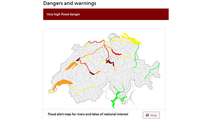
What a strange summer! Depending on where you live, you might currently be suffering from heat. In Switzerland, we are suffering from an exceptionally rainy and stormy weather situation, with high to very high flood danger issued for many major rivers and lakes (see warning map above, taken from the Federal Office for the Environment FOEN on Wednesday 14 July).
For certain rivers, controlled flooding of riparian area started (for example for the Reuss, see some pictures here). The forecasts about the precipitation to come in the next hours are highly uncertain. And, of course, the public and the media are actively looking for information from specialists about the current situation.

Swiss weather forecast for Thursday 15 July, for the capital (left), and situation in Europe (right)
I tend to refrain from talking to journalists about the current hydrological situation, especially in the context of flood warning. First of all, because I am not directly involved in or closely following any operational forecasting activities. Second, I tend to get too many questions on the underlying meteorological situation, which I can generally not comment on. Finally, I am still lacking any formal training on how to communicate with the media, and I am not sure that learning on the spot is the best option.
Yesterday, I nevertheless accepted to talk to a journalist who announced that he would like to write an update on the state-of-the art of hydrological modelling. This was probably the first time ever that I had detailed questions on hydrological modelling from a non-specialist.
The discussion was highly challenging: What was the key improvement of hydrological modelling for real-time forecasting as well as for flood risk estimation in recent years?
My answer focused on the better integration of ever better data sources into hydrological models, but I have to admit, that I did not feel prepared to communicate in plain language what progress we are making in hydrological modelling for operational applications.
So, I return the question to the hydrological community: What would you have answered?
