We’re back to the HydroData Chronicles, where we enter into the exceptionally wonderful world—as massive as it is—of datasets about water phenomena, such as rivers and weather. Today, we focus on ΕStreams, a comprehensive dataset and catalogue of streamflow, hydro-climatic, and landscape data for Europe. This pioneering initiative fills the hydrological data availability gap, offering an invaluable resource for researchers, policymakers, and industries reliant on water systems alike.
Let’s delve into the inception of ΕStreams, its extensive array of applications, and the significance of steering the future of hydrological research.
The Vision Behind ΕStreams
The EStreams dataset emerges as a response to the on-growing demand for harmonized, high-resolution hydrological information in Europe. Developed in collaborative research, ΕStreams combines heterogeneous hydrological datasets, streamflow observations, climatic data, and landscape characteristics into an integrated, open-access repository.
Essentially, EStreams:
- Provides a standardized, quality-controlled dataset of thousands of European river basins.
- Supports hydro-climatic research through streamflow data in conjunction with key meteorological and landscape variables.
- Supports data-driven decision-making for water resource management, flood mitigation, and climate adaptation planning.
A Dataset with Multifaceted Applications
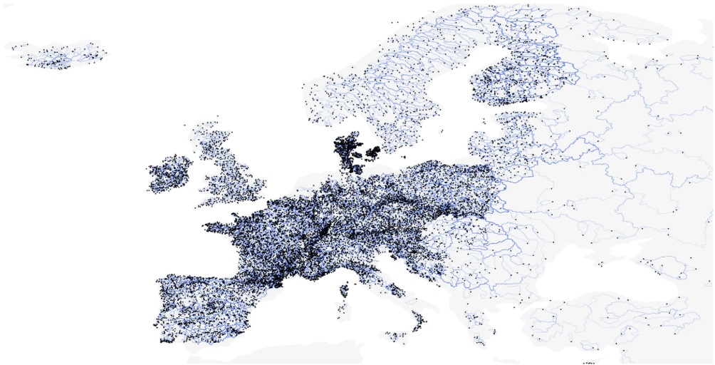
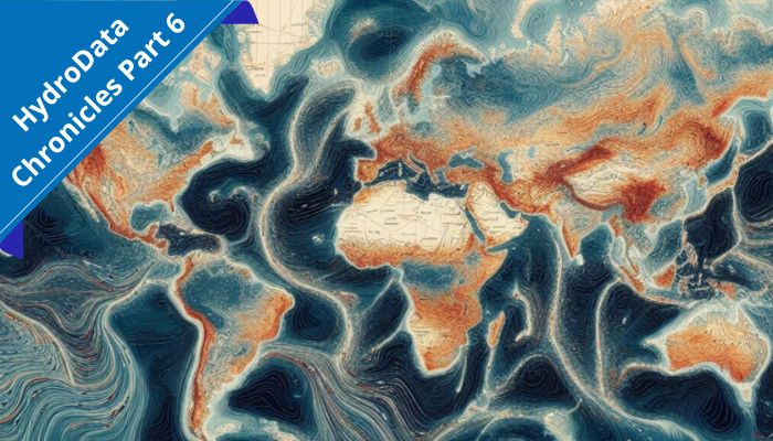
Spatial distribution of the 17,130 streamflow gauges currently included in EStreams (in black dots) with their catchment boundaries in background (in blue) over Europe. © 2025 Springer Nature Limited
The diversified character of the ΕStreams dataset extends far beyond the academic community, being of immense value to a range of industries:
- Scientific Research – Climatologists, hydrologists, and environmental scientists on European water resources.
- Agriculture & Water Management – Irrigation planners and farmers can utilize EStreams to optimize the use of water, predict dry spells, and develop more drought-resistant agricultural practices.
- Infrastructure & Risk Assessment – Engineers can use EStreams data to input hydrological models and determine flood risk, manage dams, and create resilient infrastructure.
- Policy & Governance – EStreams can be utilized by policymakers to create evidence-based water policy so that sustainable and equitable use of water resources can be guaranteed.
- Climate Adaptation & Sustainability – NGOs and environmental agencies.
The Power of Open Science
One of the strongest aspects of EStreams is its open-access data sharing approach. By making this information goldmine available for free, policymakers and researchers can undertake transparent, reproducible science and enable cross-disciplinary collaboration. The dataset is provided via Springer Nature’s online repository with rich metadata, and download options for seamless incorporation into hydrological models.
Looking Ahead: The Future of Hydrological Data
As climate change increases hydrological extremes across Europe, open-access datasets like EStreams are crucial in delivering timely, data-driven answers to water problems. The capacity to examine historical patterns, model future projections, and guide real-time decision-making will be paramount in addressing the complexities of water resource management in a changing climate.
Explore the EStreams Dataset
Interested in exploring EStreams for your own research or applications? The dataset is available here:
🔗 Introducing EStreams – A Comprehensive Dataset for Europe
🔗 Read the Full Paper on Nature Scientific Data
Are you already an EStreams user? Check the Google Group community where you may receive updates about new versions of the dataset!
Call for Contents
As we continue our journey through the world of hydrological data, we invite fellow researchers, scientists, and enthusiasts to contribute to the HydroData Chronicles. If you have a dataset that you believe would be valuable to others in the field, we would love to feature it in an upcoming post.
Feel free to reach out to [athanseraf@hotmail.com] to discuss featuring your dataset in an upcoming post. Together, let’s delve deeper into the realm of hydrological data and uncover its untold stories.