In the heart of India’s rapid urban expansion, Bengaluru city’s escalating water crisis reveals a direct connection to the deteriorating health of its lake systems, once the lifeline of this burgeoning city. Bengaluru has an area of about 741 sq km and a population of 13.6 million (2023) and has been historically celebrated as the “city of lakes.” These lakes are interconnected with canals/ drains to transfer excess water to the cascading lake systems and cater to basic needs such as recharging groundwater, maintaining the surrounding ecosystem and ecology, and providing drinking water to the surrounding people.
However, in recent decades, studies have shown a decline in the number of these water bodies from 1,452 in the early 1800s to just 80 today, drastically reducing their water storage capacity from 2,715 MLD (million litres per day) to 388 MLD. This decline is due to encroachment, rapid urbanisation, concretization, climate change, and disrupted connectivity between cascading lakes.
Historically, these interconnected lakes and canals were crucial in recharging groundwater, supporting ecosystems, and providing drinking water. The degradation of this system has not only led to increased urban flooding due to insufficient rainwater absorption and management but has also significantly contributed to the city’s pressing water crisis.
From waterscapes to cityscapes
Bengaluru’s rapid transformation from a serene city interspersed with numerous lakes and water bodies to a bustling urban metropolis is a story of stark contrasts. In the span of three decades, from 1990 to 2020, the city has witnessed explosive population growth, more than tripling in size. This demographic and spatial expansion has directly impacted the region’s Land Use and Land Cover (LULC), with the built-up area skyrocketing from 18,650 sq km in 1992 to 66,463 sq km by 2020 — an increase of 66%. Conversely, water bodies have halved in area from 1,790 sq km to 696 sq km, indicating a severe environmental crisis. Analysis by the Global Surface Water Explorer shows a significant decrease in lake surface water from 1984 to 2021, with only a few lakes experiencing growth.

LULC changes of Bengaluru city from 1973 to 2020 (Source- Energy and Wetlands Research Group (EWRG) at the Indian Institute of Science – IISc)

Surface water changes in the lakes from 1984 to 2021 using Global Surface Water Explorer
Furthermore, the urban sprawl has severely impacted the quality of Bengaluru’s water bodies. By 1996, sewage and eutrophication affected about 28% of lakes, turning them into sewage dumps and threatening local ecosystems. This growth has shrunk lakes and, in some cases, led to their disappearance, overtaking areas meant for natural water absorption. The city’s capacity to handle stormwater has been compromised, with crucial stormwater drains, once feeding the lakes, now obstructed by urban sprawl, further intensifying water scarcity issues.
Contrasts of Crisis: From Water Scarcity to Flooding
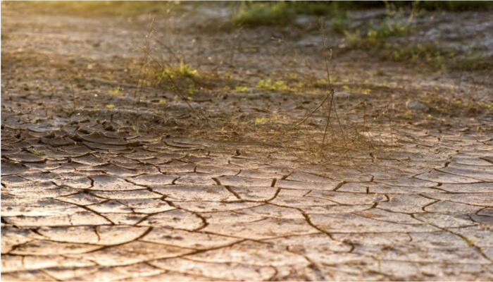
In Bengaluru, the contrasts of water scarcity and flooding vividly illustrate the city’s complex water crisis. During peak summer, the city faces severe water shortages as it tries to supply water to a population of 13.6 million. Lakes and borewells, traditionally the city’s primary water sources, are no longer reliable, leading to an increased dependence on water tankers that bring in water from distant places. This dependence on tankers, apart from being an unregulated and expensive solution, underscores the city’s acute water crisis. The Urban Water Balance report highlights a stark reality: the city consumes an estimated 1,372 million litres per day (MLD) of groundwater, in addition to 1,460 MLD from the Cauvery River, yet the natural recharge through lakes and green spaces is as low as 148 MLD. This disparity between extraction and recharge rates has led to a dwindling groundwater supply, a crisis further enhanced by the degradation of lakes, which can no longer effectively recharge the groundwater.
In contrast, the monsoon season reverses Bengaluru’s situation dramatically, and it becomes a flooding ground. This abrupt shift is largely due to compromised lake systems that can no longer effectively manage stormwater and extensive unplanned urban development encroaching upon natural water absorption areas. An analysis of Bengaluru’s seasonal rainfall trends over 30 years (1991 to 2020), based on daily data from the India Meteorological Department (IMD) for four rain gauge stations, reveals an average annual rainfall of 830 mm. Notably, the years 2015, 2017, and 2020 experienced rainfall exceeding 1000 mm, emphasising the city’s vulnerability to significant variations in rainfall patterns. Such fluctuations, coupled with the city’s compromised drainage systems, lead to severe urban flooding during the monsoons. The cascading lake systems, designed to mitigate such surpluses by channelling water from one lake to another, have been significantly impaired, leading to waterlogging and urban flooding during heavy rains.
Therefore, Bengaluru’s transformation from a city of lakes to an urban sprawl has resulted in a severe water crisis, as evidenced by disappearing water bodies and a failing groundwater recharge system. To combat this, the city is focusing on conserving and protecting 480 MLD of precious stormwater, along with advocating for rooftop rainwater harvesting across buildings with more than 100 square metres of rooftop area. These measures, complemented by the advancement towards treating 70% of the city’s wastewater generated to potability after tertiary-level treatment, are pivotal steps towards a sustainable water future for Bengaluru’s growing population.
Edited by Christina Orieschnig
Dr Pradeep Kumar Majumdar
I have been seeing this kind of report may be since last 30-35 years, every time there is a weak monsoon year, the problem is understanding of water scarcity, which is a creeping phenomenon, alarms only when on the edge. Reliability on basin water is your problem, as you can not think without it. Groundwater is in weathered and fractured mantle, not equipped with analyzing the flow and storage characterization in multi-porous system and wells. Point location hydro-geological data is be-fooling many researchers, as they conceive aquifers in hard rocks are similar to alluviums. Therefore data analyses shown in the blog is mischievous and misleading not done with real time data. Sediment cleaning of lakes have also been tried in the past, but found effective for limited periods, you may have to do it frequently, looking at the waste management strategies in Bangalore. Think of your scale of management, you are no more allowed it to do it basin or watershed wise in cities, like irrigation commands. Population demands door to door water and solid waste management looked after by the owner, only promoted not governed by the boards. Your data monitoring also suits that, conceptual orientations are flaws here.
sakshieq
This insightful analysis highlights the critical connection between Bengaluru’s water crisis and the degradation of its lake systems. The drastic reduction in water bodies underscores the urgent need for sustainable urban planning and restoration efforts to revive these vital ecosystems and ensure water security for the city’s growing population.
Praveen Rajarapu
This article highlights the serious water challenges facing Bengaluru and the importance of preserving natural ecosystems. Sustainable developments like Forest Nation emphasize responsible planning, green spaces, and environmental conservation, helping create communities that support a healthier and more balanced future.