Can we learn about hydrology through video games? Plenty of educational video games exist specifically to teach scientific concepts, but lots of these games are not particularly fun. But can popular commercial-off-the-shelf (COTS) video games fulfill the same function of teaching players scientific concepts through tangential learning as a secondary benefit to enjoying the game? Existing peer reviewed research has suggested they do, from geology and geomorphology in Pokémon Legends: Arceus to volcanic hazards and palaeontology in a variety of popular games, to a previous EGU blog post about the geology of Skyrim.
In our research, we took a deep-dive into another popular game that depicts realistic natural environments: The Legend of Zelda: Breath of the Wild.
Tackling the Legend of Zelda and Its Hydrology
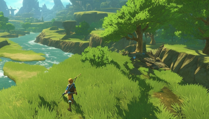
The Legend of Zelda: Breath of the Wild (BotW), the 2017 game of the year, has sold over 30 million copies worldwide. The Legend of Zelda games are usually set in the fictional land of Hyrule. Players travel across an increasingly detailed environment in each successive game. The franchise is now at the point where the games’ landscapes are so realistic, they can be difficult to distinguish from the real world. In particular, BotW’s watershed hydrology shows astonishing detail and realism. The game exposes the players to a range of hydrological features and related topics.
For instance, BotW represents damming, and associated real-world implications of upstream river modifications like flooding. We believe this makes BotW a practicable, approachable and accessible alternative for higher education to a potentially mundane fieldsite, for instance for a watershed delineation exercise (Fig. 1).

Fig. 1*: The topographic map of Hyrule from Breath of the Wild*, retrieved from https://zelda.fandom.com/wiki/Map_of_Hyrule. We have delineated the boundaries of 10 major watersheds in red, approximate flow lines represented by blue arrows, and estimates of sub-basin boundaries or heights of land within the major watersheds are shown as dashed black lines. Numbers 1-10 throughout the map label the major watersheds we identified. Please click here on the figure for a high resolution version to read labelled features. © Nintendo 2017.
Using Hyrule in a Watershed Delineation Exercise
Many students will already be familiar with the generalised landscape, allowing for a better understanding of some of the features present in the game. The delineation exercise also exposes less-experienced students to the idea that while water drains from high to low points in the landscape, these divisions can range from very clear heights of land, like the mountain ranges bounding Gerudo Desert, to indistinct lowland topographies like the subwatershed that splits Hyrule Field that we were unable to confidently draw.
Students performing this watershed delineation exercise will have to make educated guesses about groundwater flow based on local topography, which may connect seemingly isolated water bodies to the larger watershed.
For example, the largest lake on the map, Lake Hylia (Fig. 2a), appears to have no outlet, but close investigation of Cora Lake to the immediate south shows water emerging from a spring under the western lakeside cliff (Fig. 2b). Students could infer that this is the Lake Hylia outlet, draining from the lake through groundwater.
This discontinuous nature of the water bodies within Hyrule can be used to help students appreciate that flow lines in watersheds do not need to correspond with continuously connected surface water body networks, and that they instead represent where water would flow from any point on the map following a precipitation event, or via groundwater and/or ephemeral streams where surface water connections aren’t obvious.
The idea of ephemeral or discontinuous streams can also help students understand that watershed network appearances vary depending on the magnitude of flow. We identified a few locations on the map that could be ephemeral water bodies and are sometimes connected via surface water at high flows based on the topography of the local area. For example, South Nabi Lake could connect with Nabi Lake at high flows, as indicated also by the low topography and muddy terrain with ponded water between these two lakes (Fig. 2c).
Other Teachable Hydrological Features
In the 10 major watersheds we identified (Fig. 1), there are several other teachable hydrological features.
First, Watershed 5 can be used to discuss the idea of river bifurcation. It has two major termini, because the Hylia River splits into two “distributaries” (Fig. 2d). River bifurcations that do not reconnect downstream (i.e. braided channels), or that are not located at river outlets (i.e. deltas) are uncommon but do exist in the real world, such as the South Saskatchewan River in Canada that splits in Lake Diefenbaker to form the Qu’Appelle River.
Second, Watersheds 2, 3 and 7 are endorheic basins, with no connected drainage to a marine environment. Some endorheic lakes, like hot spring Lakes Intenoch and Ferona (Fig. 2f) in watershed 7, are a turquoise colour. Combined with their healing effect in the game, this could be interpreted to represent a higher dissolved mineral content, as in real-world salty endorheic lakes like the Dead Sea.
Third, dams and reservoirs are a major plot point. The player learns that Zora’s Domain (Fig. 2g) is subject to heavy rains every decade, so East Reservoir Lake was created by damming to protect Hyrule from flooding. However, this engineered hydrological system may be sending their flooding problem downstream, which is why water levels in the Lanayru Wetlands (Fig. 2h) and even further downstream at the Sage Temple Ruins (Fig. 2i) are high, as indicated by the flooded trees and ruins.
Conclusion
Overall, BotW offers players the ability to learn very basic hydrology through casual play, and expose students to more complex ideas through exercises like watershed delineation, which could be used in a higher education context. Casual players can also be introduced to these concepts and tangentially learn and assimilate details about the natural world that they would otherwise not have the opportunity to.

Figure 2*: Screenshots of different hydrological features from around Hyrule in Breath of the Wild. (a) Lake Hylia. (b) The groundwater spring that probably drains Lake Hylia into Cora Lake. (c) The muddy area with ponded water between South Nabi Lake and Nabi Lake that may connect at high flows. (d) The red arrow points to the divergence of the Hylia River into two distributaries. (e) Endorheic Strock Lake. (f) The turquoise hot spring endorheic Lake Ferona. (g) The red arrow points to Rutala Dam, the southern dam that forms East Reservoir Lake. (h) The flooded area in Lanayru Wetlands. (i) The flooded Sage Temple Ruins. © Nintendo 2017.
The guest authors of this blog post were both previously G. Evelyn Hutchinson Postdoctoral Fellows at Yale University in the United States, where they connected on the idea of the learning potential of video games, during a time when field work and in-person studies were restricted. Both authors are members of the Multiplay Network, a multidisciplinary research group on digital play and games, and Lewis maintains a blog called “Can Games Teach?”
The authors explicitly state that they have no commercial ties to the Nintendo corporation, producer of The Legend of Zelda: Breath of the Wild video game. Screenshots and images included here are for educational purposes.
*This file depicts work from a copyrighted video game or otherwise copyrighted material. The copyright for it is most likely owned by either Nintendo and/or its affiliates or the person or organization that developed the concept. It is believed that its use here constitutes fair use, given that: it is used in a non-commercial, research and educational setting, and therefore is not being used to generate profit in this context; its use here does not significantly impede the right of the copyright holder to sell the copyrighted material.
Edited by B. Schaefli
Further reading suggestion: Hut, R., Albers, C., Illingworth, S. and Chris Skinner, C, 2019: Taking a Breath of the Wild: are geoscientists more effective than non-geoscientists in determining whether video game world landscapes are realistic? Geoscience Communication