Recently, an increased number of visually striking “scientific” images have been found online: snapshots of turbulent flows with dreamlike structure, eerily symmetric cloud patterns, and what appeared to be global temperature fields annotated with plausible colormaps and scientific-looking labels. Many of these posts quickly go viral on social media. And yet, in many cases, the images ...[Read More]
AI-generated Images: the fragility of visual evidence in geosciences
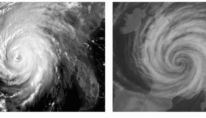
Figure: (left) Infrared satellite imagery of Hurricane Katrina. (right) AI-generated fake satellite image of a tropical cyclone over France. While visually similar to infrared satellite imagery, the storm structure and location are physically implausible and not based on real atmospheric data.