
G
Geodesy

edited by Rebekka Steffen

Rebekka is a researcher at Lantmäteriet (The Swedish Mapping, Cadastral and Land Registration Authority). She is working on glacial isostatic adjustment (GIA) modelling with a focus on stress field changes and model development, and is involved in the development of a European velocity model as part of EUREF (Regional Reference Frame IAG Sub-Commission for Europe). Rebekka is also the chair of a IAG (International Association of Geodesy) Joint Study Group on GIA. She received her PhD in 2013 from the University of Calgary.

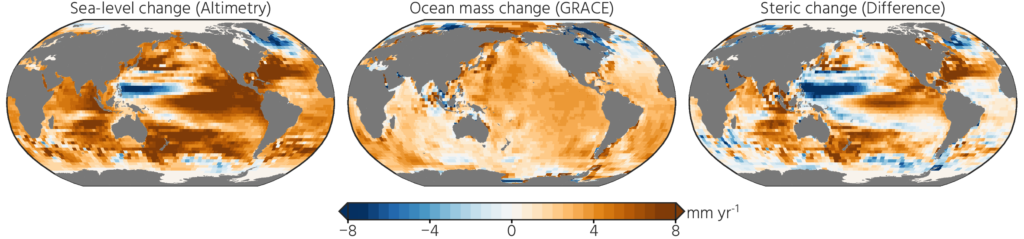
Want to really understand sea-level rise? Bring in the geodesists!

Want to really understand sea-level rise? Bring in the geodesists!

  A remarkably large number of papers and proposals have sentences like “this study is critical to better project future sea-level rise” in their introduction. Most times this is just marketing to trick reviewers and program managers into believing the work is important. On the other hand, geodetic papers and proposals have some compelling reasons …[Read More]

The comprehensive Geodetic Information Portal of GGOS

The comprehensive Geodetic Information Portal of GGOS

The Global Geodetic Observing System (GGOS) of the International Association of Geodesy (IAG) is a collaborative contribution of the global geodesy community to the observation and monitoring of the Earth System. Geodesy is the science of determining the shape of the Earth, its gravity field, and its rotation as functions of time. Essential to reaching …[Read More]