The Global Geodetic Observing System (GGOS) of the International Association of Geodesy (IAG) is a collaborative contribution of the global geodesy community to the observation and monitoring of the Earth System. Geodesy is the science of determining the shape of the Earth, its gravity field, and its rotation as functions of time. Essential to reaching this goal are stable and consistent geodetic reference frames, which provide the fundamental layer for the determination of time-dependent coordinates of points or objects, and for describing the motion of the Earth in space. With modern instrumentation and analytical techniques, geodesy is capable of detecting time variations ranging from large and secular scales to very small and transient deformations – all with increasing spatial and temporal resolution, high accuracy, and decreasing latency. Geodetic observation techniques and analysis infrastructures, as well as the high-quality geodetic products, provide the foundation upon which advances in Earth and planetary system sciences and applications are built.
Geodetic Products – A primary goal of GGOS is supporting the integration of different geodetic observation techniques and models to obtain consistent geodetic products. This forms the basis for studying the Earth System and the interactions between its sub-components and the outer space.
GGOS endeavors to facilitate and enable production and sharing of the Earth observations needed to monitor, map, and understand changes in the Earth’s shape, rotation, and mass distribution. GGOS also advocates for the United Nation’s Global Geodetic Reference Frame (GGRF) as the fundamental backbone for measuring and consistently interpreting global change processes, as well as the essential geospatial infrastructure to ensure sustainable development worldwide.
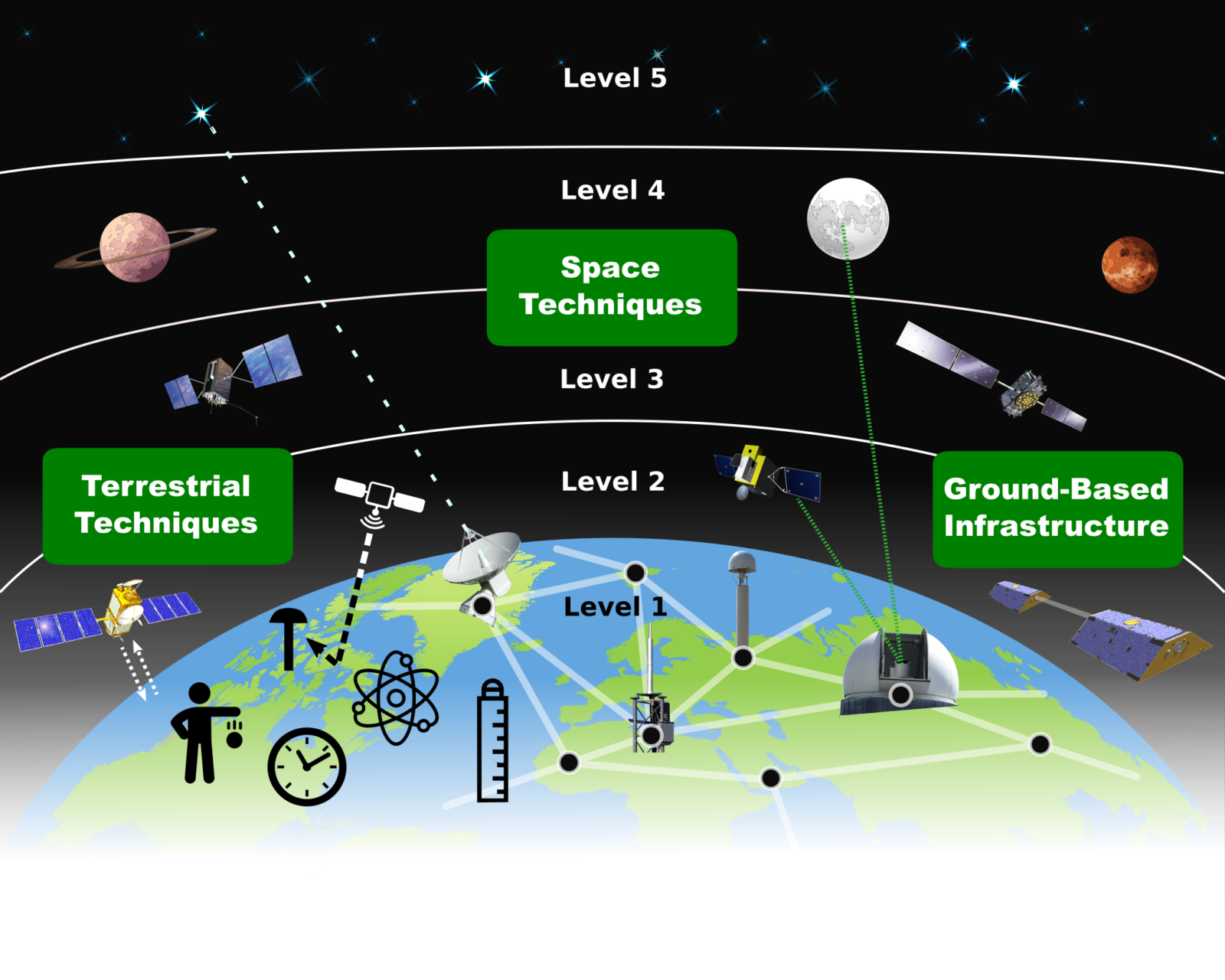
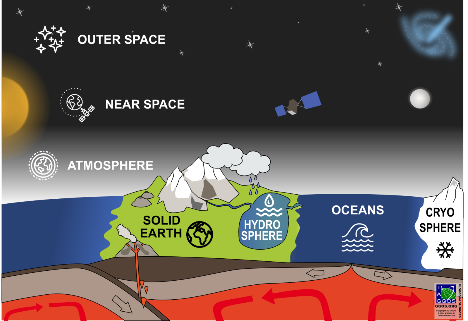
Geodetic Earth Observations – The toolbox of geodesy comprises different sensors and instruments on the Earth, in the air, and in space, which together form one large, comprehensive “geodetic instrument” for monitoring the System Earth in a wide range of spatial and temporal scales.
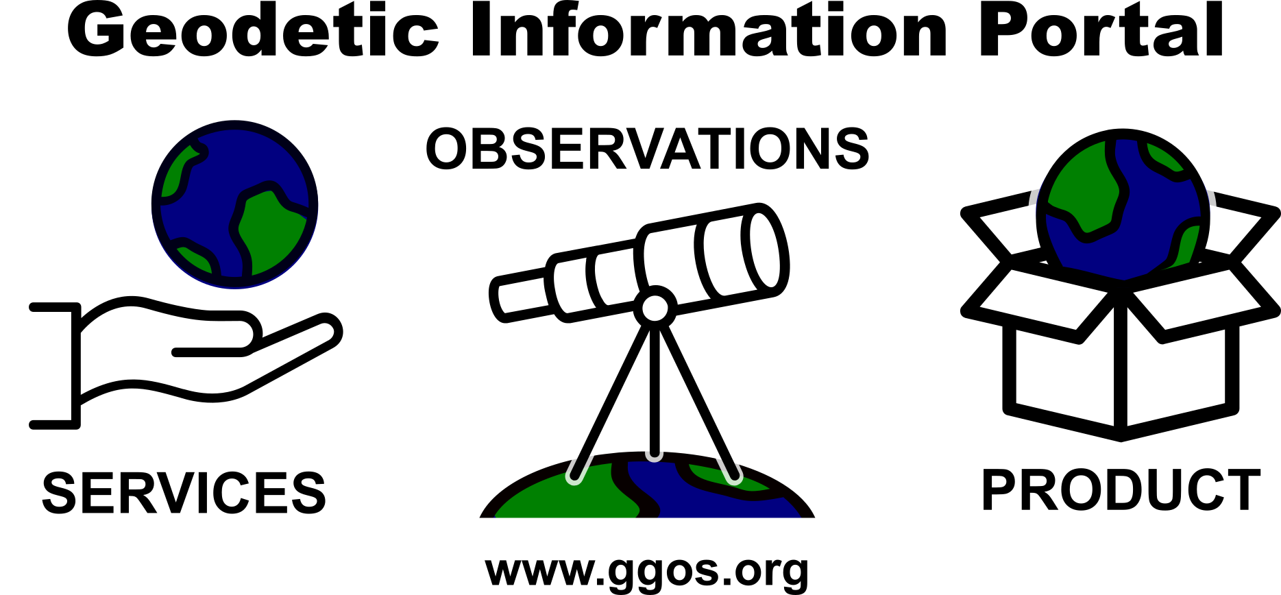
One main objective of GGOS is to support actions and initiatives to communicate the value of Geodesy to society, as well as help to understand and solve complex issues facing the global geodetic community. Towards this objective, GGOS has completely redesigned its website, www.ggos.org, which serves as a “point of entry to geodesy” to facilitate discoverability and usability of geodetic data and products. This includes explanations about: IAG services, geodetic observations and geodetic products. With this, GGOS engages with diverse user communities to increase awareness of geodesy and the ever-expanding benefits of geodesy in every-day applications.
In addition, GGOS recently produced short videos to explain the applications and importance of geodesy to non-geodesists. The new “Discover GGOS” video is available on YouTube in multiple languages; we encourage you to watch and share this entertaining and enlightening resource!
Check here for more videos: https://www.youtube.com/c/GGOSGlobalGeodeticObservingSystem