Getting the small g (the absolute gravity value) outdoors has always been some sort of a challenge. But, in the early 2000s the possibility to measure gravity has changed by the arrival of the first A10 absolute gravimeters. They to a large extent revolutionized the approach of performing gravity measurements in the open field and with that improved the approach to design and measure national gravity networks. The ability to obtain absolute gravity values in the field no longer required the need of performing relative measurements between stations which is known to be a time-consuming process. Also, the possibility to measure several stations per day and not needing a stable hut to perform the measurements has eased the field surveys. But, why do we need a dense network of g? Let’s make it short: Without these measurements our GNSS (Global Navigation Satellite System) data would not be that accurate as they are now. So, if you use GNSS or gravity data in your research, keep in mind that it also includes results from absolute gravity measurements.
The Institute of Geodesy and Cartography (IGC) in Poland purchased an A10 gravimeter (sn 020) in late 2008 with the goal to improve the Polish gravity network. Quite quickly it occurred that a demand in those type of gravity surveys was emerging across Europe, partially due to the success of A10 gravimeters already in place in France and Germany. However, even though that the A10 made field surveys easier, it still takes a lot of time, effort and consistency. And, not to forget all the mistakes that you make while learning how to efficiently use the A10 gravimeter. For the next 13 years the IGC team managed to survey more than 450 stations in eight different European countries (Poland, Sweden, Finland, Ireland, Denmark, Norway, Republic of Ireland, Northern Ireland). The most special trips for me were the surveys on the island of Ireland since 2018, where we entered an area untouched by modern gravity measurement techniques.
The most memorable trip for me was in 2019 as this one lasted a full month during August and September. Because of the sheer number of surveys, we had already done and do on a regular basis, the surveys themselves are the easy part of the whole trip. Based on our experience from all past trips, you basically need to have a good plan and pack to be ready for anything (and here I mean really, anything). Logistics of planning such a trip start months ahead with fixing a timeline of such a long trip in between work and family. Once that is settled the trip was fixed by the timelines of available ferries to Ireland. One large portion of the trip was to get from Warsaw to Cherbourg (North of France), which was a bit trickier this time. On the way some rodents (probably martens) chew through some of the rubber lines in the car engine. But being prepared worked out well, half a day of extra time was just enough to fix the car and get to Cherbourg on time.

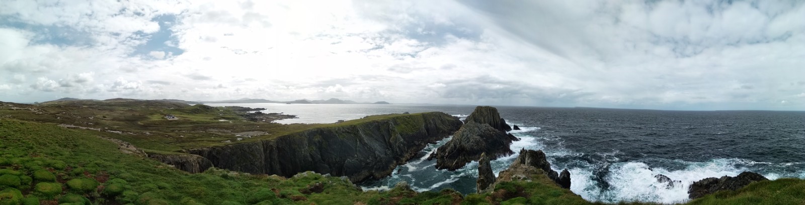
Kliffs of Kilkee, one of the measurement locations in Ireland.
Once we arrived in Ireland, we carried out the surveys with colleagues from the Ordnance Survey of Ireland (OSi) and the Land and Property Services (LPS) of Northern Ireland. The surveys are planned in a way to cover 2-3 gravity stations per day in what might be called a semi-organised freestyle, namely we know which stations we want to cover but planning on where to go next is only a day ahead. This is as far as the “locals” trust it, weather in Ireland is unpredictable for longer. The main advantage of the Ireland collaborations was the support of both OSi and LPS. A team of 1-2 people would be always present with me, taking care of the surrounding area, making sure that I can do what I came here to do, also helping out to find a place to stay for the following night. Similar to the situation with the stations be measure, we would book mid-day for the upcoming night. I won’t lie, a comfy B&B with full Irish breakfast was my preference. Spending 30 days on the road, I spent each night at a different place. The support by the locals really was a game changer.
Malin Head (most northern point of Ireland).
A few things were also a bit challenging in the beginning in Ireland and required us to get used to it. One was the left-hand side driving, which to my surprise was very easy to get used to. It was just a bit tricky from time to time for not having the right view on some turns and going through any sort of barriers feasible for right-hand drive cars. The other thing was the weather. The saying is that you can have all four weathers seasons in one day in Ireland. As strange as this sounds, it is true. Surprising weather events were the so called “showers” which are exactly what it sounds. Out of nowhere, 3-5-minute bursts of heavy rain in between a sunny day. Considering the expected unexpected weather packing for 30+ days on the road is also a bit tricky.
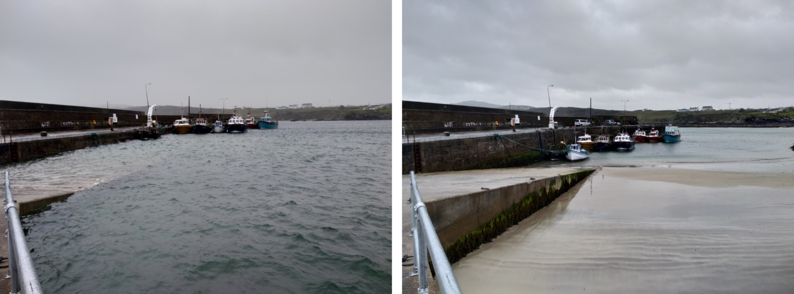
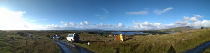
Ocean tides at Malin Harbour & Slievebane Bay (Ireland).
When you are scheduling a 3-4 week survey the key beyond planning is setting yourself into the right pace, physically and mentally. The body adjusts much easier. At least one day per week is planned to be free of work. That is the time to take care of your mind and get yourself far away from thinking about gravity and work. It was also a fantastic chance to visit beautiful places like the most northern point of Ireland, Malin Head. One thing that is worth to remember is that Ireland is a very beautiful place. Seeing the ocean tides in person is also something that I will remember (photos above). Barely a few hours difference and almost 3 meters of ocean level change. Can’t be compared to the tiny tides we have along the Polish coast.
The 2019 trip in total lasted for 32 days, 8138 km on the road, about 30 stations covered with absolute gravity and vertical gravity gradient measurements. End to end in August 2021 with an almost 1.5 years delay caused by the Covid-19 pandemic, we managed to complete all the necessary surveys in Ireland and now if someone asks me if I have ever been to Ireland I can say: Yep! (photo below).
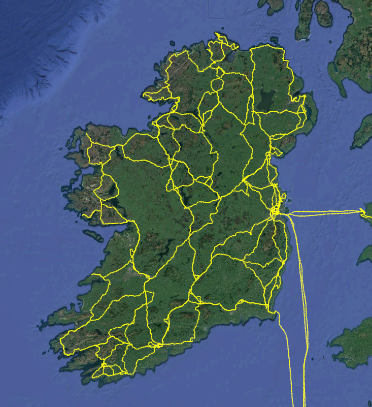
Track recorded during 2018, 2019, 2021 gravity trips to Ireland.
Doing so many different locations you often end up telling a story on what you are doing, where are you from, and it is always a pleasant conversation. These conversations always help to understand that I do have a pretty unusual job that allows me to be in unusual places and meeting interesting people. There are moments during these trips that you think that you must be doing something right in your life, if your work allows you to travel to so many interesting places.
For me the Ireland endeavour was the trip of a lifetime, and I hope I will get the chance to get back to Ireland, not necessary for work purposes. However as much as exciting these trips were, the views were amazing, the people were nice, there is a downside. It is the time spent away from my family, especially now when my boy is 6 and my little girl is 2 years old. In their lifetime one month is a lot of time.
Interest for these types of surveys still exists in Europe and around the world, which simply means more kilometres on the road for me and my colleagues at the IGC. And as much fun it is to work with an A10 gravimeter, in late 2021 a new type of gravimeter arrived at the IGC, an Absolute Quantum Gravimeter, which is also an instrument that allows measuring gravity in the field. And, something tells me that there will be more kilometres on the road for me related to this.