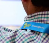
On 14th of November 1934, the Dutch travelled to the harbor of Den Helder situated in the north of the Netherlands to catch a glimpse of the departure of Hr. Ms. K-XVII: A submarine of the Royal Dutch Navy setting sail on a trip around the world. Onboard was a unique traveler and with his non-typical height of 2 meters tall, he towered above the average submarine sailor. Professor Vening Meinesz would accompany the 36-headed crew lead by Commander Hetterschij and Lt. Wytema on an 8-month journey to Surabaya, Dutch East Indies (now Indonesia). During this trip, the submarine K-XVIII would dive 140 times to 30-meter depths, allowing prof. Vening Meinesz to capture the gravity field of the Earth with unprecedented precision. A dataset that would reveal many secrets of the Earth’s subsurface and tectonics.

Crew of the Hr. Ms. K-XVIII during the 8 month voyage to the Dutch Indies with prof. Vening Meinesz. Photo credit: From the digital collection Vening Meinesz TU Delft Library.
Felix Andries Vening Meinesz was born on 30th of July 1887, in a small town called Scheveningen (close to Den Hague, the Netherlands). His mother was of noble descent and his father would be the mayor of Rotterdam and Amsterdam, two major cities in Holland. He studied Civil Engineering in Delft and was asked to look at the gravity reference frame of the Netherlands for his PhD research. His plan was to develop an apparatus that could determine the local gravity magnitude with high precision without sensing disturbances from the unstable river sediments that make out most of the subsurface of the lowlands. A multiple pendulum-based device proved to be the optimal solution. He mapped the entire country with this new device.
Due to the enormous success in the Netherlands, Vening Meinesz decided to test his apparatus on the sea. A first test on a surface ship, a ferry towards England, failed. However, he did not give up and during a presentation at the 19th Dutch Medical and Physics Conference the director of the Dutch State Mines suggested him to try his luck on submarines. The wave motion at 30 meters depth has a longer wavelength and the electrical motors would produce less vibrations than the noisy surface ships. His first test on the Hr. Ms. K-II in the North Sea was successful and kick started a long list of submarine expeditions around the world. The trick was not to measure the motion of one pendulum but the distance between two opposing-swinging pendulums. With some clever mathematical tricks, prof. Vening Meinesz was able to remove the disturbing motion of the ship from the measurements and was left with the eigen motion of a mathematical pendulum. Measuring the period of that pendulum would make it possible to determine the local gravity field with high precision. It opened up the oceans for geophysical gravity research.
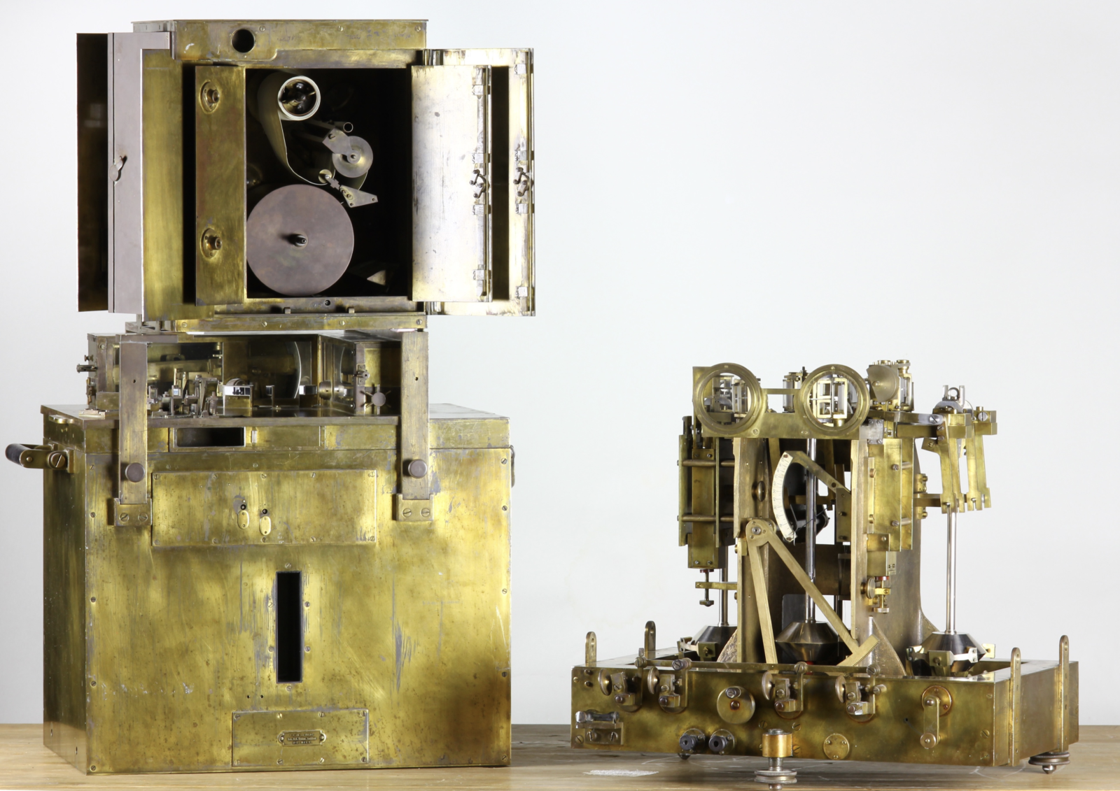
The Pendulum apparatus of prof. Vening Meinesz: ’the Golden Calf’. The device is presented disassembled with the recording chamber on top of the protection casing on the left and the inner structure of the device with its three pendulums on the right. Photo credit: Sander van Dam, TU Delft Library.
The apparatus was soon nick-named ‘the Golden Calf’, which might be due to its goldish copper appearance. However, another anecdote also sheds light on the name. During a dive, performing a measurement (taking 45 min), all non-essential crew should lie still in their bunks to reduce any unwanted vibrations. This was seen by the Dutch Navy as a deprivation of living standards. To compensate the crew for this, one extra guilder per dive was assigned to each crew member. So, when the submarine crew saw the machine carried in during boarding, they would exclaim: “Ah, our Golden Calf has arrived!”. Which story to believe is unclear, but the latter one supports the adventurous ambiance around the expeditions.
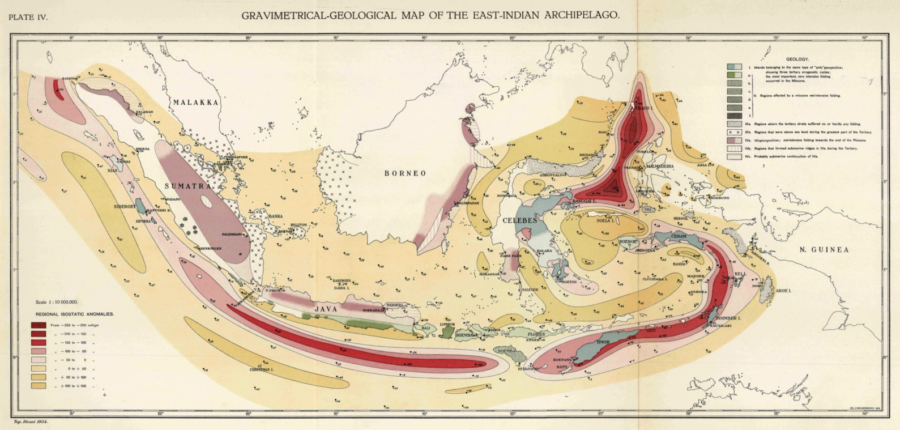
The longest expedition of Vening Meinesz was his 1934-1935 voyage with the K-XVIII, sailing from Den Helder, down to Dakar, South America, Kaaptown, Mauritius, Fremantle and finally up North to Surabaya. On this 8-month long trip Vening Meinesz took 240 measurements of the gravity field with an accuracy of around a few mGal (accuracies comparable with current day satellite missions). The data nicely showed the ellipsoidal shape of the oceans, but also that volcanic islands were in a flexural isostatic state. He recorded the gravity signal of the Romanche Deep, now known as a major transform fault in the Atlantic Ocean. Moreover, he determined for the first time the divergent gravity signals between spreading ridges and subduction zones (structures not well defined back then, but back then named Vening Meinesz belts!!!). His open mindedness to research and lending his instrument to others would inspire other countries to perform oceanic gravimetry expeditions. A close collaboration and friendship with Harry Hess was established. Hess is one of the founding fathers of the theory of plate tectonics, something that the Civil Engineer Vening Meinesz would never agree to, as “the plate would never break”. Ironically, only after the death of Vening Meinesz in 1966, plate tectonics was fully accepted by the scientific community. However, discussions between Vening Meinesz and the much younger Harry Hess about the gravity data made Hess more inclined to see that the plate could break and produce spreading ridges and subduction zones.
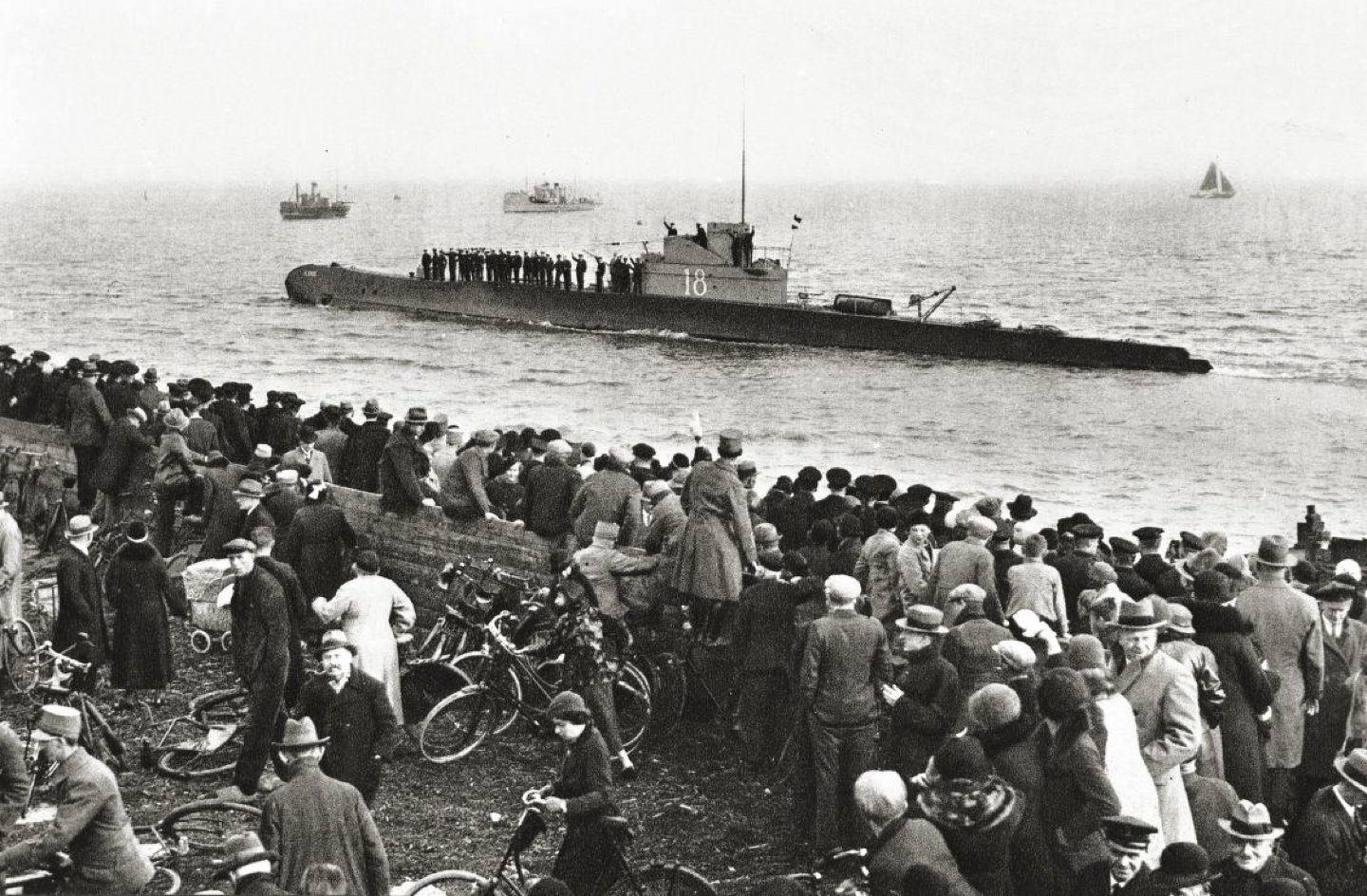
Departure of the Hr. Ms.K-XVIII at Den Helder on the 14th of November 1934 with Vening Meinesz onboard. Can you spot him on the deck? Photo credit: From the book “Alles Wel Geen Bijzonders!!” by A.W.P. Angenent.
The dedication to science and Vening Meinesz’s openness to share his work should inspire us all. He shared not only to his fellow colleagues but also to the public during the many colloquia he gave when visiting the shore. Even the submarine crew were treated with small lectures when asked what he was doing onboard the submarine. His down-to-Earth nature and ability to make science accessible for the common man gave him the title ‘professor’ by the crew, long before he was officially a tenured professor. In the same time his noble upbringing would help in all the official meetings with the government and navy personnel to secure funding and transportation for his expeditions. His vision that geodesy and geophysics should be done together not separately made him a professor at TU Delft (Geodesy) and Utrecht University (Geophysics). The science and inspiration of Vening Meinesz continues with the many dedicated satellite gravimetry missions around the Earth and even other solar system bodies to unravel the secrets of the interior.
The library of the TU Delft has the travelling suitcases, instruments, and data records still in possession. In 2014 the heritage team decided to start a project to describe the adventures of the professor and release all material to the public. So, make sure to check out the library when you are visiting Delft the next time and have a look at the instruments developed by Vening Meinesz. For more reading on the K-XVIII voyage and the heritage project go to the interactive website: http://expeditiewikipedia.nl/#vening-meinesz