Roughly 50 million years ago, the Eurasian and Indian continental plates began to crash into each other, dramatically changing the landscape of modern-day Asia. The force of the collision caused the Earth to scrunch together at the zone of impact, subsequently forming the Himalayan mountain range. However, to the north of the crash, a stretch of the Earth uplifted without bunching up or wrinkling; instead the clash formed an elevated flat surface five times as large as France, now known as the Tibetan Plateau.
The Tibetan Plateau is often called the ‘Roof of the World,’ as the region’s average elevation exceeds 4,500 metres and is home to the Earth’s highest peaks, including Mount Everest and K2. The plateau is also a crossroad for many different kinds of ecosystems and geologic features, including deep canyons, winding rivers, massive glaciers, boundless grasslands and alpine deserts.
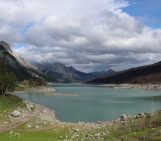
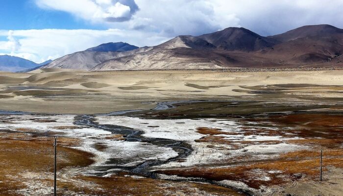
This week’s featured image, taken by Monica Cardarilli, a risk and safety engineer at the Sapienza University of Rome in Italy, gives a snapshot into the plateau’s dynamic and diverse environment, where snow, water, soil and organic matter all make their mark on the landscape. “In this picture natural elements are expressed by the colors, like a painting where the whole exceeds the single parts in a mix of perceptions,” says Cardarilli.
The landscape of the plateau and the surrounding mountainous regions is also as fragile as it is diverse, and many scientists fear that climate change and other human activities are rapidly altering this corner of the Earth. For example, research suggests that the Tibetan Plateau is experiencing higher rates of warming compared to the global average, which has already caused concerning levels of glacier melt, flooding, desertification and grassland degradation in the area.
A recent report suggests that, due to climate change, at least one third of the glaciers situated within the plateau and the surrounding Hindu Kush-Himalaya (HKH) region will be lost from ice melt by the end of the century. This level of melting would have major consequences for the surrounding population, as more than 1.5 billion people rely on freshwater that stems from the region and many local communities would be threatened by severe flooding and lake bursts.
The report, undertaken by more than 200 researchers, warns that climate action is necessary to prevent even further melting in this region and avoid worse disasters.
By Olivia Trani, EGU Communications Officer
Imaggeo is the EGU’s online open access geosciences image repository. All geoscientists (and others) can submit their photographs and videos to this repository and, since it is open access, these images can be used for free by scientists for their presentations or publications, by educators and the general public, and some images can even be used freely for commercial purposes. Photographers also retain full rights of use, as Imaggeo images are licensed and distributed by the EGU under a Creative Commons licence. Submit your photos at http://imaggeo.egu.eu/upload/.