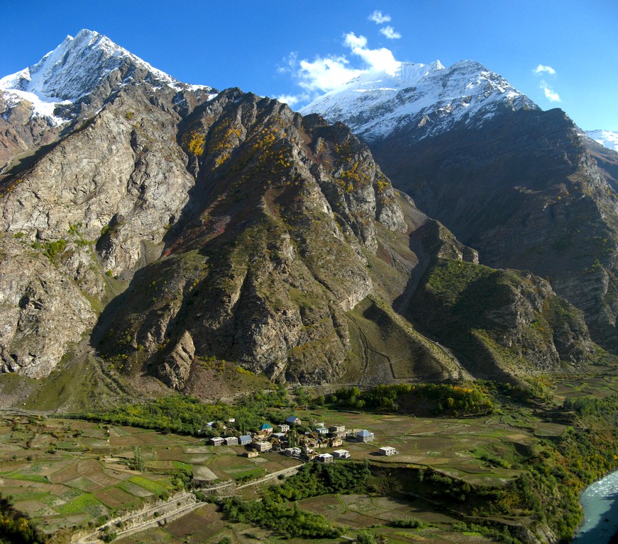
Deep in the Himalayas . Credit: Yuval Sadeh (distributed via imaggeo.egu.eu).
The Himalayas: vast, formidable and home to the Earth’s highest peaks. The mountain range stretches inexorably through Indian, Bhutan, Nepal, China (Tibet) and Pakistan separating the Tibetan Plateau to the north from India’s alluvial plains to the south.
India, as we know it today, started life much further south, as an island not far off the coast of Australia. It was separated from Asia (on the Eurasian plate) by the Tethys Ocean, a vast body of water which wrapped, almost entirely, around the supercontinent Pangea. As the supercontinent started to break up, some 200 million years ago, India began its slow (in human terms, but quite fast geologically speaking) journey north towards Asia.
Moving at speeds between 9 to 16 cm per year (for comparison, human hair grows roughly 15 cm per year), by 80 million years ago, India was located 6,400 km south of Asia. The Tethys was being slowly subducted under the Asian plate and would eventually close (disappear) all together some 30 million years later, when the Indian plate collided against Asia and the Himalayas began to uplift.
The closing and subduction of the Tethyan Ocean, followed by the collision of the two continents produced the Himalayas. The mountain range is divided into six parallel belts, each of which has distinct lithotectonic zones. They are highly complex and represent a long history of tectonic processes and deformation events.
The high peaks of Nepal and China attract a fair share of the limelight, offering thrill seeking adventurers the possibility to get close to (if not scale) the highest mountains on Earth. But lesser known areas of the Himalayas also offer a window into the geological past of the planet and breathtaking scenes for intrepid people too.
Today’s photograph features a valley deep in the Indian Himalayas, and illustrates some geological, geomorphological and other phenomena’s together with a small village that was built inside this glacier curved valley.
If you pre-register for the 2017 General Assembly (Vienna, 22 – 28 April), you can take part in our annual photo competition! From 1 February up until 1 March, every participant pre-registered for the General Assembly can submit up three original photos and one moving image related to the Earth, planetary, and space sciences in competition for free registration to next year’s General Assembly! These can include fantastic field photos, a stunning shot of your favourite thin section, what you’ve captured out on holiday or under the electron microscope – if it’s geoscientific, it fits the bill. Find out more about how to take part at http://imaggeo.egu.eu/photo-contest/information/.


Pingback: GeoLog | Imaggeo on Mondays: Sand and snow on the Tibetan Plateau - GeoLog