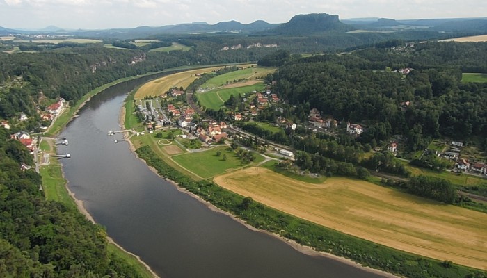
The picture shows the Elbe Rivervalley, one of the major rivers of Central Europe. It was taken from the Bastei Bridge close to Rathen, which towers 194 meters above the Elbe River in the state of Saxony in the south-eastern Germany. This region belongs to the national park known as Saxon Switzerland. Together with the Bohemian Switzerland in the Czech Republic, the Saxon Switzerland National Park forms the Elbe Sandstone Mountains, which represents the greatest cretaceous sandstone erosion complex in Europe and is popular with tourists and climbers.
The Elbe basin covers the largest area in Germany (65.5 %) and the Czech Republic (33.7 %). The smaller parts of the basin lie in the Austria (0.6 %) and Poland (0.2 %). It starts in the northern Czech Republic at an elevation of about about 1400 meters above sea level and flows via Bohemian, Germany, and into the North Sea at Cuxhaven. Therefore, the Elbe river system connects four countries as well as large German cities such as Dresden, Wittenberg, Magdeburg and Hamburg.
The sandstone of the Elbe Mountains was formed by accumulation of sands during a marine regression – a process where previously submerged seafloor becomes exposed due to receding ocean waters – (Cretaceous sea) millions of years ago. The varying sandstone formations that make up the mountains represent variations in pressure regime, horizontal structure and fossil content. After the marine regression, the developed sandstone formations were uplifted. The uplifted sandstone formations have been shaped by subsequent chemical and physical erosion and biological processes acting on the rocks. Moreover, the water masses of the Elbe River formed the valleys and streambeds. Therefore, the current state of the landscape of the Elbe Sandstone Mountains is characterised by the changes between plains, ravines, table mountains and rocky regions with undeveloped areas of forest. Human activity also plays an important role in the shaping of the highland region’s landscape as it is affected by settlements, tourisms and climbers.
The image illustrates how the interplay between long-term processes, such as geology, tectonic history, geomorphology, climate, biology and human influence shape landscapes.
By Tatiana Feskova, researcher at the Helmholtz Centre for Environmental Research.
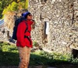
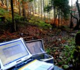
Imaggeo is the EGU’s online open access geosciences image repository. All geoscientists (and others) can submit their photographs and videos to this repository and, since it is open access, these images can be used for free by scientists for their presentations or publications, by educators and the general public, and some images can even be used freely for commercial purposes. Photographers also retain full rights of use, as Imaggeo images are licensed and distributed by the EGU under a Creative Commons licence. Submit your photos at http://imaggeo.egu.eu/upload/.