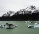
Glacial lake outburst floods (GLOFs) are caused when masses of meltwater are released from behind a glacier moraine. Moraines are piles of unconsolidated debris that have either eroded from the glacier valley or have been deposited by melting glaciers. When they fail, a huge volume of water can be released, threatening populations further down the valley. Moraine failure can be caused by avalanches, earthquakes, erosion or an immense build-up of water pressure, but until recently there has been little in the way of a broadly applicable indicator of GLOF risk.
This is because, as far as field trips go, getting to a glacier is one of the hardest feats. So, if you can’t send a scientist to scope out the site, how can you rate the risk of flooding and assess its potential impact?
Recent research, published in Natural Hazards and Earth System Sciences suggests taking to the skies. Remote sensing is becoming an increasingly important part of Earth systems monitoring and provides great insight into the risks of a variety of natural hazards occurring, including tsunamis and volcanic eruptions.
Another use is investigating the risk of GLOFs, which present a serious hazard in the Himalayas. But detailed ground-based studies of them are rarely undertaken in here because they are so difficult to access.
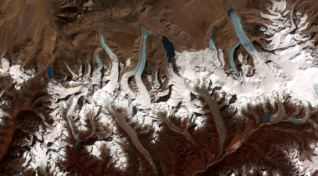
A series of glacial lakes in Bhutan. (Credit: NASA)
The remote location of glacial lakes ensures the trigger of GLOFs remains a mystery, but the effect of the outburst of the damming moraine can give us clues. GLOFs leave in their wake a v-shaped channel that slices through the moraine, suggesting that moraine failure is a key factor in the onset of a GLOF.
Given the difficulty of getting to glaciers in high Himalayan locations, there is a pressing need to effectively assess risk using remote sensing techniques. Koji Fujita and his team have developed means of using satellite data and digital elevation models to do just that.
The steep lakefront area lies ahead of the lake and much of the moraine, and the steeper it is, the more likely the lake is to flood. Fujita identified a critical angle beyond which there is a significant risk of a GLOF occurring – that angle is 10 degrees. GLOFs are also more likely to occur when the moraine dam is narrow, as this makes it weaker and more susceptible to failure.
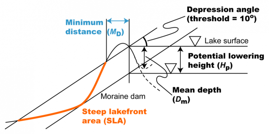
All these parameters can be calculated with some satellite data and a digital elevation model. The depression angle of the steep lakefront area, together with the minimum distance tell us how likely a moraine dam is to fail, and the other parameters help calculate the potential flood volume. Since we know how area relates to lake depth, scientists can use satellite data to estimate lake depth without making any measurements on site. (Credit: Fujita et al, 2013)
In addition to monitoring the risk of moraine failure remotely, satellite data can be used to estimate the amount of water dammed behind it. Combining these approaches allows not just the risk of an event occurring to be estimated, but also its magnitude – fundamental factors in hazard assessment. The potential flood volume can be calculated from the lake area (which can also be used to infer how deep the lake is) and the level the lake surface is likely to drop by. Knowing the potential flood volume can help assess risk to populations downstream of the glacier.
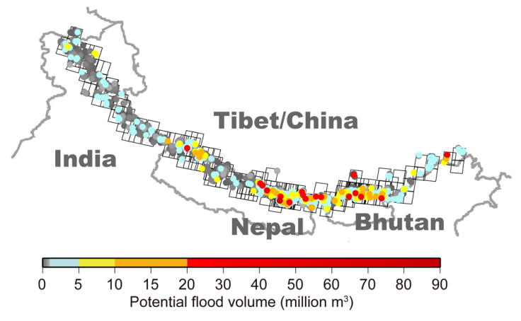
The potential flood volume of glacial lakes in the Himalayas. (Credit: Fujita et al, 2013)
GLOFs are a serious natural hazard in Himalayan countries, but when armed with the knowledge of which lakes have the greatest potential flood volume, scientists can prioritise areas for more detailed study. There are thousands of glacial lakes in the Himalayas, making the ability to screen them remotely and hone in on those that are most hazardous a very important development.
By Sara Mynott, EGU Communications Officer
References:
Fujita, K., Sakai, A., Takenaka, S., Nuimura, T., Surazakov, A. B., Sawagaki, T., and Yamanokuchi, T.: Potential flood volume of Himalayan glacial lakes, Nat. Hazards Earth Syst. Sci., 13, 1827-1839, 2013.
Hoechner, A., Ge, M., Babeyko, A. Y., and Sobolev, S. V.: Instant tsunami early warning based on real-time GPS – Tohoku 2011 case study, Nat. Hazards Earth Syst. Sci., 13, 1285-129, 2013.
Strozzi, T., Wiesmann, A., Kääb, A., Joshi, S., and Mool, P.: Glacial lake mapping with very high resolution satellite SAR data, Nat. Hazards Earth Syst. Sci., 12, 2487-2498, 2012.

Pingback: GeoLog | Glacial lake outburst floods: What we know about this destructive ice hazard