GeoLog

Imaggeo on Mondays

Imaggeo on Mondays: Exploring ice in the deep
Imaggeo on Mondays: Exploring ice in the deep
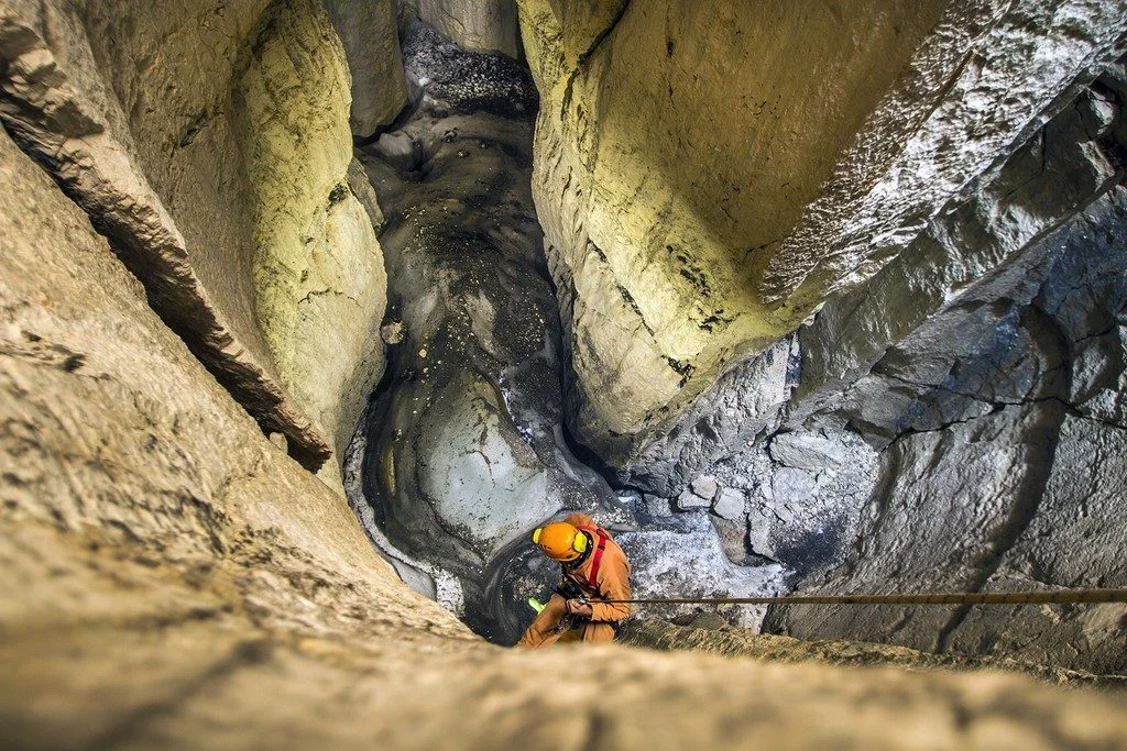
The occurrence of sporadic permafrost in the Alps often needs challenging fieldwork in order to be investigated. Here in the high altitude karstic plateau of Mt. Canin-Kanin (2587 m asl) in the Julian Alps (southeastern European Alps) several permanent ice deposits have been recently investigated highlighting how also in such more resilient environments global warming is acting rapidly. Important ...[Read More]

Imaggeo on Mondays: Watching the world from space with EarthKAM

Imaggeo on Mondays: Watching the world from space with EarthKAM

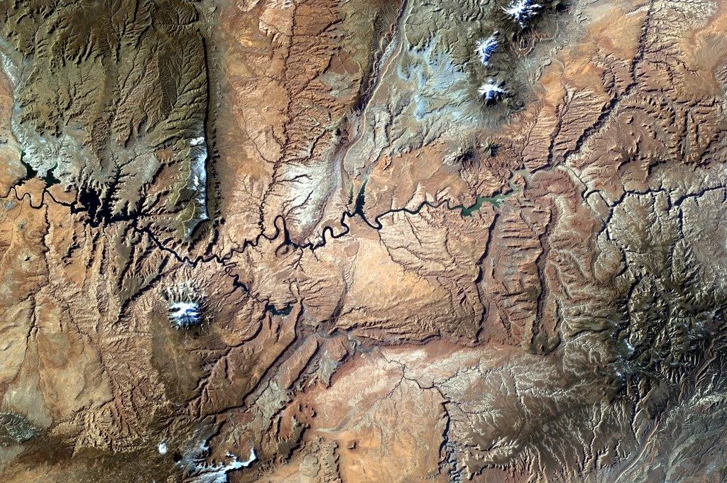
This photo was taken from the International Space Station (ISS), approx. 400 km above the Earth, in the NASA-led educational project Sally Ride EarthKAM (www.earthkam.org), Mission 58, April 2017. The image was requested by a team of 10th and 11th grade students from the National College of Computer Science, Piatra-Neamț, Romania, coordinated by me. The lenses used on the digital camera mounted on ...[Read More]

Imaggeo on Mondays: On the way to Tristan’s penguins

Imaggeo on Mondays: On the way to Tristan’s penguins

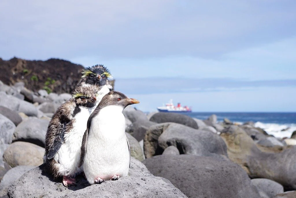
Tristan da Cunha is a remote volcanic island in the south Atlantic Ocean. In fact, it is the most remote inhabited archipelago in the world. Tristan is still volcanically active; the last time it erupted was in 1961. After the eruption, which luckily did not have any casualties, the whole population of around 260 people evacuated the island for some time, but they all returned back to the island b ...[Read More]

Imaggeo on Mondays: Small scale processes, large scale landforms

Imaggeo on Mondays: Small scale processes, large scale landforms

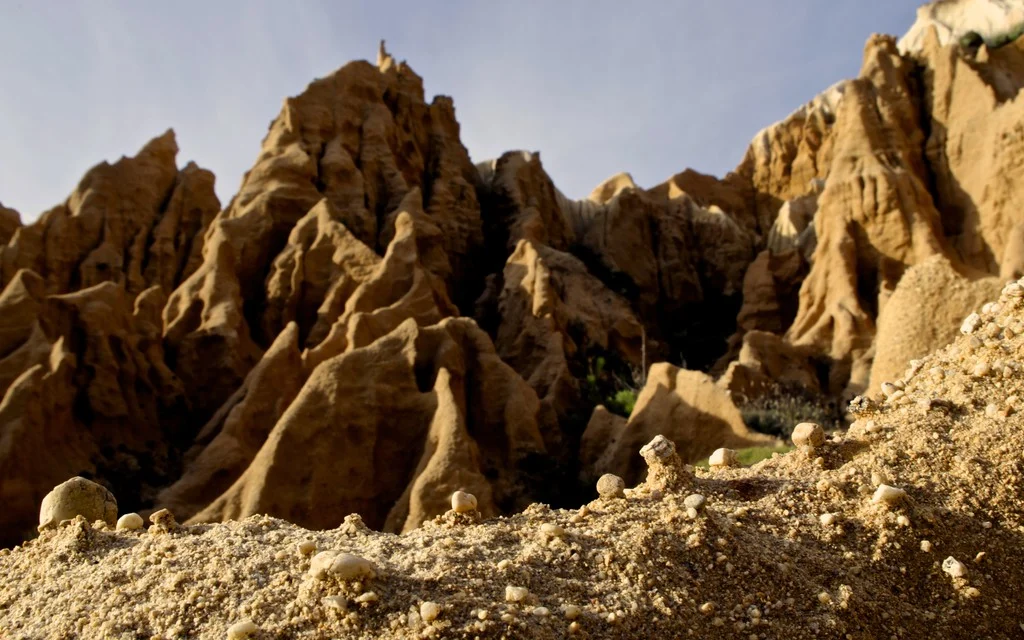
This picture was taken in a sea cliff gully landscape at the Portuguese coast. It shows the microrelief which small scale wash and erosional processes produce in these poorly consolidated sediments. These small scale landforms could be interpreted as initial stages of larger scale gully landforms, which can be seen in the back. This highlights the importance of regarding scales and scale linkages ...[Read More]

Imaggeo on Mondays: In-tents Icelandic sunset

Imaggeo on Mondays: In-tents Icelandic sunset

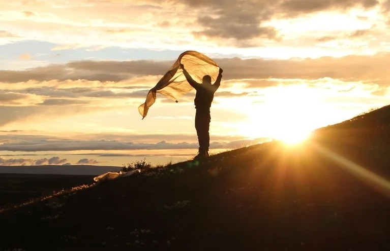
This photograph was taken at the campsite near lake Mỳvatn during a field trip to Iceland. Every year a group of students from Wageningen University travels from the Netherlands to Iceland for a weeklong excursion as part of a course on catchment hydrology. The aim of the trip is to provide students with real life examples of the processes they learned during their lectures. After a rainy morning ...[Read More]

Imaggeo on Mondays: Hole in a hole in a hole…

Imaggeo on Mondays: Hole in a hole in a hole…

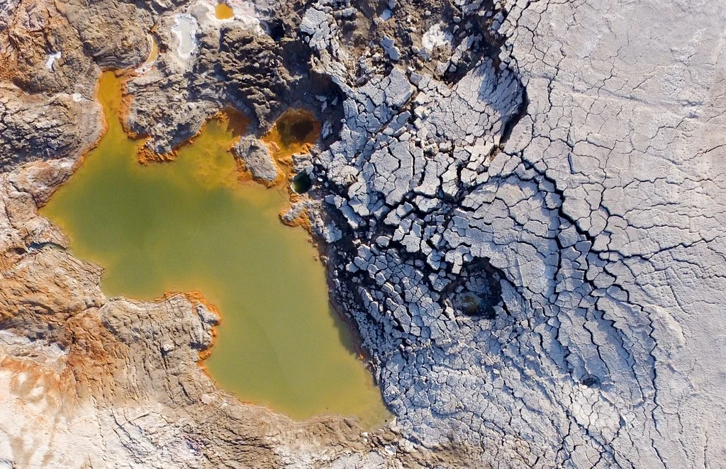
This photo, captured by drone about 80 metres above the ground, shows a nested sinkhole system in the Dead Sea. Such systems typically take form in karst areas, landscapes where soluble rock, such as limestone, dolomite or gypsum, are sculpted and perforated by dissolution and erosion. Over time, these deteriorating processes can cause the surface to crack and collapse. The olive-green hued sinkho ...[Read More]

Imaggeo on Mondays: A modern cliff hides ancient dunes

Imaggeo on Mondays: A modern cliff hides ancient dunes

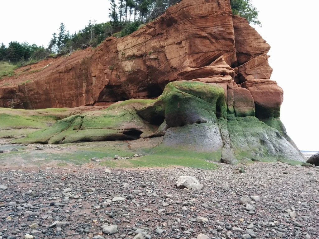
Ancient sand dunes exposed off a cliff face on the shoreline of Nova Scotia at the Islands Provincial Park. The juxtaposition of the high angled strata and flat lying layers above revels the drastic change in climate in Nova Scotia’s history; from vast sand dunes to a calm lake system, and presently the western coastline of the Atlantic Ocean. Description by Robert Wu, as it first appeared o ...[Read More]

Imaggeo on Mondays: Life between the arid mountains of Gansu, China

Imaggeo on Mondays: Life between the arid mountains of Gansu, China

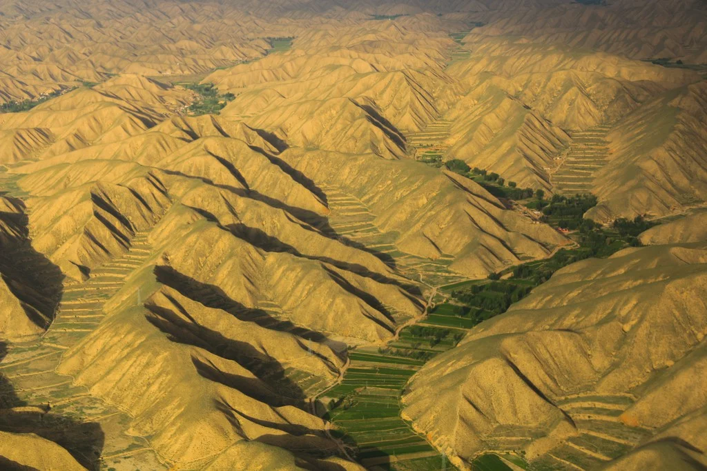
Even within Earth’s more arid environments, you can find life! This featured photo was taken near the Lanzhou Zhongchuan Airport, about 50 km away from Lanzhou city, the capital of Gansu province in Western China. The area lies in a region between the Qinghai-Tibet Plateau and the Loess Plateau, with an elevation ranging from 1,500 m to 2,200 m. The landscape is dominated by a network of ridges an ...[Read More]

Imaggeo on Mondays: How erosion creates natural clay walls

Imaggeo on Mondays: How erosion creates natural clay walls

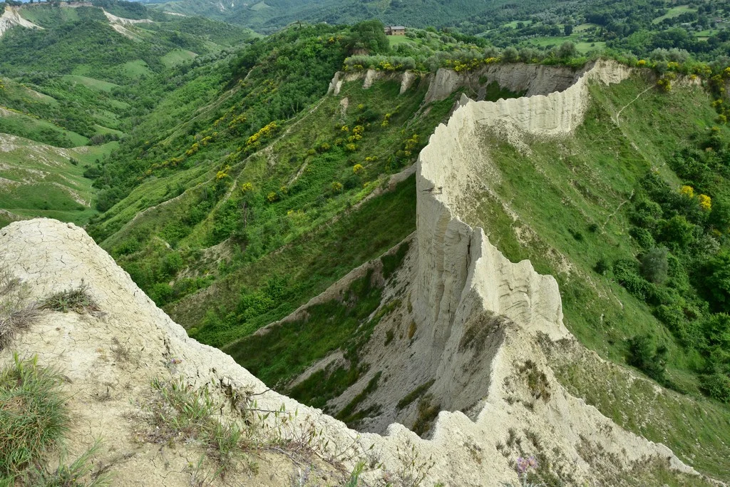
The badlands valley of Civita di Bagnoregio is a hidden natural gem in the province of Viterbo, Italy, just 100 kilometres from Rome. Pictured here is the ‘wall,’ one of the valley’s most peculiar features, where you can even find the wooden structural remains of a trail used for agricultural purposes in the 19th and 20th centuries. The photograph was taken by Chiara Arrighi, a post-doc research a ...[Read More]

Imaggeo on Mondays: The Henry Mountains, living textbook of modern geomorphology

Imaggeo on Mondays: The Henry Mountains, living textbook of modern geomorphology

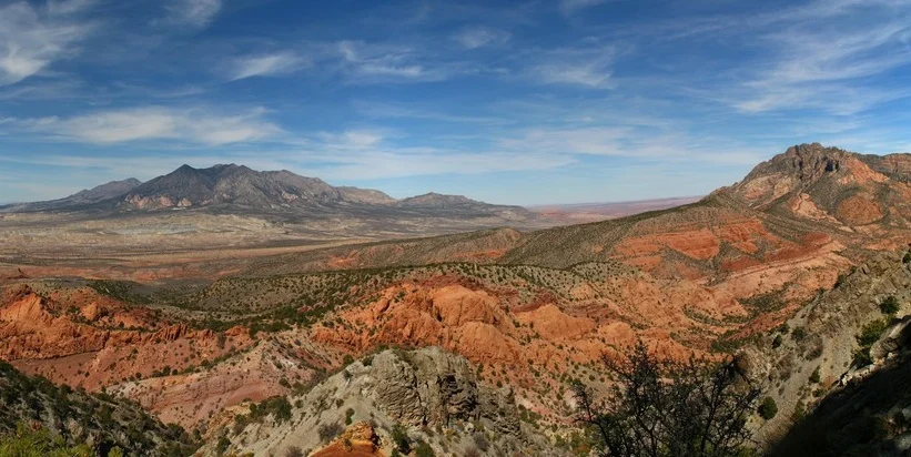
In 1877, the United States Geological Survey published a report “On the Geology of the Henry Mountains”, on the small range of peaks in southern Utah, pictured here. Up to that point, little scientific study had been made of the unassuming peaks, but the author of the report, one Grove Karl Gilbert, not only detailed the structure and mineralogy of the landscape, but in doing so also l ...[Read More]