Hello Elisa! Thank you for agreeing to this GeoTalk interview. Could you briefly introduce yourself and your background to our readers?
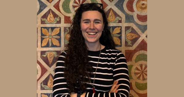
Hello, and thank you for having me. My name is Elisa Nobile and I recently completed my PhD at IUSS Pavia, in Italy. My background is in engineering for the mitigation of risk from natural hazards, and during my studies I quickly became interested in the impacts of natural hazards, and in particular flooding.
Today I work on the socio-economic impacts of floods at large scales for different assets, including firms and supply chains, but also cultural heritage. Next to my research, I am the Early Career Scientist (ECS) representative for the EGU Natural Hazards division.
When we think of loss and damage due to climate change, it is common to think of material impacts, such as financial cost and damaged infrastructure. However, there are also intangible impacts, such as the loss of cultural heritage. Compared to tangible impacts, how well are these intangible impacts represented when looking at flooding?
They are represented much less. In Europe the legal basis is actually strong, because the EU Floods Directive asks Member States to reduce the consequences of flooding on human health, the environment, cultural heritage and economic activity. In practice most countries stop at identifying the heritage sites located in a flood prone area, and what happens to those sites is left to local authorities.
One reason is that these impacts are very difficult to quantify in standard monetary terms, and this is why they have been left out from traditional assessments so far. The other reason is a data problem, on exposure and on vulnerability. Heritage assets are usually stored in national inventories as single points, and the attributes change from one country to another, making it difficult to have cross-national studies.
We should look at events at the scale where they really happen, which is often larger than one river basin or one country.
On the vulnerability side, the standard tool of flood risk assessment does not work. For residential buildings we use depth damage functions, because thousands of buildings share similar characteristics and small errors compensate each other in the total. However, a church, a bridge and an archaeological site are all unique, they are damaged in different ways by the same water depth, and a damaged monument may never come back to its original state.
We also have very few records of damage from past floods, so we cannot calibrate the functions we would like to build. This creates a loop, because intangible losses are not recorded in loss databases, so we cannot model them, and because we cannot model them they stay out of the assessments.
The adverse impacts of flooding extend beyond their direct impacts, contributing to economic shocks and supply chain disruption; how are these indirect impacts identified?
Honestly, we estimate them much more than we observe them. Most numbers arrive after the event. National authorities prepare the post disaster assessments, sometimes with the support of international organisations, and these figures then end up in loss databases, some of them public and some of them held by the insurance sector. European institutions mainly compile and reuse these sources when they publish their reports. In all these cases the indirect part is often a residual, so the same flood can be reported with different figures. There are also surveys of affected firms and households, but usually they are very localized.
A large part of what we know comes from models, and this is where the community has advanced a lot in the last years. Today we have economic models and network models that can follow a disruption from one damaged road to firms and households located in another region, or even in another country, and that can also represent how the system recovers over time. So the tools are there.
What is missing is the data to calibrate and validate them. We rarely collect information on how long a company stopped producing, or how long a road stayed closed, and this kind of information is exactly what our models would need. For me this is the main bottleneck of the field at the moment, because we have strong models and weak observations to test them against.
What do you think needs to change in Europe’s approach to disaster risk management?
I think we should look at events at the scale where they really happen, which is often larger than one river basin or one country. The Floods Directive is organised by river basin district and by Member State. This makes sense administratively, and it produced a lot of good work in twenty years. But a severe storm does not follow those boundaries.
Storm Boris in September 2024 is a very clear example, because one storm caused flooding in several basins and several countries at the same time, in Austria, Czechia, Poland, Slovakia and Romania. If each basin and each country assesses its losses separately, we lose the picture of the whole event. We also lose the interactions, because emergency teams and reconstruction capacity are requested everywhere at once, and economic effects travel across borders through transport and supply chains. So we need assessments that treat such an event as one single event.
You are also the Early Career Scientist representative for the EGU Natural Hazards division; how do you support the division’s ECS?
The work has two rhythms, the whole year and the General Assembly week. During the year we keep the community alive online and we contribute to networking. We organise Campfire events, which are short and informal seminar-style online events where senior and early career scientists present their work. We also have a fantastic blog team that publishes posts and interviews written by early career scientists in the Natural Hazards division’s blog.
During the General Assembly the focus moves to meeting in person, so we organise our division events and help newcomers to find their way in a very big conference. Research can sometimes be a lonely experience, and I would like people to feel there is a community they can join.
How can people get involved with EGU’s Natural Hazards community?
The easiest way is to write to us. You can reach the division ECS team by email at ecs-nh@egu.eu, and you can find us on social media (LinkedIn, Bluesky), where we announce all our events. There is no special requirement to join. Just drop us a message! If you have an idea for a Campfire or a topic you would like to see covered, just tell us. We are also always looking for new people in the blog team. And of course, come to say hello at the General Assembly!