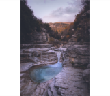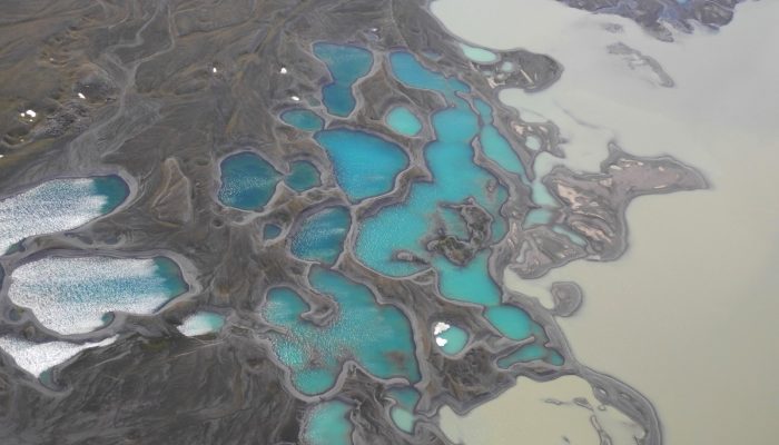
Earth is spectacularly beautiful, especially when seen from a bird’s eye view. This image, of a sweeping pattern made by a river in Iceland is testimony to it.
The picture shows river Leirá which drains sediment-loaded glacial water from the Myrdalsjökull glacier in Iceland. Myrdalsjökull glacier covers Katla, one of Iceland’s most active and ice-covered volcanoes.
A high sediment load (the suspended particles which are transported in river water) is typical for these glacial rivers and is visible as the fast-flowing glacial river (on the right of this image) appears light brown in colour. The sediment is gradually lost in the labyrinth of small lakes and narrow, crooked connections between lakes as can be seen as a gradual change in colour to dark blue.
The sediment load, height of the water and chemistry of this and other glacial rivers are measured partly in real-time by the Icelandic Meteorological Office. This is done for research purposes and in order to detect floods from subglacial lakes that travel up to several tens of kilometers beneath the glacier before they reach a glacial river.
These glacial outburst floods do not only threaten people, livestock and property, but also infrastructure such as Route 1, a circular, national road which runs around the island. They occur regularly due to volcanic activity or localized geothermal melting on the volcano, creating a need for an effective early-warning system.
Advances in the last years include the usage of GPS instruments on top of a subglacial lake and the flood path in order to increase the early-warning for these floods. In 2015, the GPS network, gave scientists on duty at the Icelandic Meteorological Office 3.5 days of warning before one of the largest floods from western Vatnajökull emerged from beneath the ice.
The peak discharge exceeded 2000 m3/s, which is comparable to an increase in discharge from that of the Thames to that of the Rhine. This flood was also pioneeringly monitored with clusters of seismometers, so called arrays (from University College Dublin & Dublin Institute for Advanced Studies, Ireland), that enabled an early-warning of at least 20 hours and allowed to track the flood front merely using the ground vibrations it excited. The flood propagated under the glacier at a speed of around 2 km/h; so assuming you can keep up the speed over nearly a day you can escape the flood by walking while it is moving beneath the glacier.
Related publications about the tracking of these subglacial floods will emerge in the published literature soon (real time update available at www.evapseibl.wordpress.com).
By Eva Eibl, researcher at the Dublin Institute for Advanced Studies.
Thanks go to www.volcanoheli.is who organised this trip.
Imaggeo is the EGU’s online open access geosciences image repository. All geoscientists (and others) can submit their photographs and videos to this repository and, since it is open access, these images can be used for free by scientists for their presentations or publications, by educators and the general public, and some images can even be used freely for commercial purposes. Photographers also retain full rights of use, as Imaggeo images are licensed and distributed by the EGU under a Creative Commons licence. Submit your photos at http://imaggeo.egu.eu/upload/.