Ruby skies and calm waters are the backdrop for this week’s Imaggeo image – one of the ten finalist images in this year’s EGU Photo contest.
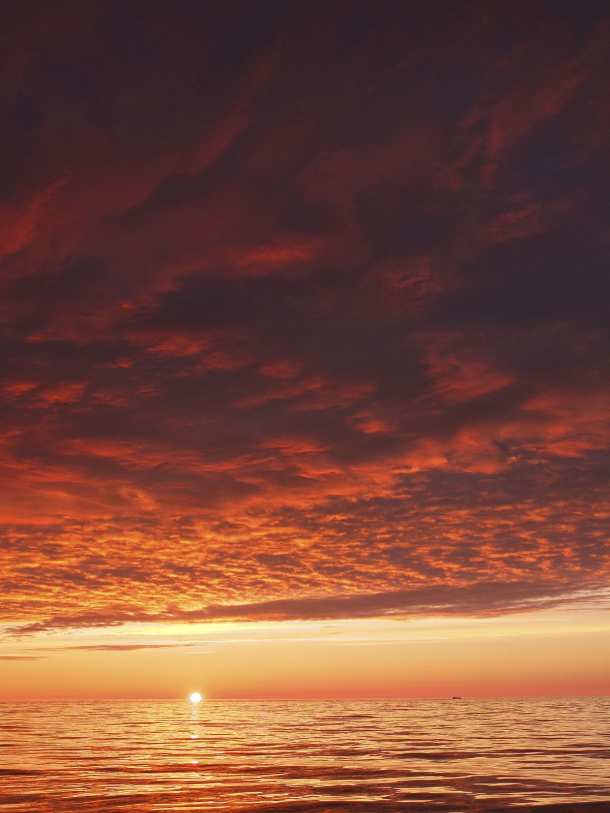
Sunset over the Labrador Sea. Credit: Christof Pearce (distributed via imaggeo.egu.eu)
“I took the picture while on a scientific cruise in West Greenland in 2013,” explains Christof Pearce, a postdoctoral researcher at Stockholm University. “We spent most of the time inside the fjord systems around the Greenland capital, Nuuk, but this specific day we were outside on the shelf in the open Labrador Sea. The black dot on the horizon toward the right of the image is a massive iceberg floating in the distance.”
Pearce took part in a research cruise which aimed to obtain high-resolution marine sedimentary records, which would shed light on the geology and past climate of Greenland during the Holocene, the epoch which began 11,700 years ago and continues to the present day.
A total of 12 scientists and students took part in the Danish-Greenlandic-Canadian research cruise in the Godthåbsfjord complex and on the West Greenland shelf. By acquiring cores of the sediments at the bottom of the sea floor, the research team would be able to gather information such as sediment lithology, stable isotopes preserved in fossil foraminifera – sea fairing little creatures – which can yield information about past climates, amongst other data. One of the main research aims was to learn more about the rate at which the Greenland Ice Sheet melted during the Holocene and how this affected local climate conditions and the wider climate system.
“The picture was taken approximately 25 kilometres off the shore of west Greenland coast. In this region the water depth is ca. 500 meters,” describes Pearce. “At this location we deployed a so-called gravity corer and took a 6 meter long sediment core from the ocean floor. Based on radiocarbon measurements – by measuring how much carbon 14 is left in a sample, the age of the sampled units can be known – we now know that these 6 meters correspond to approximately 12000 years of sedimentation, and thus it captures a history of climate and oceanography from the last ice age all the way to present day.”
Imaggeo is the EGU’s online open access geosciences image repository. All geoscientists (and others) can submit their photographs and videos to this repository and, since it is open access, these images can be used for free by scientists for their presentations or publications, by educators and the general public, and some images can even be used freely for commercial purposes. Photographers also retain full rights of use, as Imaggeo images are licensed and distributed by the EGU under a Creative Commons licence. Submit your photos at http://imaggeo.egu.eu/upload/.