What are debris-covered glaciers?
Many alpine glaciers are covered with a layer of surface debris (rock and sediment), which is sourced primarily from glacier headwalls and valley flanks. So-called ‘debris-covered glaciers’ are found in most glacierized regions, with concentrations in the European Alps, the Caucasus, Hindu-Kush-Himalaya, Karakoram and Tien Shan, the Andes, and Alaska and the western Cordillera of North America. Debris cover is important for ice dynamics for several reasons:
- A layer of surface debris thicker than a few centimetres suppresses ice ablation (Brock et al., 2010), as it insulates the underlying ice from atmospheric heat and insolation.
- In contrast, a thin layer of debris serves to enhance melt rates through reduced albedo (reflectance) and enhanced heat transfer to underlying ice.
- A continuous or near-continuous layer of debris can result in debris-covered glaciers persisting at lower elevations than, and attaining lengths which exceed those of their ‘clean ice’ counterparts (Anderson and Anderson, 2016).
Miage Glacier – the largest debris-covered glacier in the European Alps
The Ghiacciaio del Miage, or Miage Glacier, is Italy’s longest glacier and is the largest debris-covered glacier in the European Alps. It is situated in the Aosta Valley, on the southwest flank of the Mont Blanc/Monte Bianco massif. The glacier descends from ~3800 m to ~1700 m above sea level (a.s.l.) across a distance of around 10 km, and is fed by four tributary glaciers. The glacier surface is extensively debris-covered below ~2400 m a.s.l., and the average surface debris thickness is 0.25 m across the lower 5 km of the glacier (Foster et al., 2012).
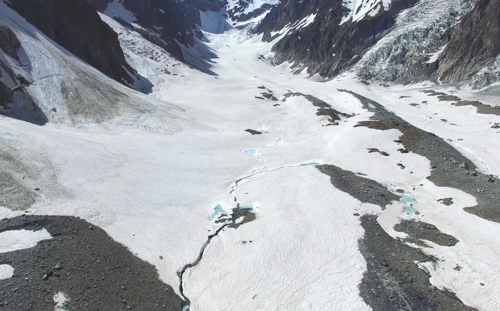
Figure 2: Up-glacier view of Miage Glacier, in which three of the glacier’s four tributaries are visible – from upper centre-left: Tête Carée Glacier, Bionnassay Glacier, Dome Glacier.
Glacier surveying using Unmanned Aerial Vehicles
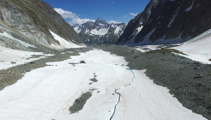
Researchers from Northumbria University, UK, acquired these images of the glacier using a lightweight unmanned aerial vehicle (UAV) during a recent field visit to Miage Glacier. During the visit the team carried out a range of activities including the installation and maintenance of a network of weather stations and temperature loggers across the glacier and geomorphological surveying of the glacier and its catchment, whilst undergraduate students collected data for their final-year research projects. The UAV imagery reveals the emergence of surface debris cover from beneath winter snow cover and the persistence of a channelized hydrological network in the snowpack, characterised as a cascade of streams and storage ponds. A recent study by Fyffe et al. (2015) found that high early-season melt rates and runoff concentration in intermoraine troughs promotes the development of a channelized subglacial hydrological system in mid-glacier areas, whilst the drainage system beneath continuously debris-covered areas down-glacier is largely inefficient due to lower melt inputs and hummocky topography.
(Edited by Emma Smith and Sophie Berger)
Matt  Westoby is a postdoctoral researcher at Northumbria University, UK. He is a quantitative geomorphologist, and uses novel high-resolution surveying technologies including repeat UAV-based Structure-from-Motion to quantify surface processes and landscape evolution in glacial and ice-marginal environments. Fieldwork on the Miage Glacier in June 2016 was supported in part by an Early Career Researcher Grant from the British Society for Geomorphology. He tweets as @MattWestoby Contact e-mail: mjwestoby@gmail.com

![Image of the Week – On thin [Arctic sea] ice](https://blogs.egu.eu/divisions/cr/files/2018/10/kayak-161x141.jpg)
Pingback: Cryospheric Sciences | Image of the Week — Looking for ice inside a volcano !
Pingback: Cryospheric Sciences | Katabatic winds – A load of hot (or cold) air?