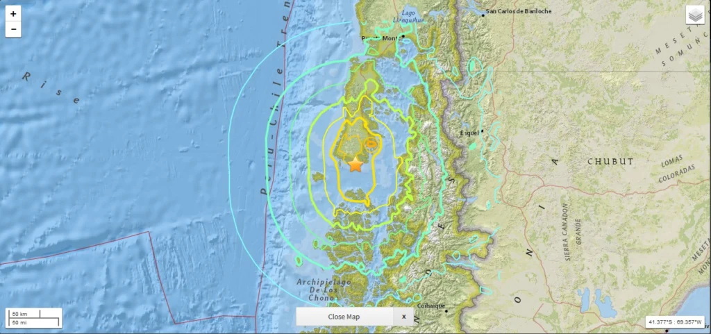
While the majority of us were midway through our Christmas Day celebrations, a powerful 7.6 M earthquake struck off the western coast of the Chile. Natural hazards are not bound by time, location or festivities; an earthquake can happen at any time in any place, regardless of the significance of the day. As a result, in this earthquake prone region, raising awareness of the risk posed by natural h ...[Read More]
Tectonics and Structural Geology
Looking back at the EGU Blogs in 2016: a competition
The past 12 months has seen an impressive 360 posts published across the EGU’s official blog, GeoLog, as well as the network and division blogs. From a lighthearted Aprils Fools’ Day post featuring an extreme chromatic phenomenon (otherwise known as FIB); through to how climate change is affecting mountain plant’s sex ratios; features on natural hazard events throughout the year and children’s dis ...[Read More]
Imaggeo on Mondays: Aoraki & a round-up of the latest New Zealand earthquake news
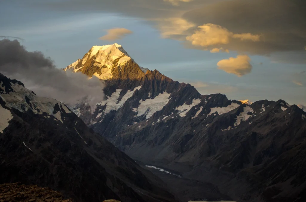
On Sunday the 13th November, New Zealand’s South Island was struck by a powerful 7.8 M earthquake. Initial analysis by the United States Geological Survey (USGS) indicates that the source of the tremor was faulting on or near the boundary between the Pacific and Australia plates. A tsunami alert (no longer active) was triggered following the earthquake, with risk of tsunami waves along coastal are ...[Read More]
Imaggeo on Mondays: recording the Earth’s magnetic field one grain at a time
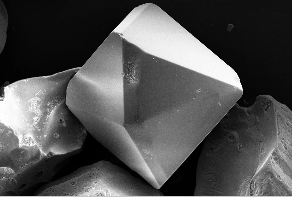
The Earth’s magnetic field extends from the core of the planet, right out to space. It is an invisible, butterfly-like, shield which protects us against the harmful particles ejected by solar flares. In addition, it guards us from atmospheric erosion and water loss caused by solar wind. But how do scientists study the Earth’s magnetic field when it can’t be see? Much of what is known results from ...[Read More]
Celebrating Earth Science Week!
For those not so familiar with the Earth sciences, geosciences and all its subdisciplines might be shrouded in mystery: boring, unfathomable, out of reach and with little relevance to everyday life. Nothing could be further from the truth! Earth Science Week, an international annual celebration founded by the American Geosciences Institute in 1998, aims to change the public’s perception of the ge ...[Read More]
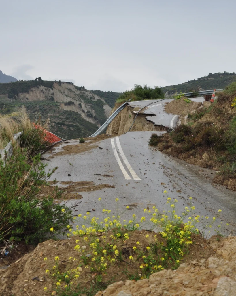
Imaggeo on Mondays: The road to nowhere – natural hazards in the Peloponnese
The Gulf of Corinth, in southern Greece, separates the Peloponnese peninsula from the continental mainland. The structural geology of the region is complex, largely defined by the subduction of the African Plate below the Eurasian Plate (a little to the south). The Gulf itself is an active extensional marine basin, i.e., one that is pulling open and where sediments accumulate. Sedimentary basins r ...[Read More]
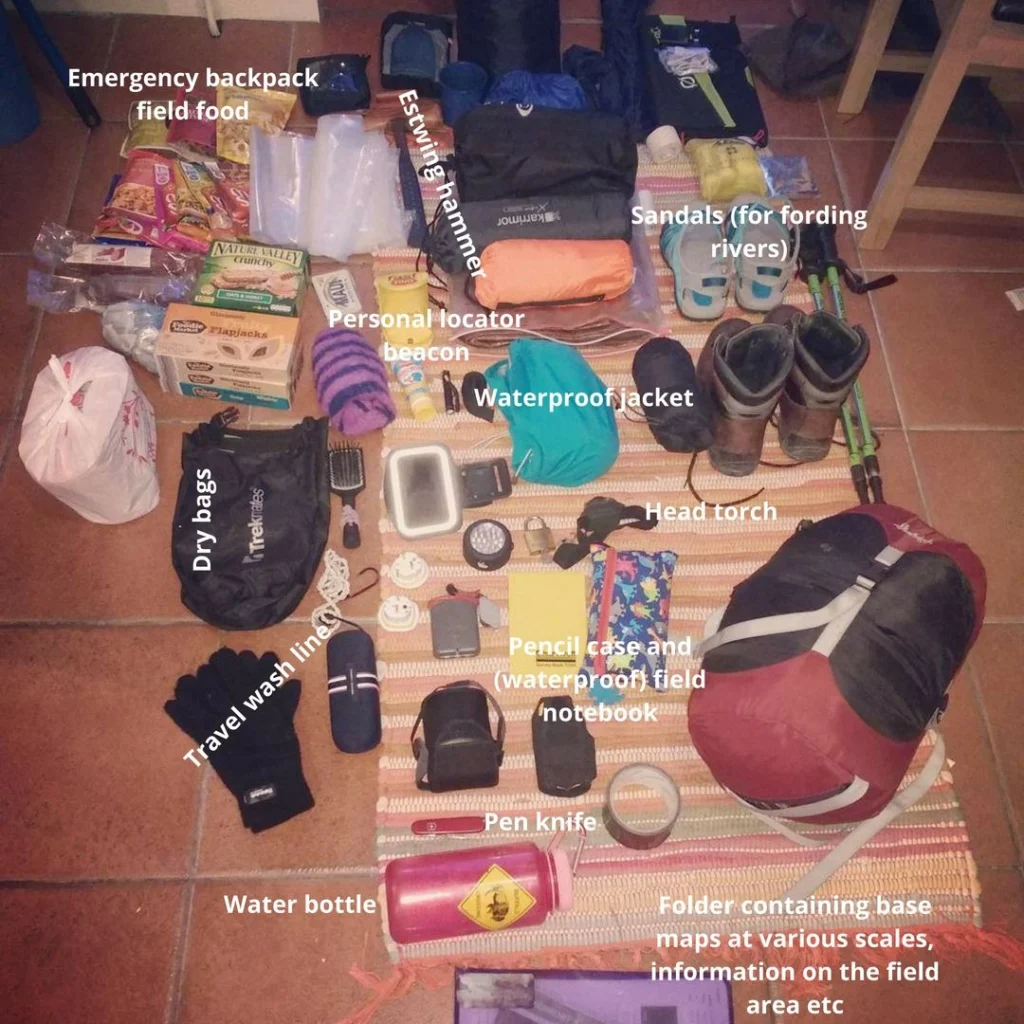
What is in your field rucksack? Camping in Iceland
Inspired by a post on Lifehacker on what your average geologist carries in their rucksack/backpack, we’ve put together a few blog posts showcasing what a range of our EGU members carry in their bags whilst in the field! Beautiful, eyrie, the land where fire meets ice: Iceland. An Earth scientist’ dream, complete with lava, volcanoes, earthquakes, impossible landscapes, ice, snow, the ocean…Iceland ...[Read More]
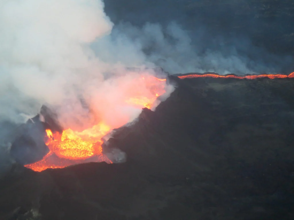
Imaggeo on Mondays: A Bubbling Cauldron
Despite being a natural hazard which requires careful management, there is no doubt that there is something awe inspiring about volcanic eruptions. To see an erupting volcano up close, even fly through the plume, is the thing of dreams. That’s exactly what Jamie Farquharson, a researcher at Université de Strasbourg (France) managed to do during the eruption of the Icelandic volcano Bárðarbunga. R ...[Read More]
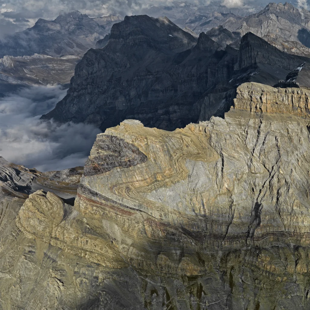
Imaggeo on Mondays: an impressive testimony to the collision between Africa and Europe
The huge fold in the flank of the 2969 m high Dent de Morcles (in Waadtland Alps, Switzerland) is an impressive testimony to the collision between Africa and Europe (which began some 65 million years ago). The layers, originally deposited on the sea floor in a horizontal position, were compressed and shifted. The darker parts developed during the Tertiary period (66 million years ago). They are yo ...[Read More]
GeoTalk: A smart way to map earthquake impact
Last week at the 2016 General Assembly Sara, one of the EGU’s press assistants, had the opportunity to speak to Koen Van Noten about his research into how crowdsourcing can be used to find out more about where earthquakes have the biggest impact at the surface. Firstly, can you tell me a little about yourself? I did a PhD in structural geology at KULeuven and, after I finished, I started to ...[Read More]