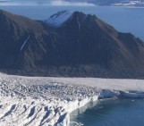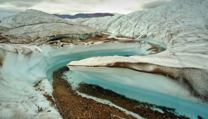
At the edge of the Greenland Ice Sheet, surface melt releases old layers of dust, that have travelled thousands of years into the ice. Under sunny weather, the dust heats up with radiation, melts the ice underneath, and thus accumulates in tiny potholes and meltwater creeks. However, this photo was taken after a rainy day. The rain triggered increased melt on the surface of the ice irrelevant of its color, resetting this miniature drainage system, but enhancing larger-scale drainage features. While working everyday on the ice, I used this particular meander as a landmark to find my way on the hilly surface of the glacier.
Description by Julien Seguinot, after the description on imaggeo.egu.eu.
Imaggeo is the EGU’s online open access geosciences image repository. All geoscientists (and others) can submit their photographs and videos to this repository and, since it is open access, these images can be used for free by scientists for their presentations or publications, by educators and the general public, and some images can even be used freely for commercial purposes. Photographers also retain full rights of use, as Imaggeo images are licensed and distributed by the EGU under a Creative Commons licence. Submit your photos at http://imaggeo.egu.eu/upload/.