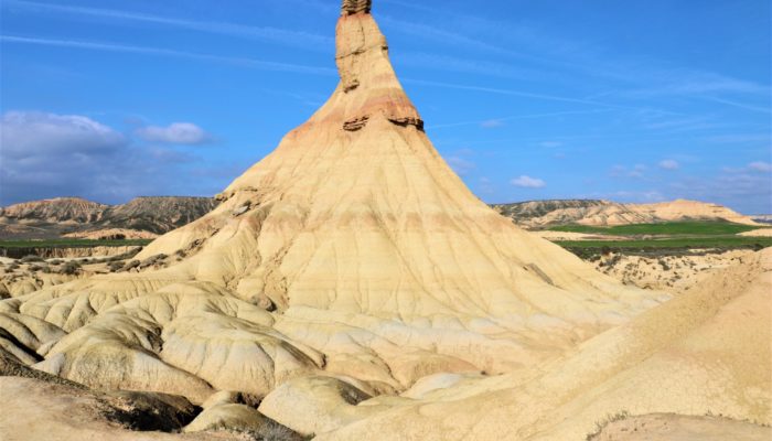
The Castil de Tierra has become the symbol of the Bardenas Reales region which is geographically located in the south-eastern margin of the Navarra Province in northern Spain. The Bardenas Reales is a semi-desert natural region situated in the middle-western sector of the Ebro depression. The geology is made up of Tertiary and Quaternary sediments. Rainfall events, wind and high temperatures enhance surface wash and erosional processes and have created fascinating erosional features and landforms such as canyons, isolated hills and talus flatirons. The Castil de Tierra is a striking example for differential erosion of the predominant clays and sandstones and the related landforms.
Description by Katja Laute, as it first appeared on imaggeo.egu.eu.
Imaggeo is the EGU’s online open access geosciences image repository. All geoscientists (and others) can submit their photographs and videos to this repository and, since it is open access, these images can be used for free by scientists for their presentations or publications, by educators and the general public, and some images can even be used freely for commercial purposes. Photographers also retain full rights of use, as Imaggeo images are licensed and distributed by the EGU under a Creative Commons licence. Submit your photos at http://imaggeo.egu.eu/upload/.


