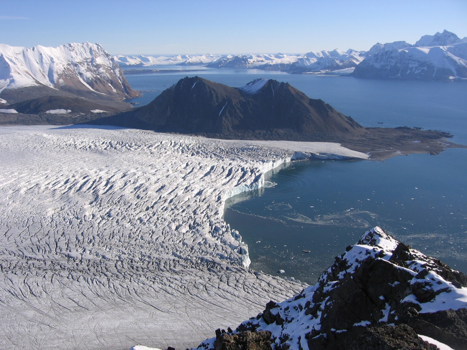
The Svalbard archipelago is considered to be one of the best places to study the geological history of the Earth because its rocks represent every geological period. This image shows a view from the peak of Fugleberget (569 m a. s. l.; 77º 00’ N, 15º 30’ E) on the south-western coast of the island of Spitsbergen. Glaciation of this geologically diverse area gave rise to a variety of geomorphic features. The most prominent of them, depicted in the picture, is the Hornsund Fjord that cuts through metamorphic and sedimentary rocks ranging from the Proterozoic (up to 2.5 billion years old!) to the Cretaceous Age (older than 66 million years). A spectacular example of glacial erosion can be seen on both sides of the fjord in the cliffs formed of Paleozoic carbonate rocks. Nowadays, this landscape is changing because glaciers are retreating in response to the rapid warming of the Arctic. Patterns of glacial retreat can be recognized at the margin of the Hans Glacier, which descends to the fjord below. Floating parts of the glacier are unstable as they readily break up, form crevasses, and eventually calve in to the fjord, as recorded in the photograph. The 1.5 km long calving front is retreating faster than the grounded parts of the glacier. As glaciers move, they can leave behind large amounts of dirt and rocks, known as moraines. Reduction in the thickness of Hans Glacier, is reflected by the height of the lateral moraine, which can be seen above the ice edge as an elongated ridge with an irregular surface. Retreating glaciers expose new areas of land and water, which affects fluxes of energy and matter in the arctic environment.
By Przemyslaw Wachniew, AGH University of Science and Technology in Kraków .
Imaggeo is the EGU’s online open access geosciences image repository. All geoscientists (and others) can submit their photographs and videos to this repository and, since it is open access, these images can be used for free by scientists for their presentations or publications, by educators and the general public, and some images can even be used freely for commercial purposes. Photographers also retain full rights of use, as Imaggeo images are licensed and distributed by the EGU under a Creative Commons licence. Submit your photos at http://imaggeo.egu.eu/upload/.

