As the world searches for practical innovations that can mitigate the impact of climate change, traditional methods of environmental management can offer inspiration. In Hindu Kush and Karakoram region, local people have been growing, or grafting, glaciers for at least 100 years. Legend has it that artificial glaciers were grown in mountain passes as early as the twelfth century to block the advan ...[Read More]
Image of the Week – Ice Stupas: a solution for Himalayan water shortage?
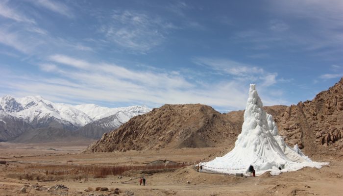
Ice cones in the high altitude deserts of Ladakh, Himalayas. [Credit: Dadul Lobzang, Ice Stupa Project]

