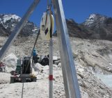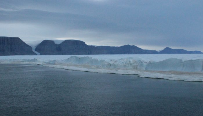
5th August 2015, 10:30 in the morning. The meeting had to be interrupted to take this picture. We were aboard the Swedish icebreaker Oden, and were now closer than anyone before to the terminus of Petermann Glacier in northwestern Greenland. But we had not travelled that far just for pictures…
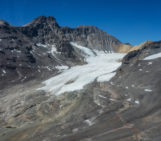
Petermann’s ice tongue
Petermann is one of Greenland’s largest “marine terminating glaciers”. As the name indicates, this is a glacier, i.e. frozen freshwater, and its terminus floats on the ocean’s surface. Since Petermann is confined within a fjord, the glacier is long and narrow and can be referred to as an “ice tongue”.
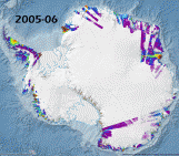
Petermann Glacier is famous for its recent calving events. In August 2010, about a quarter of the ice tongue (260 km2) broke off as an iceberg (Fig. 2). In July 2012, Petermann calved again and its ice tongue lost an extra 130 km2.
These are not isolated events. Greenland’s marine terminating glaciers are all thinning and retreating in response to a warming of both air and ocean temperatures (Straneo et al., 2013), and Greenland’s entire ice sheet itself is threatened. Hence, international fieldwork expeditions are needed to understand the dynamics of these glaciers.
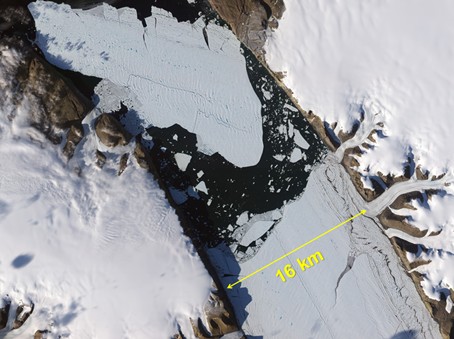
Fig. 2: The 2010 calving event of Petermann. Natural-color image from the Advanced Land Imager (ALI) on NASA’s Earth Observing-1 (EO-1) satellite ( August 16, 2010). [Credit: NASA’s Earth Observatory]
The Petermann 2015 expedition
In summer 2015, a paleoceanography expedition was conducted to study Petermann Fjord and its surroundings, in order to assess how unusual these recent calving events are compared to the glacier’s past. Our small team focused on the present-day ocean, and specifically investigated how much of the glacier is melted from below by the comparatively warm ocean (that process has been described on this blog previously). In fact, this “basal melting” could be responsible for up to 80% of the mass loss of Petermann Glacier (Rignot, 1996). Additionally, we were also the first scientists to take measurements in this region since the calving events.
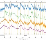
Our results are now published (Heuzé et al., 2017). We show that the meltwater can be detected and tracked by simply using the temperature and salinity measurements that are routinely taken during expeditions (that, also, has been described on this blog previously). Moreover, we found that the processes happening near the glacier are more complex than we expected and require measurements at a higher temporal resolution, daily to hourly and over several months, than the traditional summer single profiles. Luckily, this is why we deployed new sensors there! And since these have already sent their data, we should report on them soon!
Edited by David Rounce and Sophie Berger
References and further reading
- Heuzé, C., Wåhlin, A., Johnson, H. L., and Münchow, A. (2017). Pathways of meltwater export from Petermann Glacier, Greenland. Journal of Physical Oceanography, in press.
- For more information about the Petermann expedition, check out the videos of 77th Parallel.
- For more Greenland fieldwork posts, continue reading our blog (that post with drones in particular)