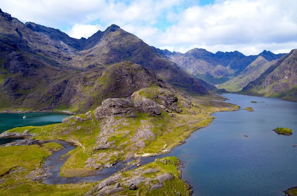
On the south-western coast of the Isle of Skye, Scotland, lies Loch Coruisk, supposedly home of a water horse. At the southern end of this freshwater Loch, the Scavaig River discharges into a sea Loch, Loch na Cuilce. Loch Coruisk snuggles close to the center of the Cuillin Hills complex, younger than both the northern …[Read More]
EGU Scientific Divisions
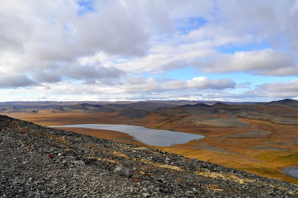
Imaggeo on Mondays: The surprising beauty of the Arctic tundra
Close your eyes and try to imagine first thing which comes to your mind, when somebody says “Tundra”. What would you imagine? Being a master student, I imagined cold, flat and a dead field. In fact, Tundra turn out to be completely different, at least in September 2010, when I and my colleagues were lucky …[Read More]
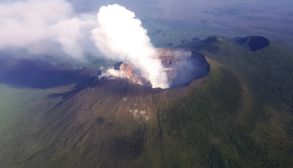
Geosciences Column: How erupting African volcanoes impact the Amazon’s atmosphere
When volcanoes erupt, they can release into the atmosphere a number of different gases initially stored in their magma, such as carbon dioxide, hydrogen sulfide, and sulfur dioxide. These kinds of gases can have a big influence on Earth’s atmosphere, even at distances hundreds to thousands of kilometres away. A team of researchers have found …[Read More]
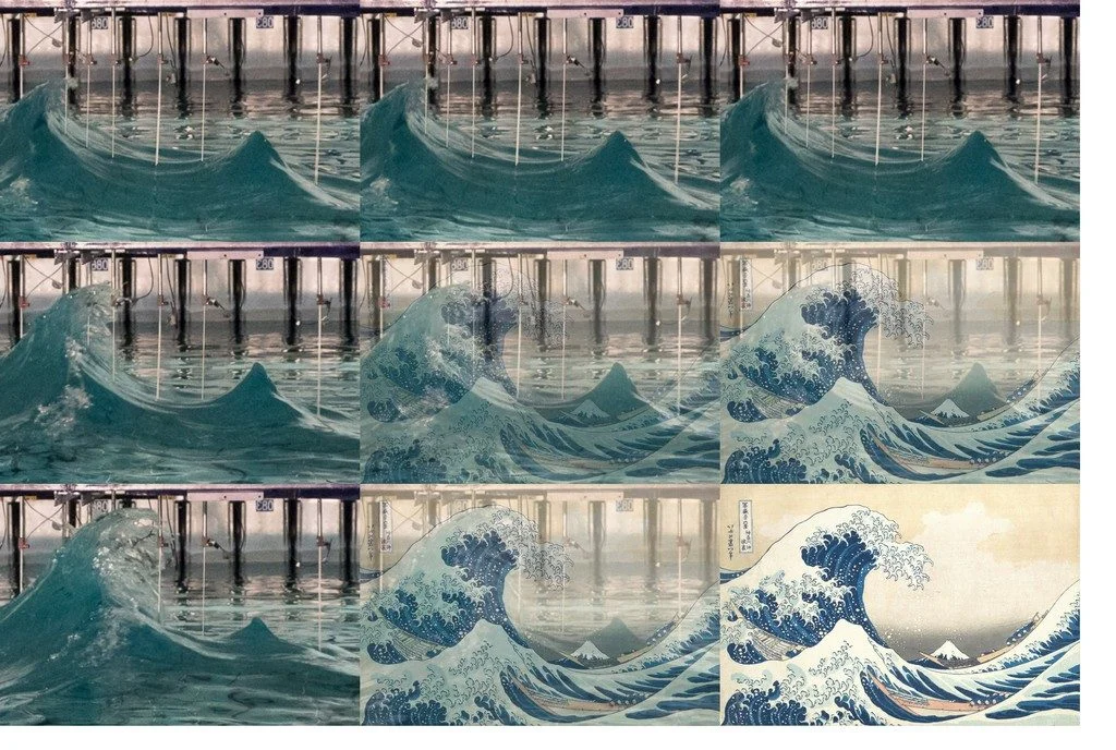
Imaggeo on Mondays: Recreating monster waves in art and science
Featured in this blog post is a collection of images that gives a picture-perfect example of life imitating art. The photos in the left column are three consecutive still frames of a breaking wave that scientists generated in a lab environment at the University of Edinburgh in the UK. The pictures in the centre and …[Read More]
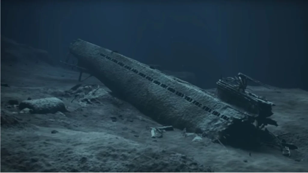
GeoPolicy: Preventing mercury leakage from a WWII submarine
I recently had the opportunity to interview Matthias Kaiser, a professor at Bergen University and, at the time of the interview, Director of the Centre for the Study of the Sciences and the Humanities. He is part of an expert team that has given scientific advice to Norwegian policymakers, highlighting the issues that should be …[Read More]
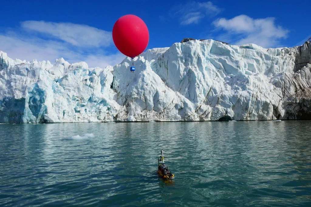
Imaggeo on Mondays: Robotics at the service of the polar science
This picture was taken in the Arctic in May 2018. It shows the unmanned marine vehicle Proteus in front of the tidewater glacier Conwaybreen in the Kongsfjorden in Spitsbergen in the Svalbard Archipelago. The front of tidewater glaciers is an almost vertical wall of ice standing over the sea where direct measurements are very critical …[Read More]
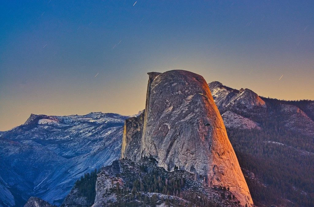
Imaggeo on Mondays: Sunset and moonrise at Yosemite
This side view of Half Dome at Yosemite National Park (California, USA) was taken from Washburn Point, a less frequented overlook a few hundred meters away from the popular Glacier Point outlook. The sun just on the right side behind the camera, which gave the orange tint to the back side of Half Dome. At …[Read More]
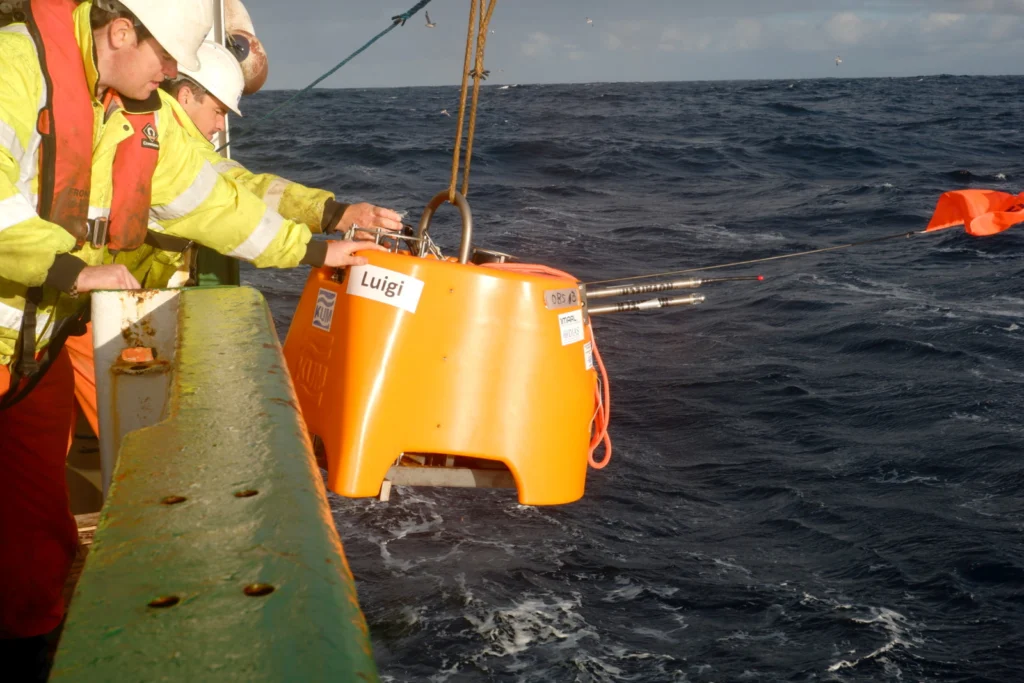
Weathering the storm from a research vessel
Fieldwork can take geoscientists to some of the most remote corners of the Earth in some of the harshest conditions imaginable, but stories from the field hardly make it into a published paper. In this blog post, Raffaele Bonadio, a PhD student in seismology at the Dublin Institute for Advanced Studies in Ireland, shares a …[Read More]
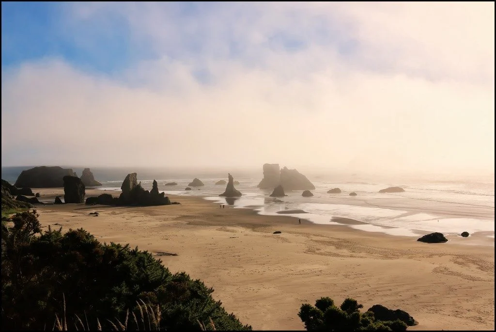
Imaggeo on Mondays: Foggy Bandon beach, Oregon
This picture was taken at Bandon beach, Oregon. Bandon is well-known for its memorable seascape of stacks of all shapes and sizes. These rock formations are known to geologists as ‘knockers’ and carry nicknames like ‘the Wizards hat’. They date from the Jurassic period – about 200 to 145 million years ago – and are …[Read More]
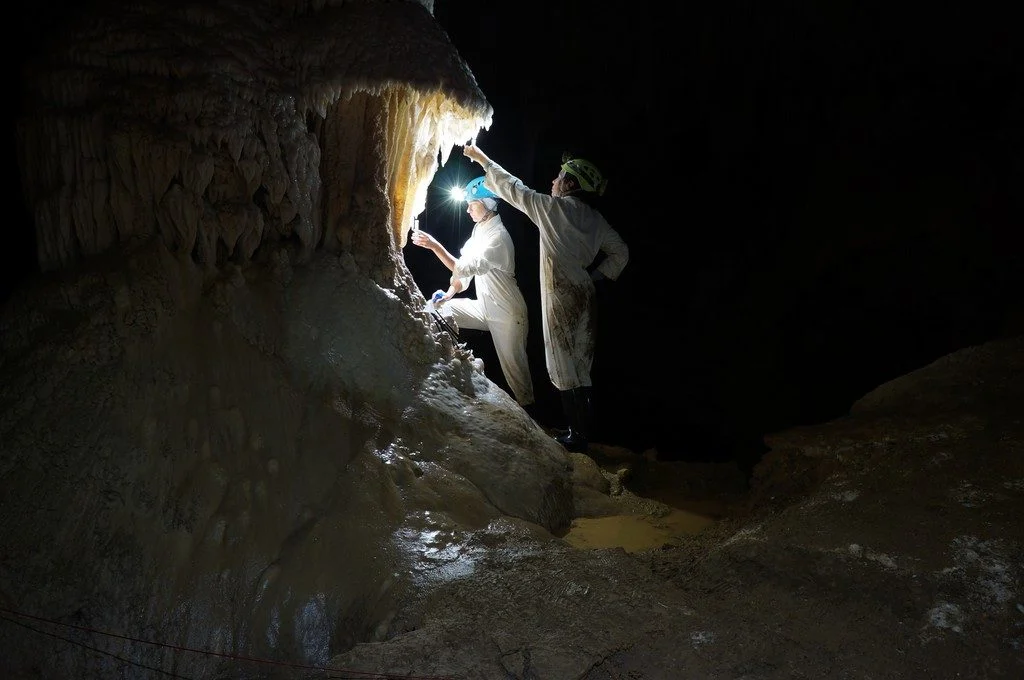
Imaggeo on Mondays: Our QUEST for innovative tools to understand changing environments and climates
The photo shown here shows typical sampling work underground. You can see Ola Kwiecien and Cinthya Nava Fernandez, researchers at Ruhr University Bochum in Germany, collecting dripwater in New Zealand’s Waipuna Cave as part of a four-year EU-funded monitoring programme. Our research aims at developing innovative geochemical indicators that we can use to quantify changes …[Read More]