Remote, rugged, raw and beautiful beyond measure, the island of South Georgia rises from the wild waters of the South Atlantic, 1300 km south east of the Falkland Islands.
The Allardyce Range rises imposingly, south of Cumberland Bay, dominating the central part of the island. At its highest, it towers 2935 m (Mount Paget) above the surrounding landscape. In the region of 150 glaciers carve their way down the rocky peaks, toward craggy clifftops and the emerald green waters of the ocean.
Geologically speaking, the territory is unique. South Georgia sits atop the place where the South American Plate and the Scotia Plate slide past one another; exactly which can claim ownership of the mountainous outpost is highly debated.
As East and West Gondwana split, about 185 million years ago, South Georgia was pulled away from Tierra del Fuego, an archipelago off the southernmost tip of mainland South American, and experienced severe volcanism.
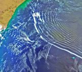
The island is so remote and exposed, it creates its own weather system. It sits in the path of very strong winds, the westerlies, which flow through the subtropical highs in the Southern Hemisphere. As air flows over the high mountains of South Georgia, they generate atmospheric gravity waves (which transfer energy from the troposphere – the layer closest to the Earth’s surface – to the upper layers of the atmosphere, including the stratosphere, where the ozone layer is found). Atmospheric gravity waves are responsible for the transfer of considerable amounts of energy over large distances, and thus have a substantial impact on weather and climate.
It is precisely to study South Georgia’s atmospheric gravity waves that Andrew Moss, the author of today’s photograph, journeyed to the remote island back in January 2015 as part of the South Georgia Wave Experiment (SG-WEX). The project was led by the University of Bath, in collaboration with the British Antarctic Survey, the University of Leeds, and the UK Met Office. As part of this project Andrew worked with a colleague at the University of Bath (UK) to release radiosondes – a small, expendable instrument package that is suspended below balloon which measures pressure, temperature and humidity – to better understand the atmospheric conditions and measure atmospheric gravity-wave activity above the island.
The chilly, often cloudy and wet landscape is a wildlife haven. It is home to a staggering five million seals and 65 million seabirds. The wildlife is so rich, on and off the island, that large swathes of South Atlantic waters surrounding South Georgia are protected and onshore activities which might disturb wildlife require permits.
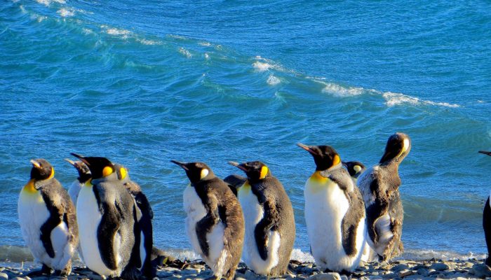
“Over the course of the two-week field campaign, King Penguins, fur seals and elephant seals often surrounded us while we worked,” describes Andrew. “During the trip, I captured a group of penguins, with their backs to the wind, clustered together on a windy day.”
References and further reading:
Imaggeo on Mondays: Atmospheric gravity waves (GeoLog, EGU Blogs, April 2017)
Hoffmann, L., Grimsdell, A. W., and Alexander, M. J.: Stratospheric gravity waves at Southern Hemisphere orographic hotspots: 2003–2014 AIRS/Aqua observations, Atmos. Chem. Phys., 16, 9381-9397, https://doi.org/10.5194/acp-16-9381-2016, 2016.
South Georgia & the South Sandwich Islands Government website
Radiosondes – a guide by the National Weather Service (NOAA)
Find out more about Andrew, here: https://www.researchgate.net/profile/Andrew_Moss8


