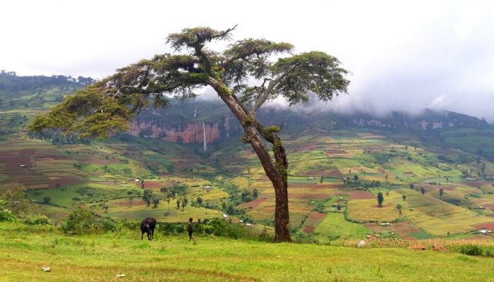
This colourful cropland patchwork is located on the fertile flanks of Mount Elgon, Uganda at an elevation of 2,400 metres above sea level. The extinct shield volcano, the oldest in East Africa, is mostly covered in clouds and provides an infinite flow of wonderful waterfalls.
Due to the climate at this elevation, the cultivated crops experience more temperate weather conditions compared to crops more typically grown in the tropics. This gives the region a less tropical outlook than what is observed at lower elevations, where the landscape views are dominated by banana trees.
Still the local communities intensely cultivate the land at these higher elevations since the soil is very fertile, a product of the mineral-rich volcanic material that was deposited during eruptions in the past twenty million years. The cultivation is only stopped by the steep cliffs that you can see in the background and the borders of the national park that encompasses Mount Elgon’s volcano top.
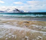
The image evokes a feeling of tranquility, but in reality, the environment is very prone to natural hazards, resulting in numerous fatalities within the densely populated communities every year.
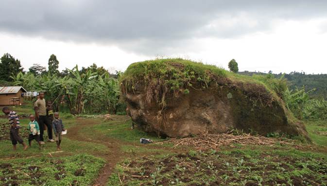
Rockfall events in the Ugandan Mount Elgon area, such as this one pictured, have destructive and fatal impacts on local communities. (Credit: Jente Broeckx)
While the local lithology results in fertile fields, the area’s steep slopes and severe tropical thunderstorms make the region vulnerable to landslides. Mount Elgon’s steep cliffs pose a second risk as they can generate rockfalls, with big blocks as large as the houses at the foot of those cliffs. Both landslides and rockfalls often leave a trace of destruction on their path, sweeping away houses and causing fatalities.
Luckily, the view we see here on the north-facing side of Mount Elgon has rather gentle slopes, experiences milder storms and receives relatively low precipitation throughout the year.
My colleagues and I study the area’s susceptibility to landslides and the high risk this poses for its inhabitants, their livelihoods and the infrastructure. The picture was taken during one of our field work campaigns, where I was mapping landslides and landslide-free locations to calibrate the first landslide susceptibility map for the Mount Elgon region. At this year’s EGU General Assembly, I will give an oral presentation on this research.
This environment provides a duality that, on the one hand attracts people with its rich natural resources, but on the other hand poses a risk for their survival. It is one of the many places on earth with a fragile equilibrium between a growing human pressure and the forces of nature.
By Jente Broeckx, a PhD researcher at KU Leuven, Belgium
Imaggeo is the EGU’s online open access geosciences image repository. All geoscientists (and others) can submit their photographs and videos to this repository and, since it is open access, these images can be used for free by scientists for their presentations or publications, by educators and the general public, and some images can even be used freely for commercial purposes. Photographers also retain full rights of use, as Imaggeo images are licensed and distributed by the EGU under a Creative Commons licence. Submit your photos at http://imaggeo.egu.eu/upload/.