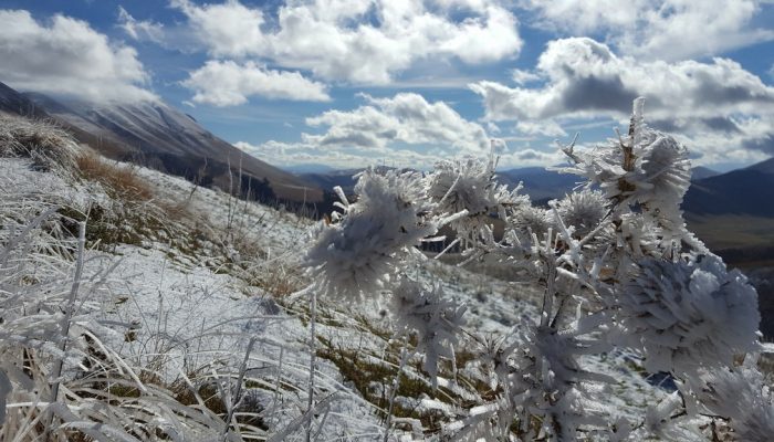
This photo was taken during a fieldwork campaign following the mainshock of the deadly seismic sequence that struck central Italy starting from 24 August 2016. The magnitude 6.2 earthquake severely damaged nearby towns, claimed more than 290 lives and injured nearly 400 people in its wake.
As a geologist from the National Institute of Geophysics and Volcanology, I was in charge of measuring the manifestations of the seismic shaking (mainly fractures and landslides) on the territory. Some of the most relevant fractures were located along the mountain ridge formed by Monte Vettore (in the background of the photo) and Monte Porche (on which the photo was taken).
The new snow and the lowering temperature signaled that winter was approaching. The changing season also meant that my colleagues and I would have to rush the survey before the snow buried even the deepest fractures.
By Roberto Vallone, a technologist at the National Institute of Geophysics and Volcanology in Italy
Imaggeo is the EGU’s online open access geosciences image repository. All geoscientists (and others) can submit their photographs and videos to this repository and, since it is open access, these images can be used for free by scientists for their presentations or publications, by educators and the general public, and some images can even be used freely for commercial purposes. Photographers also retain full rights of use, as Imaggeo images are licensed and distributed by the EGU under a Creative Commons licence. Submit your photos at http://imaggeo.egu.eu/upload/.


