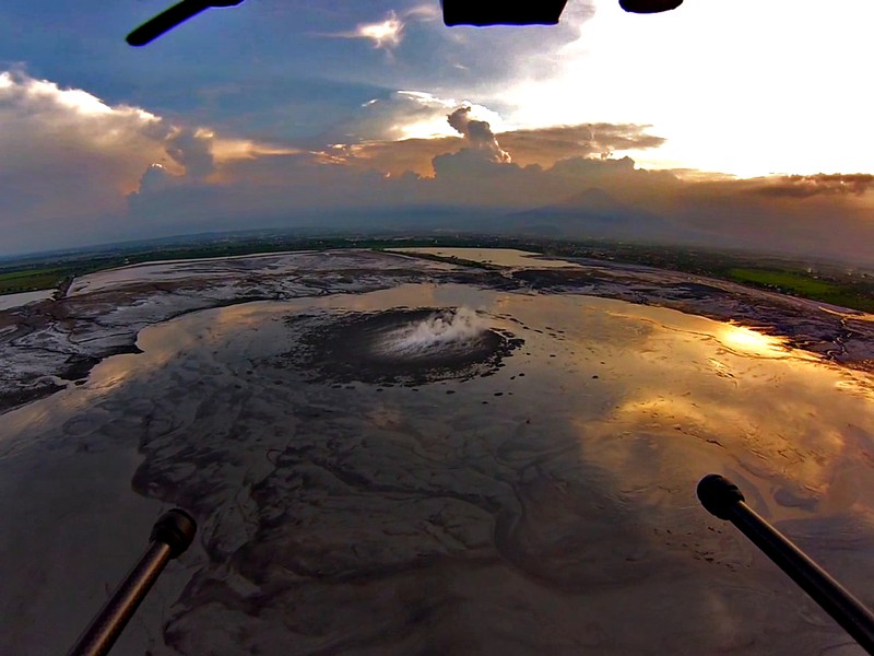
Lusi from the sky with drones. Credit: Giovanni Romeo, Adriano Mazzini and Giuseppe Di Stefano. (distributed via imaggeo.egu.eu)
The picture shows a spectacular aerial view of a sunset over the Lusi mud eruption in East Java, Indonesia. Here thousands of cubic meters of mud, are spewed out every day from a 100 m sized central crater. Since the initial eruption of the volcano in 2006, following a 6.3 M earthquake, a surface of about 7 km2 has been covered by boiling mud, which has buried more than 12 villages and resulted in the displacement of 40,000 people.
Monitoring Lusi is part of multidisciplinary project called Lusi Lab, which focuses on the study of the behaviour of this incredible mud eruption. Many unsolved questions remain: What lies beneath Lusi? Research focuses on trying to ascertain what triggers the mud eruptions. One key question is whether Lusi is truly a mud volcano, or is it connected to a hydrothermal system linked to the nearby Arjuno Welirang volcanic complex? Lusi erupts mud, water, gas and clasts in pulses and scientists do not fully understand how the intermittent activity is linked to the seismic activity of the neighbouring volcanic complex. For the purposes of hazard and risk management, much speculation has focused on how long is the activity at Lusi is likely to last.
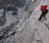
In an attempt to shed light on some of these questions the Lusi Lab team continually collect water and gas samples from the volcano, as well as assessing the seismic activity in the region ( including the neighbouring volcanic arc) through the deployment of a network of seismometers. This data gathering effort is further supported by a UAV prototype: The Lusi drone (assembled and equipped by INGV, Rome). The drone is able to access extreme environments and can provide photogrammetric and thermal images, gas and mud sampling and contact temperature measurements. A permanently installed Gopro Hero3 camera provides a continuous recording over the mud flows during flights, including this week’s Imaggeo on Mondays image. Gas and water samples collected from the crater site revealed that Lusi is part of a Sedimentary Hosted Geothermal System (SHGT) that connects Lusi with the neighbouring Arjuno Welirang volcanic complex that can be seen in the background of the picture. The eruption site is continuously fed by new surges of geothermal fluids released from the volcano in particular after frequent seismic events occurring in the subduction zone in southern Java.
By Laura Roberts Artal and Giovanni Romeo
To learn more about Lusi take a look at this paper:
Mazzini, A., Etiope, G., and Svensen, H. (2012), A new hydrothermal scenario for the 2006 Lusi eruption, Indonesia. Insights from gas geochemistry: Earth and Planetary Science Letters, 317-318. 0, 305-318.
If you pre-register for the 2015 General Assembly (Vienna, 12 – 17 April), you can take part in our annual photo competition! From 1 February up until 1 March, every participant pre-registered for the General Assembly can submit up three original photos and one moving image related to the Earth, planetary, and space sciences in competition for free registration to next year’s General Assembly! These can include fantastic field photos, a stunning shot of your favourite thin section, what you’ve captured out on holiday or under the electron microscope – if it’s geoscientific, it fits the bill. Find out more about how to take part at http://imaggeo.egu.eu/photo-contest/information/.

Pingback: Earthquake, geology and landslide news – Studying an Indonesian mud volcano with drones