This week’s Imaggeo on Mondays is brought to you by Alexis Merlaud, an atmospheric scientist from the Belgian Institute for Space Aeronomy. While the wonders of the African atmosphere feature in his photography, the East African Rift has a much bigger tale to tell. Drawing from all aspects of geoscience Alexis shares its story…
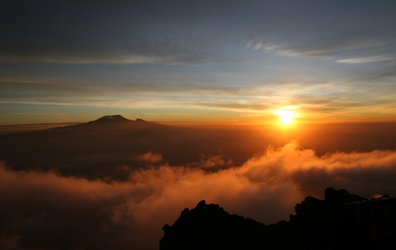
Kilimanjaro from Mount Meru. (Credit: Alexis Merlaud, distributed via imaggeo.egu.eu)
This picture shows Kilimanjaro, Africa’s highest mountain, at sunrise. It was taken from Socialist Peak, which marks the top of Mount Meru, some 70 km to the southwest. Both mountains are located in Tanzania and are among the largest stratovolcanoes of the East African Rift Zone. Unlike Kilimanjaro, Meru is active and its most recent eruption occurred in 1910.
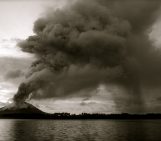
Stratovolcanoes, also called composite cones, are built-up by alternating layers of lava flows, pyroclastic rocks, and volcanic ash. During a large eruption, huge quantities of ash and sulphur dioxide can reach the stratosphere, where they can affect the climate for several years, as did the eruptions of Krakatau in 1883 and Pinatubo in 1991. Sulphur dioxide is converted to sulphuric acid droplets, which spread with the ashes throughout the stratosphere. These aerosols screen some of the sunlight, decreasing the average surface temperature by about one degree. The temperature in the stratosphere simultaneously rises by a few degrees, due to the enhanced absorption of sunlight by aerosols.
There is a difference in the tectonic processes associated with these South East Asian volcanoes and the East African Rift: the former are located above a subduction zone while the rift is a divergent boundary. An example of large volcanic eruption in a divergent zone is the Laki (Iceland) eruption in 1783, which yielded severe meteorological conditions and reduced harvests for several years in Europe. This eruption may have also helped trigger the French Revolution in 1789.
Plate tectonics in East Africa created Kilimajaro and have also played a role in early human evolution, by shaping the local landscape and the long-term climate, thus modifying the environment of our ancestors. East Africa is the area in the world where most of the hominid fossils have been discovered, including Homo sapiens – the oldest fossil record is 200,000 years old and started to move out from Africa 100,000 years ago!
A final thanks: thanks Cristina Brailescu for help climbing Meru and Emmanuel Dekemper for support on editing the picture.
By Alexis Merlaud, Belgian Institute for Space Aeronomy
Imaggeo is the EGU’s open access geosciences image repository. Photos uploaded to Imaggeo can be used by scientists, the press and the public provided the original author is credited. Photographers also retain full rights of use, as Imaggeo images are licensed and distributed by the EGU under a Creative Commons licence. You can submit your photos here.