These blogposts present interviews with outstanding scientists that bloomed and shape the theory that revolutionised Earth Sciences — Plate Tectonics. Get to know them, learn from their experience, discover the pieces of advice they share and find out where the newest challenges lie!
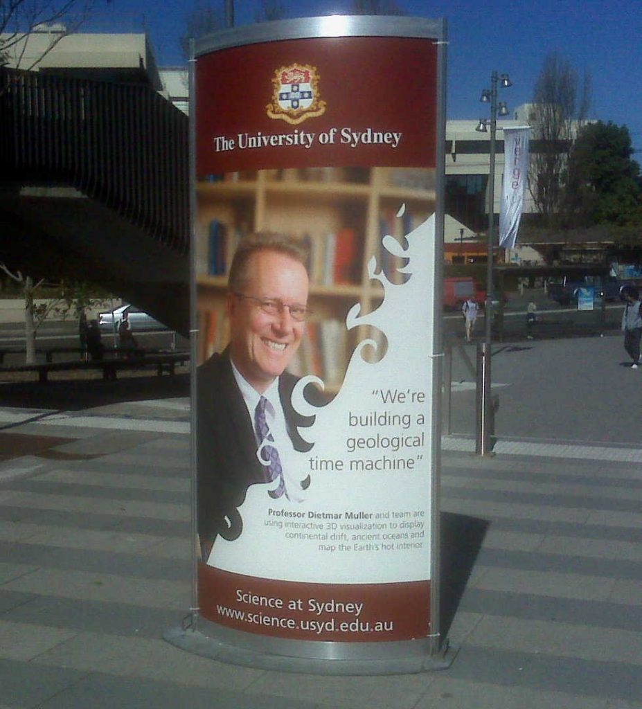
Meeting Dietmar Müller
Dietmar Müller is Professor of Geophysics at the University in Sydney and leads the EarthByte research group. He started his academic career in Germany at the University of Kiel and obtained his PhD in Earth Science at the Scripps Institution of Oceanography, UC San Diego, in 1993. Throughout his career he has straddled the boundary between geology, geophysics and computing.
Figure out what you actually enjoy doing and just go and do that.
You were educated in Germany and in the USA. How did you end up in Australia?
After I finished my PhD in 1993, I saw an advert for a lectureship in geophysics at the University of Sydney in EOS. I had never been to Australia and had no idea what life in Sydney might be like, but I thought, I might as well send off an application. A couple of months later I got a postcard from Sydney University, informing me that I had been shortlisted for the position. I thought this was vaguely interesting, but as a fresh PhD graduate, I mainly had my eyes on a couple of postdoctoral fellowships in Europe. Then I got a phone call for an interview. They had clearly decided that flying me to Sydney, all the way across the vast Pacific Ocean, was far too expensive. But they seemed to be interested in my vision for the future, and at the end of the phone interview they asked me: “If we offered the position to you, would you take it?” The thing is, this was the first real job anyone offered to me, so I thought, it’s probably a good idea to say “sure, why not”. Soon they faxed me a contract (these were not yet the days of the internet). Then I thought, hmm, what is this place actually like? So I went to the public library in San Diego and borrowed a VHS tape on Sydney. It included footage of Bondi Beach, Sydney Harbour and the Blue Mountains, with a few kangaroos and koalas thrown in for good measure. I thought this looks ok, it could be a liveable place. After I finally got my visa, I booked a 1-way flight to Sydney, and in late October 1993 I showed up in the Department of Geology and Geophysics and ran into a guy who turned out to be the Head of Department. He looked at the Scripps T-shirt I was wearing, and said: You must be the guy we hired! Of course, he had never seen me, so my T-shirt was my main identifying feature. Remarkably, over 25 years later, I am still there.
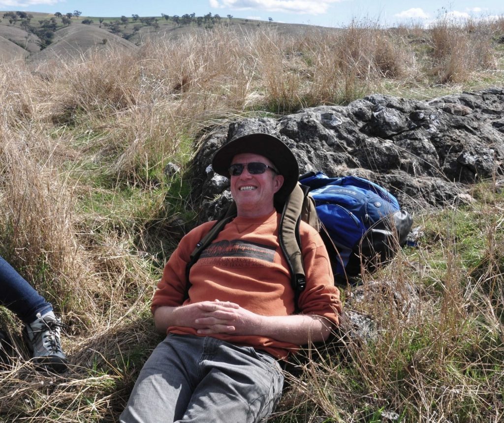
Dietmar settling into life in Australia in the 90s, mapping Devonian carbonates in Yass. Credit: unknown.
What is your main research interest? How would you describe your approach and methods?
I lead an Australian research effort, with many international links, to develop and continue to refine something that could be called a virtual Earth Laboratory. I have been an advocate for open-source software and open-access data during my entire career to make science transparent and reproducible. Based on these principles we have spearheaded the development of custom software and global data sets to reconstruct the Earth through time. To understand the Earth’s evolution we need to change our geographic reference system as we go back in time, because of plate tectonics. The plate tectonic revolution in the late 60s and 70s established the principles of how plate tectonics works. Applying these principles to build an Earth model is essentially what I have focussed my career on. I have always had a fascination with Earth evolution over geological time because its comprehension lies so far outside the everyday experience of humans. Most people cannot grasp the relevance of processes on vastly longer timescales than our own lifetime. But understanding the rhythms of Earth’s deep past and thinking about time like a geologist can perhaps give us the perspective we need for a more sustainable future. To dive into the Earth’s past, plate tectonics is indispensable. We need to be able to reconstruct geological data to their original environments. Doing this effectively requires open-source software and open-access data sets that can be shared amongst the community, enabling collaboration.
How do you build an open-source software system from scratch?
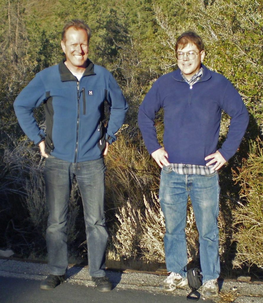
Dietmar Müller and Mike Gurnis in Altadena, 2006, taking a break from planning GPlates development. Credit: Melanie Symonds.
When I arrived in Sydney (over 25 years ago) there was no open software to build plate tectonic models, let alone to link plate motions to mantle convection models so that we can investigate the evolution of the entire plate-mantle system. I assembled a small team, partnering with Michael Gurnis at Caltech, to build the community GPlates software. This effort was initially supported by the Australian Partnership for Advanced Computing (APAC) enabling the development of GPlates1.0 on Linux and PCs and its Geographic Markup Language-based information model. In 2005, we managed to get a small educational grant from Apple Computers to develop the GPlates for Macs. We are lucky that shortly afterwards the AuScope National Collaborative Research Infrastructure was established which has supported GPlates development since 2007. That allowed us to fully develop reconstructions of plate boundary networks through time, which is essential for coupling plate tectonics to mantle convection models, as well as the 3D interactive visualisation of mantle volumes and lastly the functionality to model plate deformation, a key step beyond the classical rigid plate tectonic theory. We also developed a python library, pyGPlates, that allows users to link our plate models to many other forms of spatiotemporal data analysis and to other types of models, including geodynamic and paleoclimate models.
The slow carbon cycle is like slow cooking… over millions of years
What would you say is your favourite aspect of doing research?
Understanding the Earth as a system. I am interested in integrating observations from Plate Tectonics and mantle convection with landscape evolution and surface environments through time. I would like to adopt a definition of Earth System Science that actually includes the entire solid Earth, as well as the atmosphere, oceans and biosphere.
What are the real world applications of your research?
There are many applications of plate tectonics. They include understanding solid Earth evolution, palaeogeography, paleoclimate, paleoceanography, paleobiology, and spatiotemporal data mining, for instance for resource exploration. Most mineral deposits are associated with plate boundaries, so being able to link ore deposit formation with plate motions and the kinematic and geodynamic history of plate boundaries allows us to start understanding why certain mineral deposits form at specific windows in space and time, something we have recently started doing using the Andes as a case study.
Students will be entering a transformed workplace unlike any their parents knew
What do you consider to be your biggest academic achievement?
I am most well-known for my work on the age and palaeophysiogeography of the ocean basins. I started working on this as a PhD student. My thesis supervisor, John Sclater, made a name for himself with the first isochron map of the ocean basins. But there was no digital map. Having a digital grid, linked to a global plate model, was going to be critical for studying a whole range of processes from subduction, plate-mantle interaction, the evolution of ocean gateways through time, dynamic surface topography, and many others. I decided to synthesize all the data that we had available at the time to create the first digital map of the ocean basins, followed by a set of reconstructed paleo-age maps. This has enabled a lot of research, both my own and that of the community. For example, it has allowed us to look at the volume of the ocean basins through time (via the connection between the age and the depth of the ocean floor). A more recent achievement, fresh off the press, represents an epic decadal effort on part of the EarthByte group to complete a global plate model for the Mesozoic/Cenozoic period that includes plate deformation. Classical plate tectonics requires plates to be rigid and separated by narrow boundaries. It’s astonishing that it’s taken about 30 years since diffuse deformation was first widely recognised in the 80s to get to the point of systematically building a global model incorporating diffuse deformation for the geological past (soon to appear in Tectonics). It reveals that about a third of the continental crust has been deformed since the breakup of Pangea, about 77 million km2, partitioned into 65% extension and 35% compression. That roughly corresponds to the total area of North and South America and Africa together. The model can be used to investigate the evolution of crustal strain, thickness, topography, temperature, and heat flux, globally.
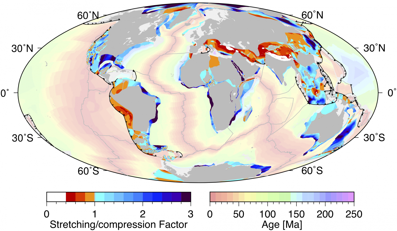
Total distributed continental deformation accumulated over 240 million years of rifting and crustal shortening. In Dietmar et al. (to come in 50th anniversary plate tectonics volume in Tectonics). A global plate model including lithospheric deformation along major rifts and orogens since the Triassic.
What would you say is the main problem that you solved during your most recent project?
Recently, I became involved in the Deep Carbon Observatory. There are a few quite exciting problems involved in understanding the Earth’s deep carbon cycle and, being an area I have not traditionally worked in, it’s a new adventure for me to try to understand how plate tectonic drives the geological carbon cycle. One of the problems that we tackled in the course of connecting plate tectonics to the “slow carbon cycle” is to investigate seafloor weathering. The slow carbon cycle takes place over tens of millions of years, driven by a series of chemical reactions and tectonic activity and is part of Earth’s life insurance, as it has maintained the planet’s habitability throughout a series of hothouse climates punctuated by ice ages. We were able to build on ocean drilling results and laboratory experiments from other groups to understand how of the storage of C02 and carbon in the ocean crust changes through time, as a function of the age of the ocean crust and of the bottom water temperature, which is quite important, because temperature strongly modulates this process. This is something we published in Science Advances in 2018.It is quite a cool paper!
We actually need geochemists and geophysicists to work together
After being many years active in the academia, looking back, what would you change to improve how science in your field is done?
The biggest change in my time in academia is the emergence of artificial intelligence (AI) and data science as a universal, rapidly growing research area and set of tools to analyse big or complex data, to assimilate data into models and to quantify uncertainties in process models and predictions. There is an urgent need for all Earth science students to become literate in these areas. By the time this year’s first-year students will graduate, they will be entering a transformed workplace unlike any their parents knew. However, the need for changing staff profiles and undergraduate curricula are often recognised and implemented much more slowly than the evolution of the world outside of our ivory towers. But this change needs to happen.
What you just exposed, goes to some extent in line with my next question: What are the biggest challenges right now in your field?
Most of the problems that we are left with are complicated problems that aim at understanding the complexity of the Earth system. That could be anything from structural geology to understanding physical and chemical problems. An example is the field of geodynamics. It is mostly dominated by looking at the physics of mantle convection. And then there is another bunch of people who look at the chemistry of the mantle. These fields have not been properly connected. We actually need geochemists, geophysicists and geologists to work together to try to understand how the Earth system works. Then we need to connect deep Earth evolution to surface environments, understand the exchange of fluids and volatiles between the solid Earth and the oceans and atmosphere.
You actually have to be in for the long game
Building a geological time machine at the University of Sydney, 2009. Credit: Rhiannon McKeon
What was your motivation, starting as an Early Career Researcher? Did you always see yourself staying in academia?
As a kid I was inspired to become a scientist by taking long walks along Germany’s Baltic Sea beaches, picking up unusual rocks and fossils along the way, none of which really belonged there. They had all originated in Scandinavia, where they had been scraped off by moving glaciers and dropped much further south after being transported in the ice over 1000 km. I still have a small collection of these rocks and fossils which include remains of sea urchins and squids from the Cretaceous period and over 400 My old pieces of ancient reefs that had once been buried deeply in the Scandinavian crust. I always wanted to be an academic, I wanted to understand how the Earth works, over geological time. I never had any second thought about that. I can see today that students are often quite confused about what they want to do. Because they are unsure about where the future might take them, they don’t end up focussing on any one subject and are not necessarily inclined to acquire skills that are deep and broad enough to excel. If you want to be successful at anything, you need to become really good at something, and persevere. Be good at something that you actually enjoy, and be in it for the long game.
Who inspires you?
I am inspired by the pioneers of open source software and open access data. Open science is the key to forming global research teams and advancing studies of the Earth system. I am inspired by Paul Wessel at the University of Hawaii, who, together with his colleagues, built one of the most extensive geo-software systems, the Generic Mapping Tools, over the past ~30 years; I started using an early version of it during my PhD and am still using it! In terms of open access data, one of my heroes in Earth Sciences is David Sandwell at the Scripps Institution of Oceanography, who revolutionised our knowledge of the deep structure of the ocean basins by making his global satellite gravity maps freely available to the community. On the geochemistry side, Kerstin Lehnert at the Lamont-Doherty Earth Observatory has accomplished an amazing feat by leading the EarthChem database effort, and now the Interdisciplinary Earth Data Alliance, a nice example for bringing geochemistry and geophysics together.
What is the best advice you ever received?
Not long after I arrived at the University in Sydney, the then professor of geophysics pulled me aside and said: “I have one piece of advice for you: Stay away from University politics and just do your own thing“. That’s exactly what I have done and that’s the best advice I have ever received. It is easy to get carried away with politics at many different levels…
Stay away from University politics
What advice would you give to students?
You have to figure out what you enjoy and what you would like to do. You should not choose a career because you think this career will pay more money than another one, or it may seem there are more jobs in one field than another. The advice I would give to students is to try to figure out what you actually enjoy doing and just go and do that. The future will be driven by big and complex data analysis and simulation and modelling, but there will still be a need for people who can identify a rock. If you can do both, you’ll have a job without any doubt!
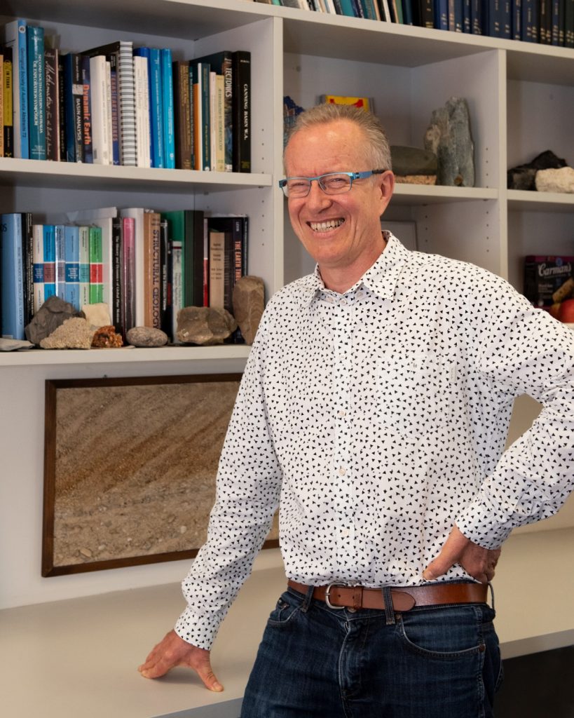
Dietmar Müller, November 2018 in his office. Credit: Jo Condon, AuScope
Interview conducted by David Fernández-Blanco