On 27 October, European Union Agency for the Space Programme (EUSPA) through its GNSS Service Centre (GSC), and the EGU Geodesy Division jointly organised a webinar to explore how Europe’s Space Programme and its services support a wide range of market segments and applications. The session focused in particular on the contribution of Galileo, Europe’s Global Navigation Satellite System (GNSS), to geomatics and geoscience, where professionals rely every day on satellite positioning to collect, analyse and understand our world.
The webinar also introduced the role of EUSPA’s GSC and the unique Galileo services and differentiators that are helping researchers and practitioners achieve greater accuracy, reliability and trust in their work.
Missed the webinar or want to revisit the discussions? You can watch the full recording on our YouTube.
Europe’s Space Programme and EUSPA: Connecting Space and Users
EUSPA plays an important role in connecting European space capabilities with users across different sectors. The EU Space Programme encompasses several key components, including Galileo, EGNOS, Copernicus, Secure Satellite Communications (Secure SATCOM), and Space Situational Awareness (SSA), as illustrated in the figure below. Through EUSPA, and in particular, its GSC, users can access information, support and resources related to Galileo, helping researchers and professionals worldwide make the most of satellite navigation capabilities.
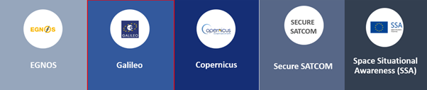
Key components of the EU Space Programme, with Galileo highlighted as the focus of the webinar. [Credit: EUSPA ]
Galileo: More than just another GNSS
Galileo is Europe’s GNSS, providing highly accurate positioning, navigation and timing services worldwide. Beyond its Open Service, Galileo offers a range of services designed for different user needs, including the High Accuracy Service (HAS) and Open Service Navigation Message Authentication (OSNMA). These capabilities help improve positioning performance, signal trustworthiness and overall service reliability, benefiting professional users in geomatics, geosciences and many other sectors. The webinar also highlighted success stories showcasing how Galileo is already being used in real-world applications, demonstrating its added value across different fields.
Video: Discover Galileo and its services, and learn how Europe’s GNSS supports positioning, navigation and timing applications. [Credit: EUSPA]
Applications for Geoinformation, Resources and Opportunities
Galileo supports a wide range of geomatics and geoscience applications, from surveying and mapping to environmental monitoring and research. During the webinar, participants explored Galileo-enabled receivers supporting HAS and OSNMA, as well as resources, including application examples, user projects, and funding opportunities for innovators and researchers working with EU Space technologies, particularly Galileo. Readers interested in market trends and future opportunities may also find the latest EUSPA GNSS Market Report a valuable resource. They may also wish to attend the upcoming EUSPA User Consultation Platform (UCP) event, taking place on 26–27 November 2026, which brings together users, industry stakeholders and experts to exchange views on needs, developments and opportunities in the EU Space Programme.
Further reading:
Interested in learning more about the European Space Programme, Galileo and the services available to users? Explore the following resources:
- EUSPA – European Union Agency for the Space Programme
https://www.euspa.europa.eu/ - EUSPA Funding and Market Opportunities
https://www.euspa.europa.eu/opportunities - European GNSS Service Centre (GSC)
https://www.gsc-europa.eu/ - Galileo High Accuracy Service (HAS)
https://www.gsc-europa.eu/galileo/services/galileo-high-accuracy-service-has - Galileo Open Service Navigation Message Authentication (OSNMA)
https://www.gsc-europa.eu/galileo/services/galileo-open-service-navigation-message-authentication-osnma
– Edited by Radoslaw Zajdel