Summer is coming to an end in the northern hemisphere, and it usually signals the end of the field season – at least in northern Europe. During the field season, we mostly take our absolute gravimeter (we call her Greta) to measure gravity at various locations across Sweden. Occasionally, we even take Greta to other countries – but that’s a story for another time.
Who is Greta?
Greta is an 18-year old American-breed instrument of type FG5X. She is very sensitive and needs to be set up indoors on a stable concrete pillar. This is because Greta needs to remain stationary at a single point for several hours, sometimes even days, and thus rain, wind, sun, etc. make her uncomfortable. You can’t set Greta up anywhere; site selection needs to be done well in advance — not just a week before. In Sweden, the locations where Greta measures were determined many years ago, and she returns to each absolute gravity station about every three years to monitor how gravity changes over time. These stations, often just a hut, aren’t just for Greta; many other geodetic instruments, such as GNSS antennas and corner reflectors for InSAR, are installed there as well. So, while we visit these stations frequently, it’s not always with Greta.
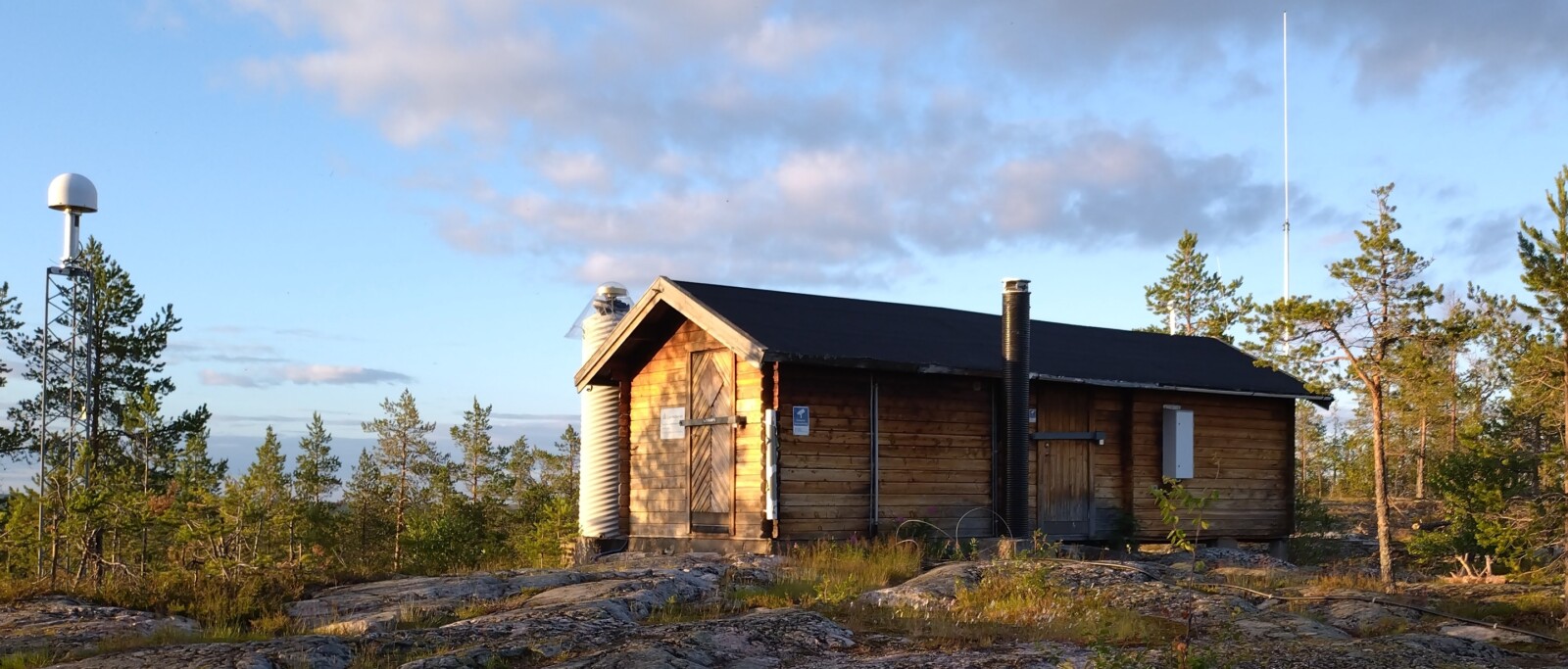
Geodetic station in Skellefteå (northern Sweden). Picture by Holger Steffen.
Why are we measuring gravity in northern Europe?
Knowledge of the absolute gravity is useful for studying various processes occurring within and on the Earth’s surface. In northern Europe, we primarily focus on glacial isostatic adjustment (GIA), which is the response of the solid Earth to ice-mass changes. Northern Europe was covered by a large ice sheet peaking in size about 21,000 years ago1, when it began to melt. The previously depressed surface (because of the heavy ice load) then started rebounding very slowly back to its original state from before the ice sheet developed. Despite most of the ice having melted by around 10,000 years ago1, the Earth’s surface is still in the process of rebounding2. This rebound causes the land to rise by up to one centimeter per year3, which also affects gravity4. On the ground, we observe a decrease in gravity of up to 1.8 microGal (= 18 nm/s2) per year4, resulting from the Earth’s surface uplifting and moving away from the planet’s center. However, when we measure gravity from space, we observe a positive gravity anomaly over northern Europe5. This is because the Earth’s surface is moving closer to the satellite, like the Gravity Recovery and Climate Experiment (GRACE), as it rebounds. Additionally, mantle material that was displaced during the ice loading is now flowing back to support the uplifting surface. This large-scale movement can also be detected in satellite gravity data. As higher-density mantle material shifts toward the uplifting center, it generates a positive gravity signal.
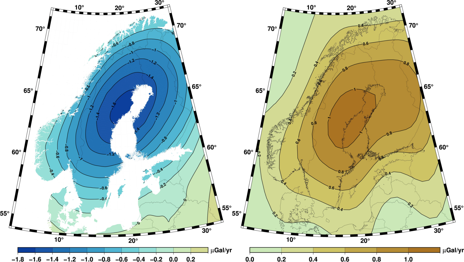
Gravity change in northern Europe as obtained from repeated measurements at absolute gravity stations (left; based on Olsson et al., 20194) and derived from the GRACE satellite data (based on CSR solution; right).
Where and how do we measure gravity?
To study changes in gravity on the ground, we set up Greta at our 14 pre-designated stations4. You pack a lot of boxes and take Greta on a tour in Sweden to sometimes very remote places. This year, we visited the station in Skellefteå, near the Baltic coast in northern Sweden, and the station in Arjeplog, in central northern Sweden. Upon arriving at a station, the first task is to check if any wildlife has gotten into the hut and remove all the dirt that piled up. The next thing is to get all the boxes from Greta to the hut – though you can’t always park the transporter right outside the hut. For our second station in Arjeplog, for instance, we had to carry everything about 50 meters through a forest full of wild berries. Greta is split up into 6 boxes and some are quite heavy, weighing up to 44 kilograms – so either you do a lot of workout or you need two people to carry them over some distance (with fresh berries as reward). Setting up the instrument may take up to two hours, but once it’s in place, you can leave the hut and let the gravimeter do its job. However, it’s a good idea to return periodically to check that everything is still working. This depends on how you programmed the measurements. On a trip like this, Greta measures the gravity every six seconds for five minutes to create one mean data point, and this is repeated every hour. Over the course of about 24 hours, you obtain a stable value, provided there hasn’t been an earthquake or significant weather change. Since Greta’s locations are usually quite remote, disturbances like passing trucks or nearby construction sites are rarely an issue. Once the measurements are complete, it’s time to build down everything, repack the boxes, and, of course, carry them all back to the transporter.
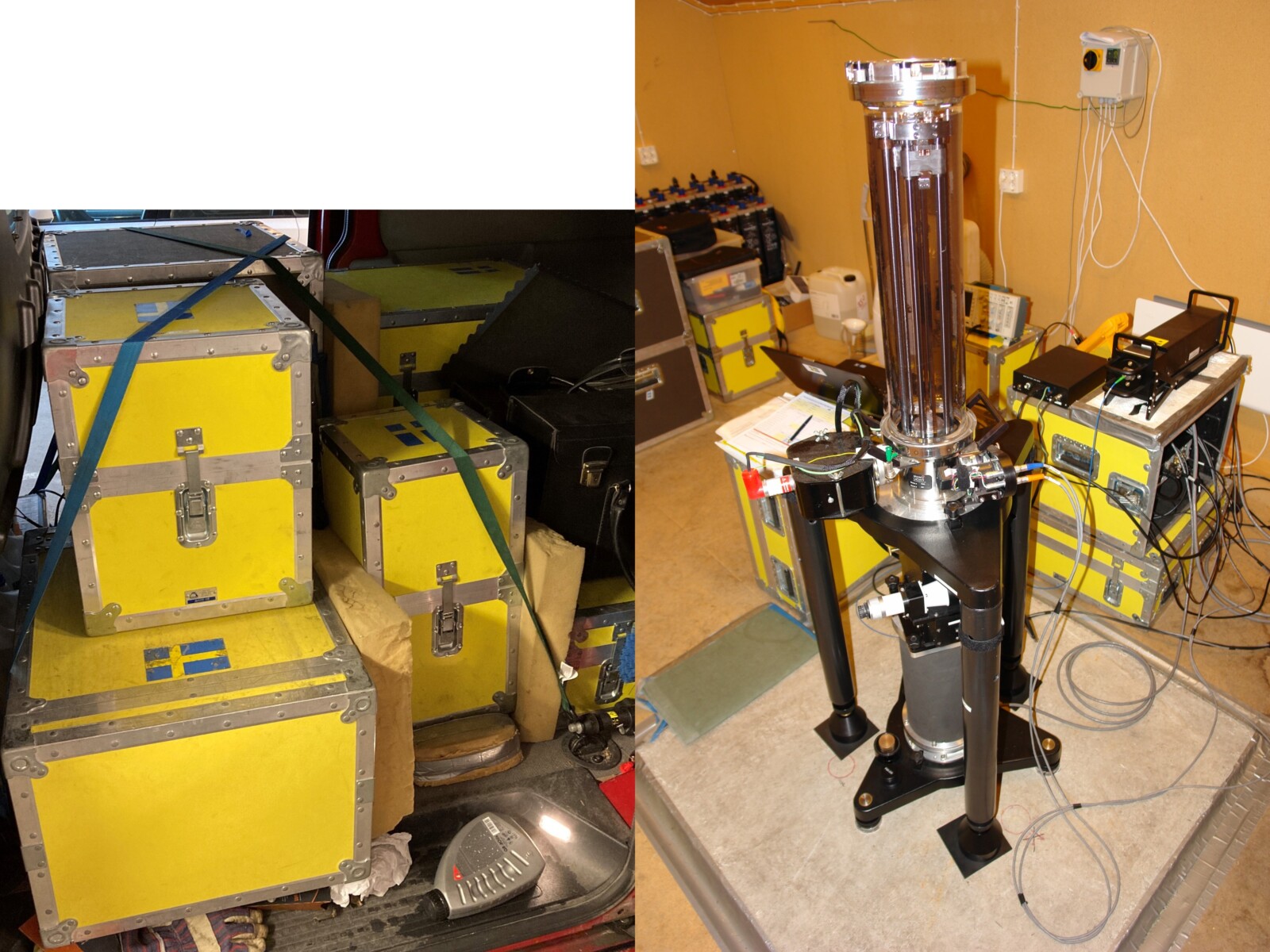
Pictures of Greta packed in boxes (left) and when setup (right). Pictures by Holger Steffen.
Who do we meet on the way?
This year’s tour to northern Sweden also gave us the chance to experience some Swedish wildlife. In Skellefteå as well as Arjeplog you get attacked by mosquitos and other flies. Yes, they are everywhere, and in bad years – thankfully, this year wasn’t too bad – you can’t go outside without wearing a full mosquito jumpsuit. On the positive side, northern Sweden is reindeer country – with most reindeer belonging to the Sami population. Unlike mosquitoes, they aren’t everywhere, but you do see them rather frequently when driving toward the Swedish “mountains.” They often relax on the roads and are a little stubborn, so be prepared for extra driving time. Some of these reindeer are also quite curious about what we’re doing in the forest. They’ll follow you to the hut while you are carrying the boxes and sniff around. Besides the reindeer, you could encounter other animals in Sweden, like bears or moose. All in all, taking Greta to the North is not only about measuring gravity but also about enjoying the Swedish wildlife and landscape.
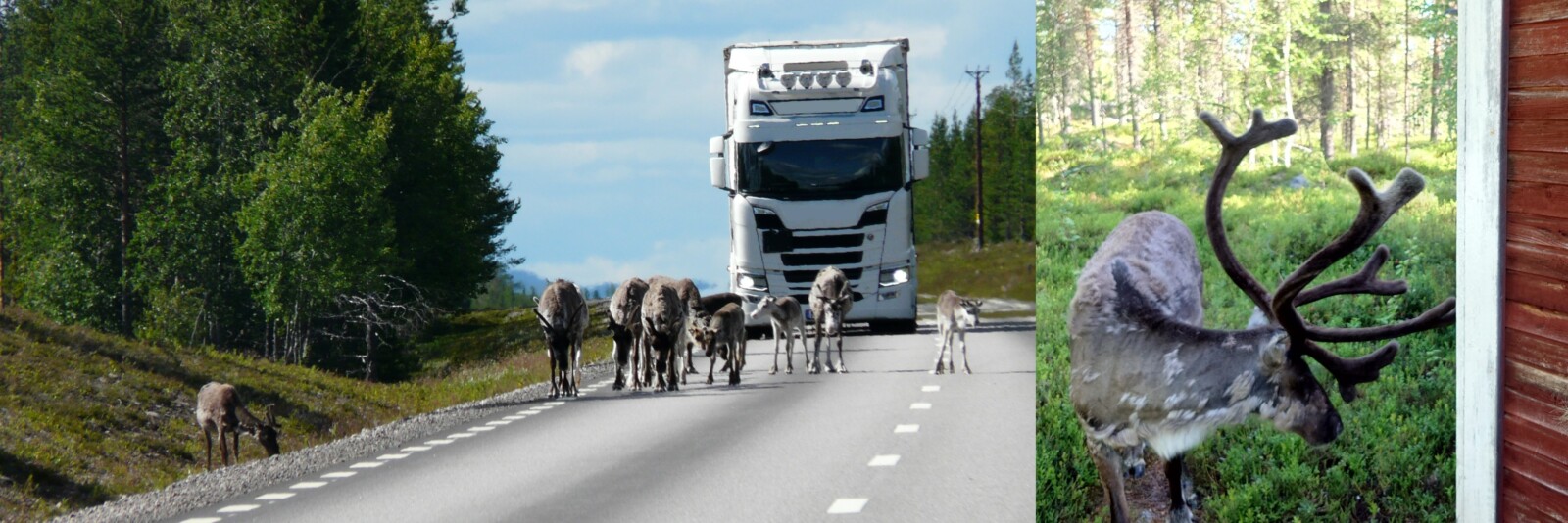
Reindeer blocking the street (left) and a curious reindeer following us to the station (right). Pictures by Rebekka Steffen.
PS: Why do we call her Greta? Well, some FG5 instruments got a name and Sweden wanted to set a good example by giving its FG5 a female name. “Greta” was then named after the famous Swedish actress Greta Garbo and it also rhymes with “gravimeter”.
Edited by Marius Schlaak, Kiana Karimi and Shivika Saxena.
References

[1] Stroeven, A.P. et al. (2016): Deglaciation of Fennoscandia. Quaternary Science Reviews, 147, 91-121.
[2] Steffen, H., Wu, P. (2011): Glacial isostatic adjustment in Fennoscandia—A review of data and modeling. Journal of Geodynamics, 52(3-4), 169-204.
[3] Kierulf, H.P. et al. (2021): A GNSS velocity field for geophysical applications in Fennoscandia. Journal of Geodynamics, 146, 101845.
[4] Olsson, P.-A. et al. (2019): Postglacial gravity change in Fennoscandia—three decades of repeated absolute gravity observations. Geophysical Journal International, 217(2), 1141–1156.
[5] Steffen, H. et al. (2010): Determination of the Earth's structure in Fennoscandia from GRACE and implications for the optimal post-processing of GRACE data. Geophysical Journal International, 182(3), 1295–1310.