“If there is a pan of ice that hits the shorefast ice from the North, it can take off a sheet of ice, and you can go with it.”
The serious expression of the 67-year-old whaling captain made it impossible to mistake the potential risk associated with the ancient tradition of spring whale hunting from the sea ice off the shore of Utqiaġvik, Alaska.
What I didn’t know at the time was that I was about to witness such a terrifying event only a few months later.
The 2014 breakout event that shook a village
The wind was brutally gripping my parka as I fumbled my way through the snowdrift
and into a weathered building. The sign on the door read “Barrow Volunteer Search and Rescue Station”. I was observed in silence by a handful of Iñupiaq men as I approached the person by the main desk. He was listening intensely to the marine band radio, which is used for communication out on the ice. A mix of interference and conversations in Iñupiaq constantly broke radio silence. “How are you?”, I asked. The man looked up with a serious expression. “Very busy” he replied short as I handed him the maps of this year’s community hunting trails on the sea ice.
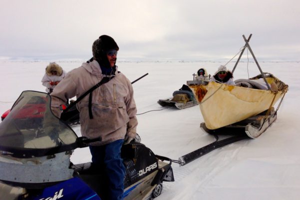
The coastal community of Utqiaġvik, previously known as Barrow, is located near the northernmost point of Alaska. During winter, several kilometers of floating ice, known as shorefast ice, typically attach to the shore. This often rugged ice has to be traversed by community whaling crews in order to hunt migrating bowhead whales at the edge of the shorefast ice. For millennia, the people of Utqiaġvik have constructed trails to the ice free ocean. This involves breaking down large blocks and ridges of ice in order to pull their traditional Umiaq skin boats to the open water. This tradition sustains the community with nutritious food and has also strong cultural, recreational, and educational significance in Utqiaġvik.
An ice trail traversing a ridge. Photo: Dyre Dammann
For over a decade, the sea ice group at the University of Alaska Fairbanks (UAF) has mapped these impressive ice trails that can take weeks to build. The mapping was initiated to understand the relationship between the trails and the ice conditions (such as the ice edge morphology or the ice roughness) and how both evolve from one year to another (Druckenmiller et al., 2012). The maps are also valuable for whalers and the community, but also help document the tradition of spring whaling.
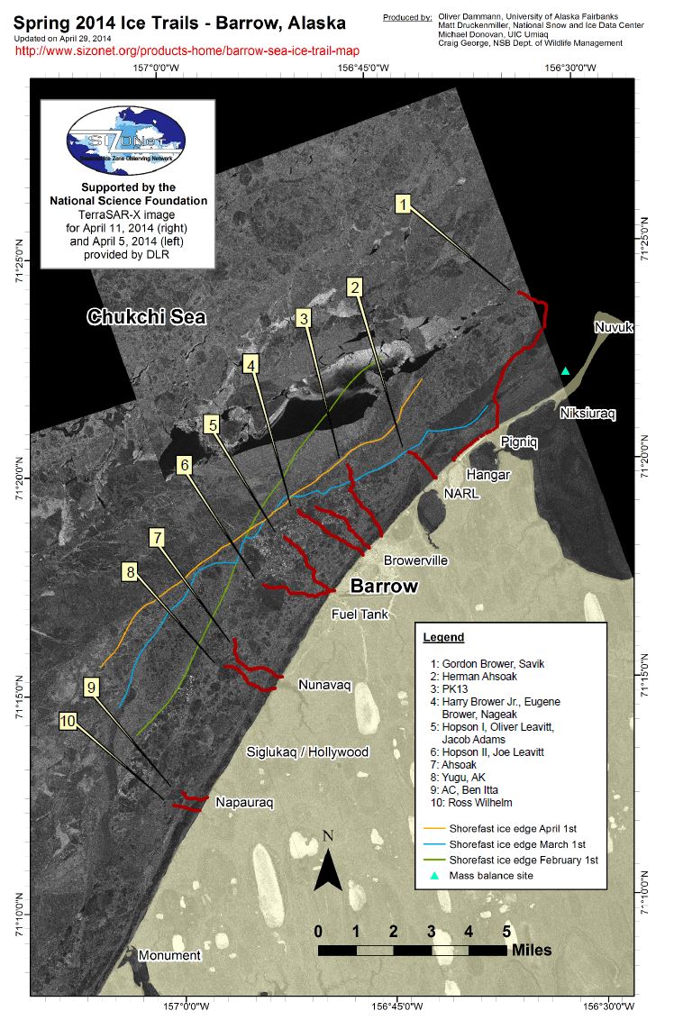
Spring 2014 whaling trail map created as part of the Seasonal Ice Zone Observing Network (SIZONet). Credit: Dyre Dammann
After studying the maps for a moment, the man looked up. “Those trails aren’t there anymore,” he quickly noted. I had been snow-machining on ice trails on the floating shorefast ice for the past few days. First, I did not understand what he meant. Then it dawned on me. “Did the ice break out?” I asked. The man pointed to the map and ran his finger straight up the coastline, across all the trail markings, while making his point clearly with an abrupt, “Rrrritch!”. In a state of shock, I continued “Were there people on the ice?”
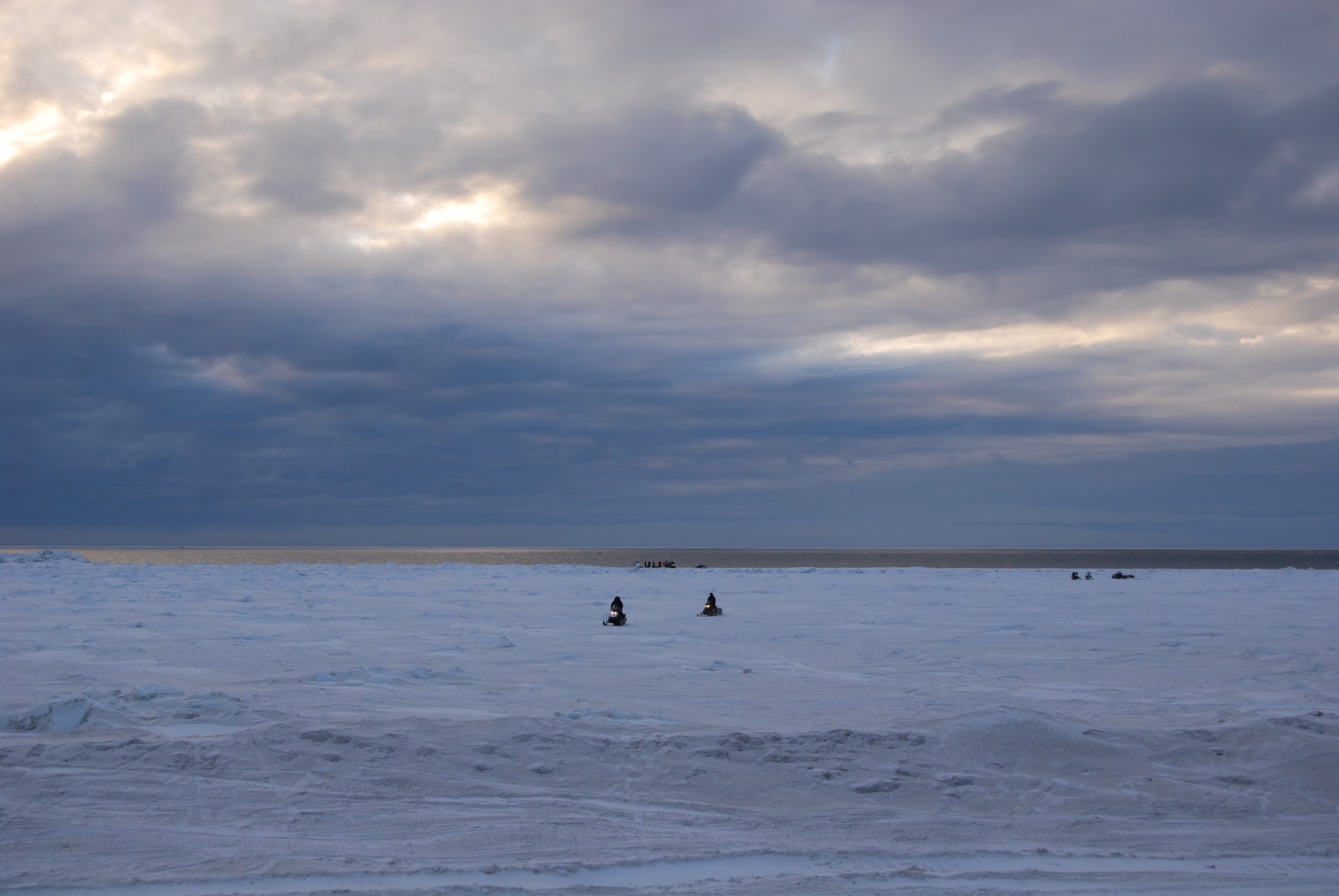
I hurried out the door and made my way down the street to the beach and a jaw-dropping sight. The ice that had carried me and my snow machine up until yesterday was gone. It had ripped away from the near-shore ice and disappeared. While witnessing the golden glow of the ice-free water in disbelief, the last answer was still resonating in my head. Yes, whalers were stuck on the ice and drifting away.
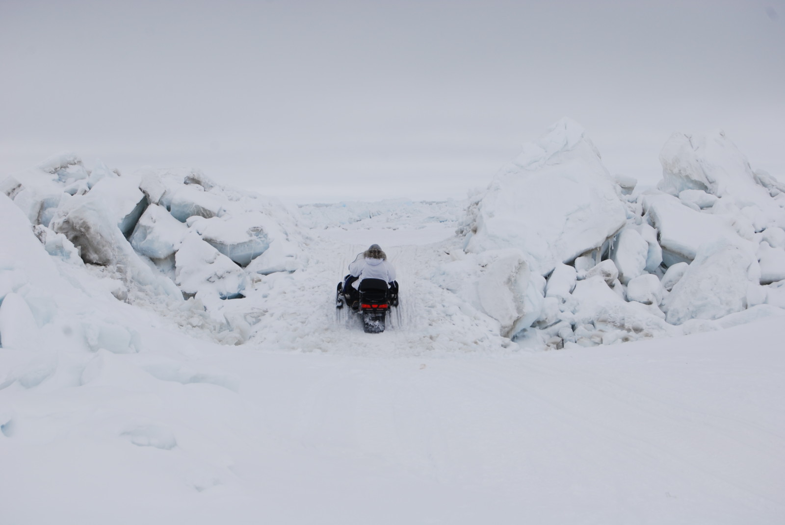
Hunters transporting equipment off the ice when the winds calmed down after the 2014 breakout event. Only a narrow strip of ice was left. Photo: Dyre Dammann
Navigating on thinner ice
During the fall of 2013, prior to the dramatic breakout, Karen Brewster (a researcher with the Oral History Program at the University of Alaska Fairbanks) and I had been interviewing whaling captains in Utqiaġvik. The interviews were a part of the Sea Ice Project Jukebox – a project to record oral history related to sea ice and changes in the ice over time. One of the interviewees was the president of the Barrow Whaling Captains Association, Eugene Brower.
“It’s going to be different this spring,” Brower noted concernedly. “You haven’t seen any ice out here, just slush ice is being formed”. He pointed out that due to global warming “it’s taking longer and longer for the ice to form up here off Barrow”. “It’s got to get colder – way colder than what it is. Go in the negative category. Minus 10, minus 15, minus 20 for it to form right. Right now, we’re still in the teens and it’s above freezing.”
Brower further described that when he was a boy, the ice would be 10, 14, 15 feet (3-4.5 m) thick and that now you are lucky if you find 3 or 4 feet (~0.9-1.2 m) thick ice when you go spring hunting. Brower explained that with the freeze up in the fall taking place later and later, there is less time for protective ridges to form. This leads to less safe ice which is more likely to break out.
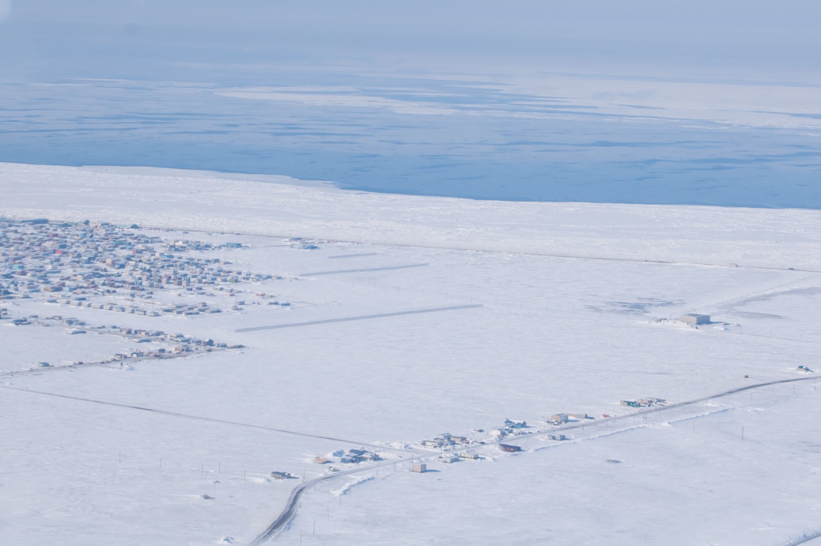
The town of Utqiaġvik, Alaska, with a strip of landfast ice hugging the shore during spring 2013. Photo: Dyre Dammann
In other interviews prior to the freeze-up in 2013, several whalers expressed concern for the safety of spring whaling in the coming season. These interviews were conducted to help gain insight into the vast amount of Indigenous knowledge about sea ice. Incorporating it in geophysical research efforts has proven particularly valuable for understanding recent and long-term changes, interconnected patterns, what conditions are abnormal, and where to direct fieldwork activities. But working closely with communities also motivates and enables research which creates a clear value for the community.
Can we predict hazards and future break-out events?
For over two decades, the sea ice group at the University of Alaska has worked with the community of Utqiaġvik, establishing an integrated observing network. This network includes local observations, a coastal radar system to monitor ice conditions, an in-situ mass balance site monitoring environmental change such as ice growth and snow cover, and the mapping of community sea ice trails.
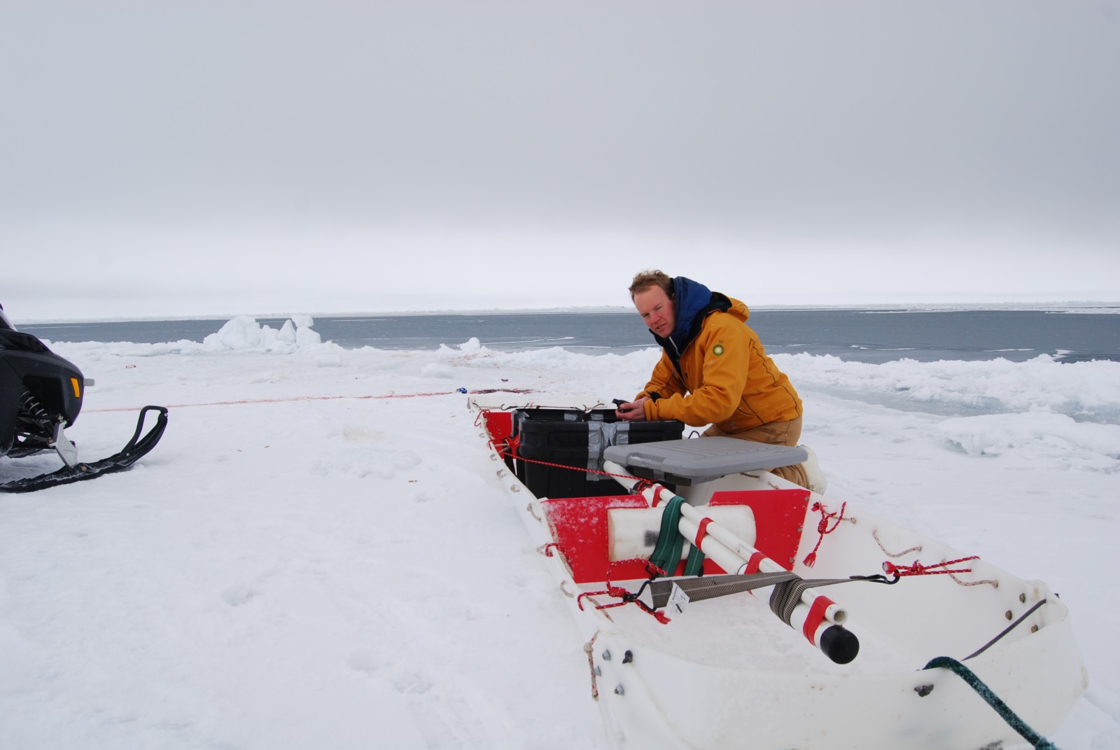
Me (Dyre Dammann) operating a sled with an electromagnetic conductivity meter to map sea ice thickness along community ice trails. Photo: Michael Donovan.
As part of this effort, we investigated applications for the use of satellite imagery (which has proven valuable for mapping ice conditions relevant for sea ice travel, see this blog post) and unoccupied aerial systems (UAS) to facilitate the mapping of optimal routes for sea ice trails (Dammann et al., 2017) and help mitigate negative effects of rapidly changing ice conditions (check out this short video if you want to see how we mapped the ice trail).
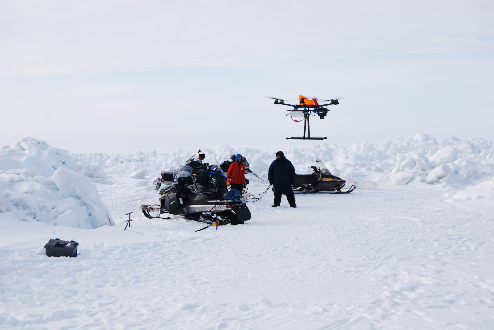
A Ptarmigan unoccupied aerial system (UAS) launched next to a whaling crew out on a trail by Alaska Center for UAS Integration (ACUASI). Photo: Dyre Dammann.
Efforts by the sea ice group has also included investigation into conditions that can lead to breakout events (Jones et al., 2016). This has been possible through a coastal radar system which enables identifying and tracking ice motion. This radar system captured the breakout in 2014 in near real time. The crew trapped on the ice broadcasted their position to search and rescue over marine-band radio. This enabled Andrew Mahoney with the sea ice group to pinpoint the crew’s location on the ice (see figure of radar imagery). The imagery was then brought to search and rescue to aid their successful rescue operation by boat several hours after the ice broke loose. You can watch the whole breakoff event captured as an animation at the bottom of this post.
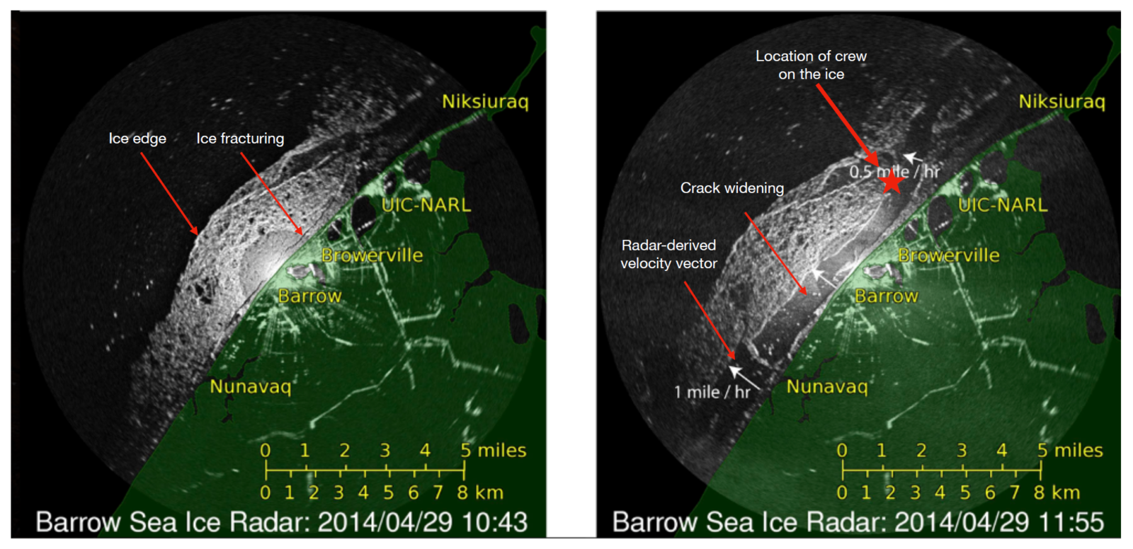
Two radar images showing the massive breakout in Utqiaġvik on the 29th of April, 2014. The star signifies location of the crew after the breakout. Credit: Andrew Mahoney, UAF.
More recent and ongoing efforts involve testing a more advanced coastal-based radar system that can monitor small millimeter-scale changes in the landfast ice sea ice (Dammann et al., 2021). This may enable detection of ice fracturing that can further lead to destabilization and breakout events with possible applications in a potential early warning system for ice breakout.
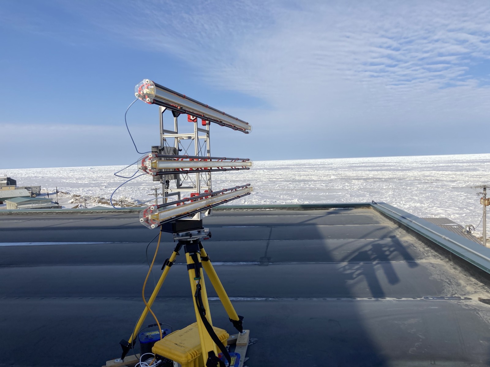
The Gamma Portable Radar Interferometer mounted on a rooftop overlooking the sea ice near Utqiaġvik during April 2021. Photo: Andrew Mahoney.
What does the future hold?
“If these ice conditions become the new norm, we are going to have to adapt to a situation where we can’t really hunt in the spring” I remember Eugene Brower saying.
Climate scientists are predicting a continued decrease of Arctic sea ice, with a complete loss of Arctic summer sea ice in the middle of this century (see this blog post, or also this one). The changes will inevitably lead to further challenges for the coastal Arctic residents. The spring trail breaking along with its cultural and educational significance is at risk of disappearing forever.
However, with the resilience of the Iñupiat people and their expert ability to travel on the sea ice, the tradition of building ice trails will likely continue for the foreseeable future. As the coast again freezes up this fall, the whaling crews will be watching closely as the ice forms, leading up to a new spring hunting season and a new icescape.
One thing is for sure: We have not yet seen the last trail north.
Further reading
- Video and further information related to the project to map ice conditions using a UAS
- Read the full interview with Eugene Brower and other here
- A local Utqiaġvik newspaper article describing the mapping project using UAS
- An article about the UAS work in the magazine Rotor Drone Pro
- Below is a video showing the full breakout event:
Animation of radar images acquired on 29 April, 2014. The radar is mounted on the top of a building in Utqiagvik (Barrow) in the center of the image. Land is masked with a transparent green shading. The landfast ice appears in light gray nuances and the ocean nearly black in the radar images. As the ice starts to move, radar-derived motion vectors are superimposed as red arrows. The animation shows the ice breaking out shortly after 9 am local time. Credit: Andrew Mahoney.
Edited by Vio Coulon and Maria Scheel
 Dyre Oliver Dammann is a Research Professional at the Geophysical Institute, University of Alaska Fairbanks where he also obtained his Ph.D. His studies involved mapping Indigenous ice use in an effort to understand trafficability across sea ice and the associated effects of recent environmental change. His work has since encompassed the exploration of new remote sensing approaches that can help map sea ice conditions relevant for ice travel.
Contact Email: dodammann@alaska.edu