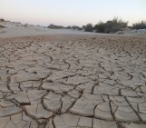
Despite being one of the driest regions on Earth, the Atacama desert is no stranger to catastrophic flood events. Today’s post highlights how the sands, clays and muds left behind once the flood waters recede can hold the key to understanding this natural hazard.
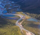
During the severe rains that occurred between May 12 and 13, 2017 in the Atacama Region (Northern Chile) the usually dry Copiapó River experienced a fast increase in its runoff. It caused the historic center of the city of Copiapó to flood and resulted in thousands of affected buildings including the University of Atacama.
The city of Copiapó (~160,000 inhabitants) is the administrative capital of this Chilean Region and is built on the Copiapó River alluvial plain. As a result, and despite being located in one of the driest deserts of the world, it has been flooded several times during the 19th and 20th century. Floods back in 2015 were among the worst recorded.
The effects of the most recent events are, luckily, significantly milder than those of 2015 as no casualties occurred. However, more than 2,000 houses are affected and hundreds have been completely lost.
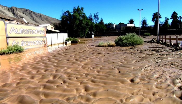
During this last event, the water height reached 75 cm over the river margins. Nearby streets where filled with torrents of mud- and sand-laden waters, with plant debris caught up in the mix too. Once the waters receded, a thick bed of randomly assorted grains of sand was deposited over the river banks and urbanized areas.
Frozen in the body of the bed, the sand grains developed different forms and structures. A layer of only the finest grained sediments, silts and clays, bears the hallmark of the final stages of the flooding. As water speeds decrease, the finest particles are able to drop out of the water and settle over the coarser particles. Finally, a water saturated layer of mud, only a few centimeters thick, blanketed the sands, preserving the sand structures in 3D.
The presence of these unusual and enigmatic muddy bedforms has been scarcely described in the scientific literature. A new study and detailed analysis of the structures will help better understand the sedimentary record of catastrophic flooding and the occurrence of high-energy out-of-channel deposits in the geological record.
By Manuel Abad and Tatiana Izquierdo, Universidad de Atacama (Chile)