GeoLog

imaggeo on mondays

Imaggeo On Monday: The evolution of a cloud during a day
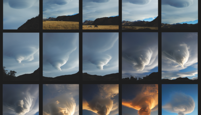
Imaggeo On Monday: The evolution of a cloud during a day

A cloud in the lee of the Patagonian Andes observed during an entire day. The shape of the cloud changed from lenticular to whirl- and funnel-shaped. Description by Christoph Mayr, after the description on imaggeo.egu.eu.   Konstantinos Kourtidis also added a comment to the image, explaining more about how lenticular clouds like these can form: “That’s a great photo sequence. The ...[Read More]

Imaggeo On Monday: Solar eclipse of November 3, 2013, observed from a geostationary orbit

Imaggeo On Monday: Solar eclipse of November 3, 2013, observed from a geostationary orbit

The solar eclipse of November 3, 2013, as observed from the MSG satellite, in geostationary orbit 36000km above the equator. The eclipsed area, where the shadow of the full Moon reached the Earth’s surface, moved over the Atlantic Ocean and Africa. This eclipse was classified as a hybrid eclipse because it started out as an annular eclipse and became a total eclipse over equatorial Africa. W ...[Read More]

Imaggeo On Monday: Alps highest peak meets folded sea floor

Imaggeo On Monday: Alps highest peak meets folded sea floor

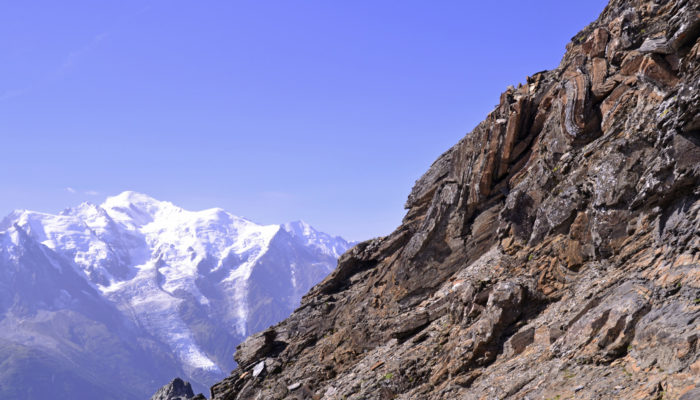
During the late Jurassic, this dolostone was formerly at the sea floor, but after millions years of tectonic movements and natural forces, these rocks now appear at 3000m! Mont Blanc, the highest peak of the Alps is less than 20km away, and is visible in the background. Thank to the Alpine collision, this former sea floor was thrusted over gneiss and granite to make both geologists and mountaineer ...[Read More]

Imaggeo On Monday: Onsala Twin Telescopes

Imaggeo On Monday: Onsala Twin Telescopes

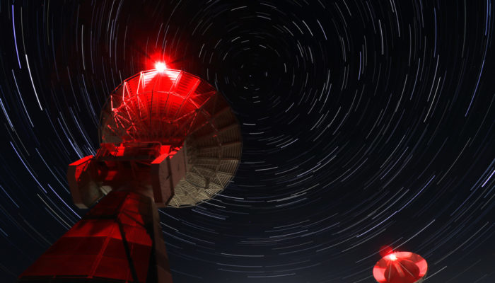
“The Onsala Twin Telescopes are part of the global geodetic Very Long Baseline Interferometry (VLBI) network. Radio telescopes all around the globe are observing extra-galactic radio sources simultaneously to determine Earth orientation parameters, source positions and station coordinates, as well as velocities. Geodetic Very Long Baseline Interferometry is used to maintain the International ...[Read More]

Imaggeo On Monday: Elephant Foot Glacier in Greenland from a Twin Otter perspective

Imaggeo On Monday: Elephant Foot Glacier in Greenland from a Twin Otter perspective

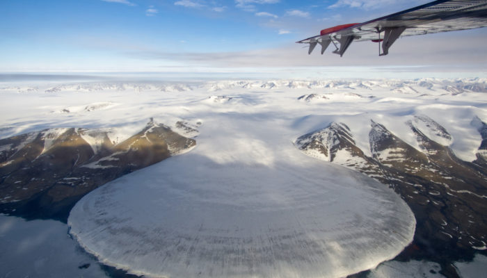
“I was told that there will be a piedmont glacier on the way from Station Nord, a Danish military base in northeast Greenland, to our destination in no-man’s-land next to the 79°N Glacier. On half the way, we passed the beautiful Elephant Foot Glacier, named after its symmetric shape originating from the viscous flow of the ice. The glacier is located on a peninsula and connected to a small ...[Read More]

Imaggeo On Monday: Geodesy on Zugspitze

Imaggeo On Monday: Geodesy on Zugspitze

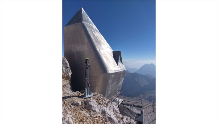
The Zugspitze Geodynamic Observatory Germany (ZUGOG) has been setup on the summit of mountain Zugspitze at an altitude of almost 3000 m during 2018 with the main scientific objective being a better understanding of seasonal and long-term mass redistributions in the European Alps. This knowledge is very important (e.g. with regard to water storage and its high sensitivity to climate change), but is ...[Read More]

Imaggeo On Monday: An ever evolving landscape – Orog Nuur, Mongolia

Imaggeo On Monday: An ever evolving landscape – Orog Nuur, Mongolia

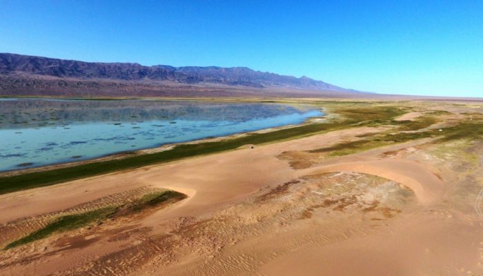
At the transition from the Gobi Altay ranges to the Valley of the Lakes in South West Mongolia, the Ikh Bogd mountain towers almost 3000 m above the aridifying endorheic Orog Nuur Basin. The actively deforming mountain front shows traces of multiple earthquakes, which in turn affect the alluvial sediments deposited in the basin. Simultaneously, strong south-eastward winds create beautiful barchan ...[Read More]

Imaggeo On Monday: Rock pyramid shaped by weathering

Imaggeo On Monday: Rock pyramid shaped by weathering

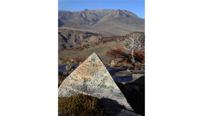
The almost perfect rock pyramid in the foreground was formed by physical weathering and found in the Los Glaciares National Park in southern Argentina. The block was deposited on top of a rock surface polished by glacial erosion. The pyramidal peaks in the background are also the result of glacial erosion, albeit on a much larger scale.   Description by Christoph Mayr, after the description o ...[Read More]

Imaggeo On Monday: The lost capital of Montserrat

Imaggeo On Monday: The lost capital of Montserrat

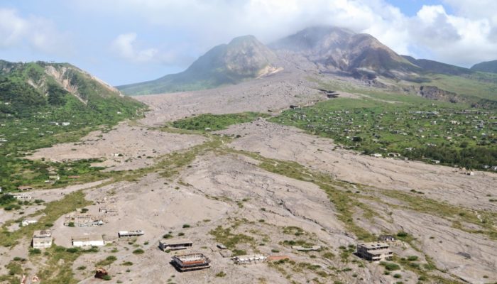
Plymouth, the capital of Montserrat, was evacuated in 1995 after the nearby Soufrière Hills Volcano (background of the image) had reactivated. Later on the town was struck by pyroclastic flows, and its centre was almost completely buried by material relocated from the upper slopes through lahars. The suburb of Town Hill can still be seen in the right centre of the photo. It remains an exclusion zo ...[Read More]

Imaggeo On Monday: Both Ends of the Rainbow

Imaggeo On Monday: Both Ends of the Rainbow

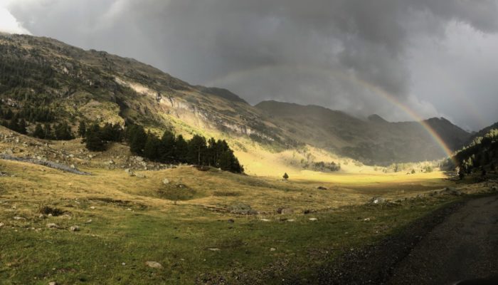
A double rainbow was captured when heading through the glaciated Benasque valley, located in the heart of the Pyrenees. The photo was taken just before the sunset, after heavy rainfall. A rainbow is caused by reflection and dispersion of light in water droplets. Second rainbow arc results from one reflection more than in the first one, thus the rainbow colours are “reverted”. The geome ...[Read More]